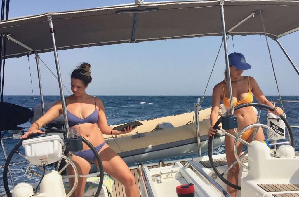
Sailing from Massawa, using two chart systems: Navionics and OpenCPN, because of the sparse charting.
Leaving Massawa in Eritrea at 10:00 on Monday the 19th March, there was a perfect 10-12 knot wind from the east to take us up the coast on a broad reach. We decided to use the wind for as long as it lasted and sailed through the night and the following day, to anchor at Talla Talla Kebir island after 215 nm. This left us with a short 53nm sail to Suakin in the Sudan the following morning. We phoned Mr Mohamed the agent, on the sat phone to advise him of our arrival. He was waiting for us at 4pm when we anchored in Suakin.
Mr Mohamed.
Mr Mohamed was fluent in English and within 30 minutes he had completed the paperwork for shore passes etc. and organised two 10GB SIM cards with enough data for our emails and for Karen to complete her UM Uni assignments. He also organised and delivered 400 litres of diesel at 70c/l to fill our tank and have 300l spare in jerry cans. The government derives a good income from yachties (Sudan desperately needs it), so we parted with USD210, including Mr Mohamed’s fee. We had a quiet evening with all of us catching up with our emails and admin – our minute Huawei modem linking all four laptops via Wi-Fi.
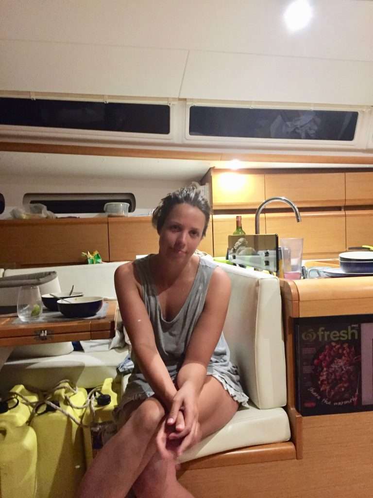
Karen contemplating her dinner menu.
The following day, the ladies on our boat set out for the markets, suitably attired for this strict Muslim country. The patriarchy is alive and well here, with very few women seen on the street or at the market – it’s a man’s world. If you do see a woman, she is covered from head to toe in fabrics. Annie and the girls were stared at by the men and felt uncomfortable. We thought Massawa in Eritrea was a sad sight, but this place is a dump – a country where the economy has been crippled by years of civil war between north and south (read Muslims and Christians). I stayed on the boat, filling the water tanks and defrosting the fridge.
Walking to market – Karen searching for a bin to put our rubbish.
Down the main street.
Buying vegetables.
Buying hooks and lures – the merchant was happy.
One of the two ladies they saw – with child.
Two big yachts, “Cannonball”, 77ft and “King’s Legend”, 65ft arrived, full of young people of Karen and Michelle’s age. We were invited to Cannonball for drinks and left later for more drinks on Soul. The girls went out with the young people to dinner and an all-night party on King’s Legend. They arrived back the next morning with hangovers, after which Annie and I lifted the anchor to motor to Sanganeb Reef, 43 nm north east of Port Sudan.
Cannonball.
Karen – last visit to the old town.
Michelle – ditto.
This turned out to be a good spot to relax with lots of reefs for snorkeling and a lighthouse to visit. The lighthouse keeper was happy to see visitors and allowed us to climb to the top.
Motoring to the lighthouse.
Lighthouse built by the British.
View across the lagoon to Esprit in the background.
The light.
The stairs going down.
Walking back to our dinghy.
Good snorkeling at the drop off by the end of the boardwalk.
We had just finished lunch after snorkelling, when Cannonball and King’s Legend dropped anchor. Our girls were a bit more cautious for a change and we enjoyed a quiet evening.
Kings legend.
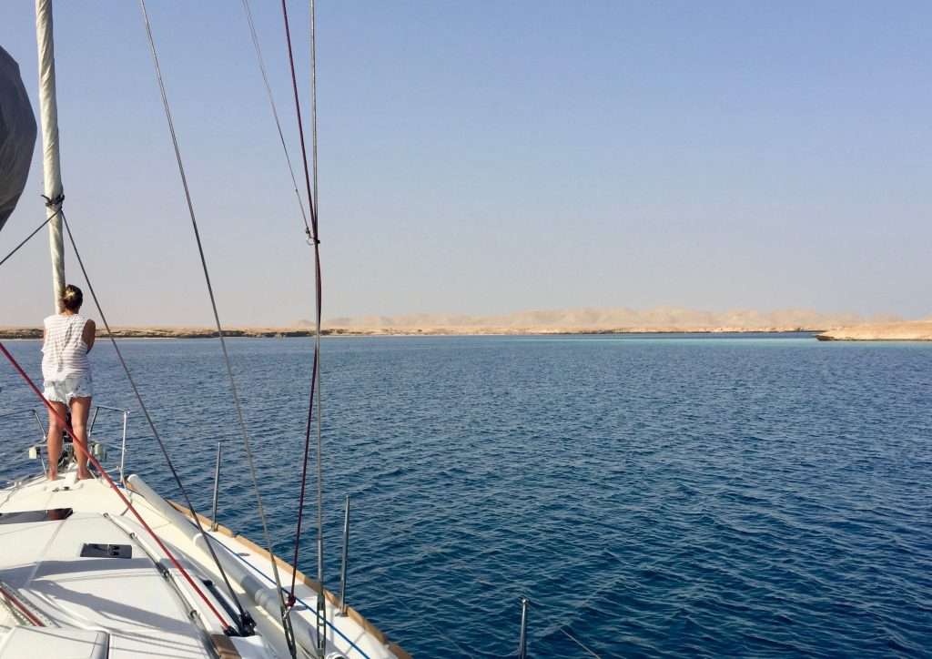
After coffee with Mike and Sarah from “Soul” the next morning, we set sail in a 10-12knot N-E to reach north west for an overnight sail to Khor Shinab, 120nm from Sanganeb reef. The sea was steep and lumpy after a strong north easter, so by sunset we started the motor and headed straight into wind. The boat was slamming hard into waves, almost dislodging the fillings in my teeth. We arrived at Khor Shinab the next morning at 8am and dropped anchor in the deepest bay of the marsa (lagoon).
Karen on bommie lookout as we enter the marsa.
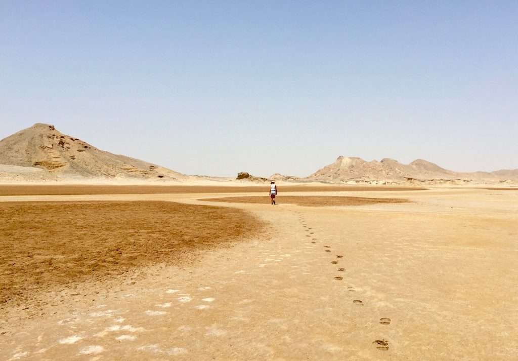
The day was spent exploring this lunar landscape, walking up a wadi and climbing some of the hillocks.
Runners on for the hike into the hills.
Walking across the wadi.
Top of the first hill.
Nice colours, but very little grows here.
View down to the marsa with Esprit in the background.
The girls hiking to the next ridge.
Well done! They made it to the top.
Afterwards the girls did their washing.
Laundry on the life lines.
Some fishermen arrived late afternoon and asked for water and we asked if they had fish to sell. We bought two red snappers with the currency of a kilogram of sugar and rice each, a packet of cigarettes and two bonus caps. Although I detest smoking, we were advised on numerous blog sites to carry cigarettes as these were as valuable as dollars. Hence, a carton of cheap lung cancer bought in Langkawi. We invited Mike and Sarah from Soul over for a fish barbeque and enjoyed a pleasant evening in their company.
Red snappers – Frank, I was thinking of you!
The next morning at 5am we lifted anchor at Khor Shinab (across the narrow Red Sea from Jeddah and Mecca in Saudi Arabia) and started motoring north to Port Ghalib in Egypt, passing the disputed border between Sudan and Egypt by midnight. Does this sound familiar? – most borders in this region are disputed. This then is a short account on the Sudan – we will report again from Egypt. Cheers for now.
Note: This is a longer post than usual, as there was more time during this passage to reflect on events and record it for posterity.
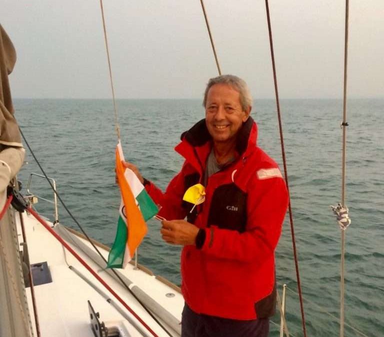
The 28th of February 2018, was spent checking out with the Cochin Harbour Master, Indian Customs and Immigration. A tedious process which took 6 hours – lots of officials aimlessly talking and walking around. We were delighted when Immigration, the last department, took only 30 minutes to exit stamp our passports, so we bolted down to the docks, jumped into our dinghy and motored out to Esprit. We were determined to leave the Indian bureaucracy, the mozzies, the heat and pollution behind us, as quickly as possible. We pulled up the anchor and motored out of the harbour at 4:30 pm to set off across the Arabian Sea on the passage to the Red Sea.
Lowering the Indian flag.
The initial plan was to anchor a mile offshore, dump the undrinkable marina water in the aft 200l tank and run the water maker for 90 minutes to fill the tank with clean water. The stiff onshore wind and swell negated this plan, so we set sail and headed south west to the Nine Degree Channel, south of the Indian Cannanore islands, about 150 miles offshore. We got word that the Turkish boat in our group had decided to set sail from the Maldives, but rather go south to round Cape Town. The New Zealand 16m catamaran “Soul” was about 5 miles behind us, so we sailed together until we could catch up with the Swiss, “Elas”.
Beautiful sunsets.
The first night’s sailing was perfect, with a 10 knot wind, flat sea with 1 knot current in our favour and a full moon. By 10am on day one (the 1st of March) Soul passed us, as the wind dropped to 5 knots. We furled the jib to slow down and ran the water maker for two hours to make 300l of fresh water. We set sail again as Soul disappeared across the horizon. We were about 20 miles south of our intended route, but during the night clawed our way back north and caught up with Soul.
Soul passing us.
At 3am, I heard Mike on Soul, less than 2 miles ahead of us, calling the 300m long cargo vessel “Colombo” to tell them that they were closing in on us at 19.5 knots at right angles to our course. No reply, so I tried to raise them a few times and eventually got a reply. Their watch captain confirmed that he could see us on AIS and after I reminded him we were under sail and have right of way over power, he said he would alter course to pass behind Esprit. It was a big a surprise to discover that he altered course to gun for the gap between Soul and Esprit, missing Soul by a mile and Esprit by about half a mile! I hastily altered course to starboard to miss his stern – so much for the laws of the sea.
Rain! Time for a shower.
Day 2 dawned, still with perfect conditions but light winds, so we hoisted the asymmetric spinnaker. By noon, we passed Suheli Par, the most westerly of the Indian Cannanore Islands – shortly after which we were called by the Indian Coast Guard, for our particulars and to enquire if we had an armed guard on board. We were puzzled by the last question, but soon discovered that the cargo vessels and tankers passing us, showed on their AIS’s “Armed Guards on board” or “Navy Seals on board”, while we were still a week or more away from the HRA “High Risk Area”. It made us feel under staffed.
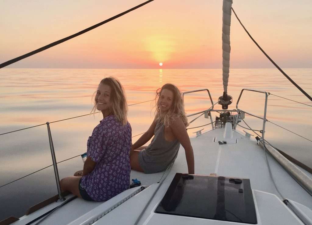
The girls having a nap after a busy day of tanning.
The winds were light and variable for the next two days, but Karen and Michelle’s racing skills came to the fore from here onwards, by using the wind shifts to maintain good boat speed. We made contact with Elas and Soul on day 4 to get their latitude and longitude positions. Our relative positions showed that Elas was about 60 miles south of us and Soul about 40 miles north-west. Elas said they had encountered head winds and that we should not wait for them, but use the north-easterly that kept us on course, to push ahead.
More beautiful sunsets.
The 5-day Predictwind forecast, downloaded on our Iridium Go, indicated a strengthening north-easterly. We decided to take advantage of the winds indicated and sail a northerly rhumb line route to Socotra, an island off the Horn of Africa – still 750 miles away. By the evening of day 4 we were pushed along at a brisk 8 – 9 knots SOG which held through the night and the following 3 days. On day 5, Karen hooked a Dorado, also known as Mahi-Mahi. This 60cm catch provided us with an excellent dinner. The girls also worked on their tans, read many books and watched movies in the evenings.
Karen’s Dorado.
If it had been slightly daunting to read about the HRA – High Risk Area for piracy, we were now having to travel through it and so of course, we wanted to get it over with as soon as possible. Vessel movement reports were sent to MSCHOA (Maritime Security Horn of Africa) and UKMTO (United Kingdom Maritime Trade Operations). It was reassuring to have the UKMTO phone number on sat phone speed dial if we needed it. The strategy adopted for dealing with the pirates seems to be working. At the height of Somali piracy in January 2011, 736 hostages and 32 ships were being held by pirates. By December 2014 that number has dropped to 30 hostages and no ships being held. In 2015 there were no attacks and just one suspicious event. Now, the Atalanta EU task force is in place, so we felt that this year is one of the safest to travel through the area.
The HRA.
The IRTC (Internationally Recognised Transit Corridor) runs for about 550nm down the Gulf of Aden, between Yemen (war) to the north and Somalia (pirates) to the south. The IRTC has two lanes, each 5nm wide and a separation zone between them, 2nm wide – effectively a traffic separation scheme. We planned to transit the Gulf of Aden in the buffer zone between the two lanes. This section to Bab el Mandeb is potentially the most dangerous area, patrolled by the coalition navies. We estimated we would reach the eastern entry point B of the IRTC on day 9 or 10, at our current speed. Our response in the event of an attack, had to be planned well in advance amongst the crew and these plans were now finalised, valuable assets hidden and radio and phone duties confirmed.
Start of the IRTC.
Day 8 arrived and the wind started dropping to 8 knots, 240nm from the IRTC. The engine was fired up again – the first time in four days. The nights have become noticeably cooler as we were heading north – evident when you looked at the water temperature readout from the hull transponder. The water temperatures varied from 32.5 degC in the tropics, to 30.8 degC in Cochin. It was down to 26.7 degC this morning. Shipping traffic has also increased approaching the IRTC, with huge tankers and cargo vessels passing us in both directions. Word from “Soul”, the 16m catamaran is, that they will be entering the IRTC tonight at around 6pm – a day ahead of Esprit. The light beam reaching winds have suited them well. “Elas” is a day or more behind us and have emailed to say they may pull into Socotra island for a break.
There are a number of yachts in Socotra taking on diesel and waiting for the best weather window. We plan to head down the IRTC, through Bab el Mandeb and on to Massawa in Eritrea for a two-day rest. Sunrise on day 9 and we passed the island of Socotra 70nm to our port side, with the north-eastern entry point B to the IRTC, still 120nm away. At 10:30am the wind died, so we furled the jib, to slowly drift while we started the water maker. After two and a half hours the water maker had made 350l of water and our water tanks were full – we didn’t plan on stopping in Djibouti, before Eritrea. I also topped up the diesel tank with 60l of diesel. The girls were enjoying the crystal clear water, diving and swimming, when a coalition patrol plane circled us not once but twice to take a closer look. Fifteen minutes later another plane arrived to do the same!
Foredeck mascots.
Diving exercises.
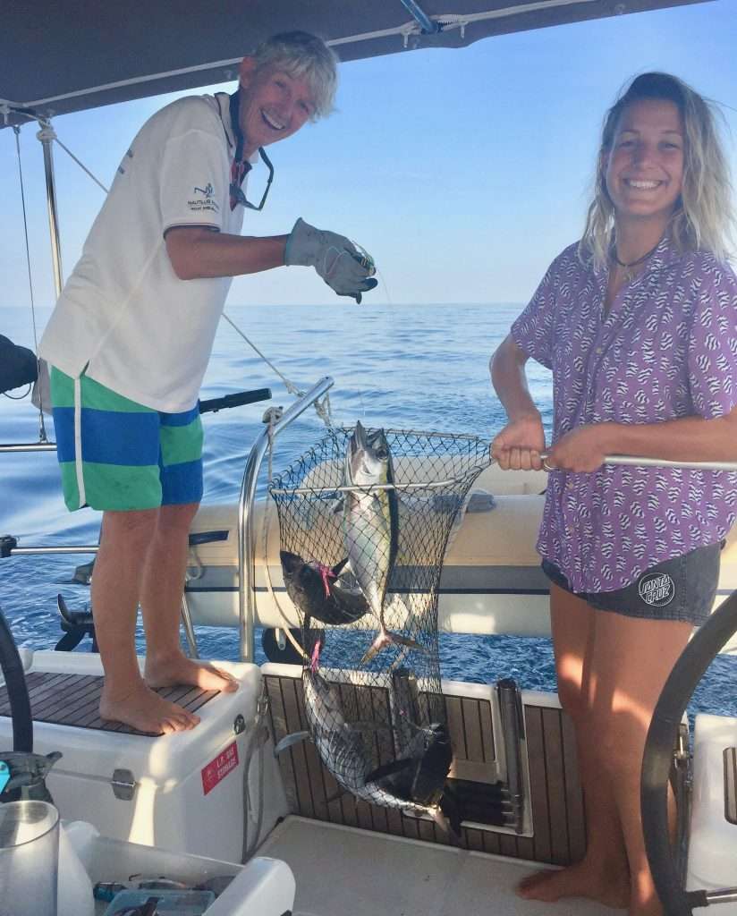
The motoring continued at 13:00 over a beautiful flat sea. An hour later I dropped Naomi Klein’s book “This changes Everything” (a slow burn read over 4 days), when there was a commotion on deck. For the past week, the girls had been trawling a thick line with four lures attached 3m apart, to improve their odds of a bite. We must have motored through a school of Bluefin tuna, because they struggled to pull in 4 tunas – all the hooks taken! We released two and cleaned and cryovacked two for eating. The sea in this area was teeming with dolphins, Orca’s and fish.
Four tunas.
Two for eating.
I just remembered a funny passage from the above book: A cartoon about global warming: A man stands up at a climate summit and asks “What if it’s a big hoax and we create a better world for nothing?”
We entered the IRTC after 9 days and 12 hours of sailing, having covered 1,447nm (2,680km) from Cochin in India. The separation zone was clear as we motored west after sunrise, but the AIS showed up to 30 target vessels on the GPS screen, passing us on both sides.
This behemoth is 400m long.
By day 14 we had cleared the IRTC and were in Djibouti waters and Karen hooked three more Bluefin tunas. Next challenge was getting through Bab-el-Mandeb, Arabic for ‘Gate of Tears’, according to Wikipedia “The strait derives its name from the dangers attending its navigation, or, according to an Arab legend, from the numbers who were drowned by the earthquake which separated Ethiopia and Arabia.” The distance across the strait is about 17 miles so the wind tends to funnel through here and bend around the land, oscillating between northerly and southerly. We had timed our passage to coincide with the change to southerly winds and a rising northern tide.
The route through Bab el Mandeb.
But, we were still a bit early and so on the Djibouti side, the wind turned east, at 15 knots and we had a leisurely sail through Bab el Mandeb up to the Hanish islands (also under dispute between Yemen and Eritrea and best avoided). Then came the expected southerly winds, but gusting up to 35knots – a shock to the system – so we put 2 reefs in the main and with a small bit of headsail we screamed up the western shore, to cover 193nm in 24 hours. Evening day 15 and we anchored in Anfile bay behind a flat, featureless island – exhausted after fighting the steep sea. We cracked a bottle of champagne to celebrate! The following day, a pleasant sail to Port Smythe, on a small island, to anchor overnight.
Predictwind showing the wind we had.
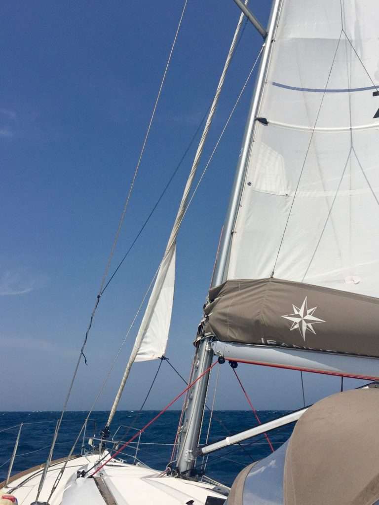
Bare minimum of canvas.
Karen having her hands full in a big sea.
A word on boat insurance for the Red Sea HRA: We have been insured for years with Club Marine in Australia. They provide cover for yachts up to 250nm off mainland Australia, Tasmania and New Zealand, but are not prepared to extend their risk beyond that geographic limit. So we had to look elsewhere and insured with Topsail (Lloyds registered) when we left Australian waters. When we approached the Red Sea, Topsail were not prepared to cover us for the HRA. Annie found a Dutch insurance company who placed the risk with Lloyds, who underwrote our risks for loss and damage in this area, but excluded piracy and war. This cost us USD5,000, but we felt it worth the while for an investment of AUD500,000 to date. Well, this was the quickest USD5,000 blown in 7 days, because of the fear industry! Think twice before spending this money.
Tied up at Massawa tug wharf.
Day 17 and we arrived in Massawa, Eritrea in the Red Sea at 11:00 to tie up at the tug jetty after 2,430nm (4,500km). After 30 minutes, we were boarded by Customs, Immigration and Quarantine for a quick check and paperwork. We received a 48-hour shore pass for free – after 48 hours you pay US$50 per person for a visa to stay longer. Esprit was then anchored 50 metres from the jetty and soon we went ashore with a mountain of washing, which we deposited with Mike (Weldemicael Habtezion) at the Yasmin Bar for washing. Mike showed us to a café he thought was good and we had a lovely seafood lunch with drinks. The girls went shopping and I went back to the boat to make water and fill the tanks, as the local water is undrinkable.
Esprit anchored behind the tugs. Note the bombed out Governor’s Palace in the background.
The restaurant. Great frontage!
Lunch spread. Mike at the head of the table.
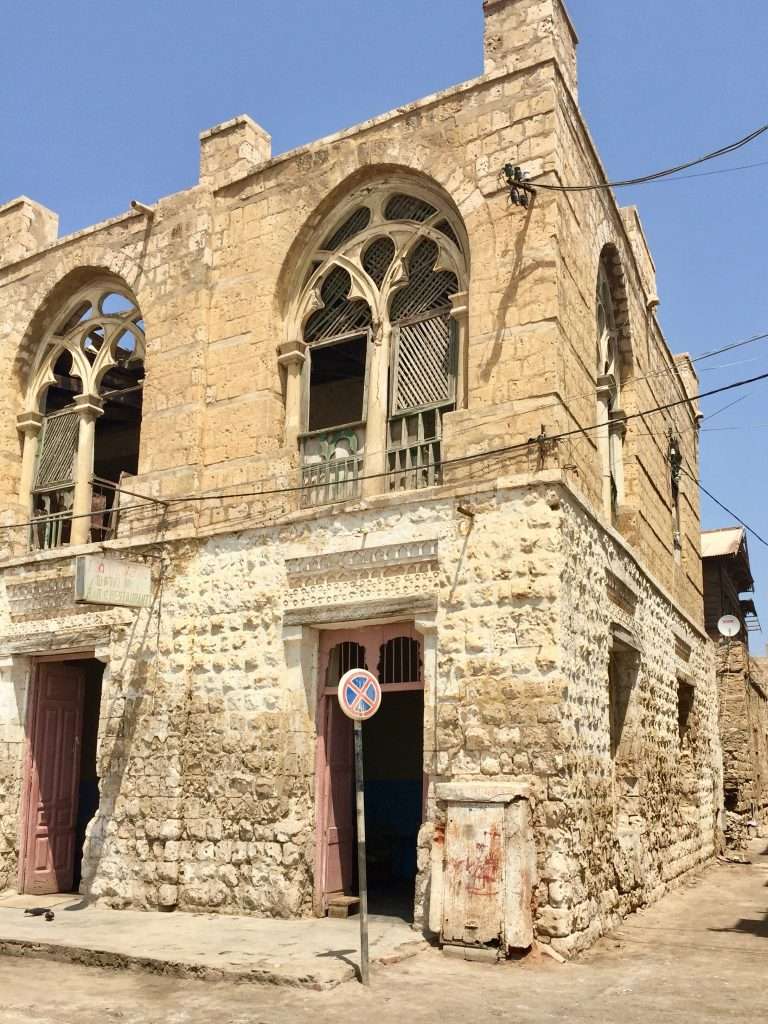
Massawa looks like a movie set for “Mad Max” after 30 years of war to get Eritrean independence from Ethiopia. Bombed out buildings everywhere, with people living in squalor and desperately poor, but so friendly you can’t believe it’s possible after all their suffering. After filling the water tanks, I had made 3 tubs of extra water to clean the salt encrusted Esprit after 17 days at sea. The girls were a great help washing the floors and pressure cleaning the deck and fittings with fresh water. Annie and I were pooped after a busy day and after a shower and a bottle of wine, hit the sack – on clean bedding! The girls had enough energy left to hit town and visit a few bars and have dinner, before getting home late.
The erstwhile Italian town hall.
The rundown old town.
These places become lively bars at night.
We had a late sleep on Sunday and the girls went shopping for fresh food at the markets while I did some necessary repairs and maintenance on the boat – anything to not go shopping! Sunday evening, we strolled around the old town with its derelict buildings, to discover this town had the highest number of bars per capita – despite the Muslim presence. We did a thorough pub crawl savouring their local beer, gin and vodka, before having dinner at a restaurant serving local dishes. On the way back to the boat, we stumbled upon a wedding and were immediately asked to join in to the festivities. Late to bed, but up early next morning to fetch our laundry at Mike’s shop, before checking out with customs and immigration who went through our boat for stowaways. At 10:00 we set sail outside the harbour for Suakin in Sudan, 240 nm to the north.
Imagine these alley’s in the days of the Italians.
We had one too many at this pub run by two wonderful ladies.