On our flight from Portland to New York, I had an informative New Yorker, Peter Miller, sitting next to me. He lives in Manhattan and offered to get us on the right trains to get to our hotel. We arrived at Newark airport at 6pm, where I had a lady waiting for me with a wheelchair. She was a recent arrival from Nigeria and pushed me all the way to the skytrain that link to the railway line to Penn Station. We had a good chat about Africa and why she came to the USA.
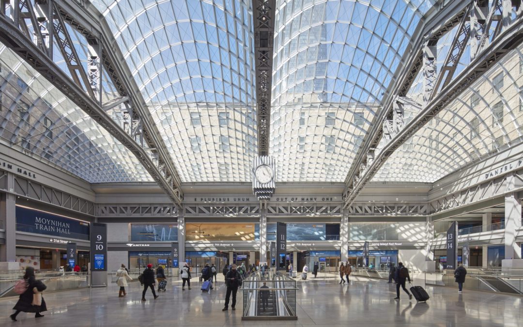
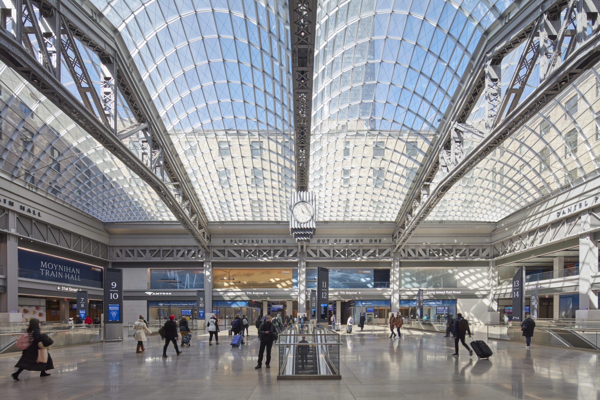
Penn station concourse.
Penn station is the main intercity railroad station in New York City and the busiest transportation facility in the Western Hemisphere. Peter got off the train with us and pointed us in the direction of our hotel, before taking the subway to his abode. We took a taxi with the driver Mr Singh, a Sikh from the Punjab in India, a recent arrival in NYC. He sported a magnificent beard and twirled military style moustache below his turban.
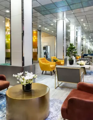
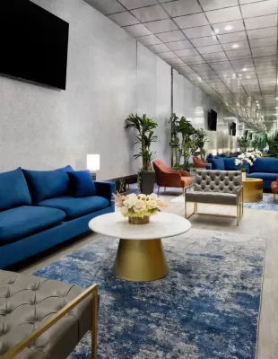
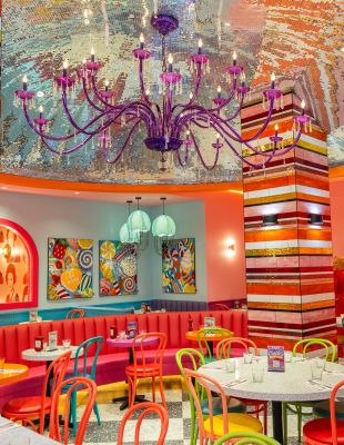
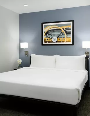
Our hotel, the OYO hotel, 150m from Times Square, is one of the new hip and arty hotels of NYC. The ground floor areas are an interior decorators dream and this piqued our interest after seeing their website – interior design on steroids. The rooms were clearly photographed with a fish eye lens – so small, you have to go outside to change your mind. It had a fridge and bathroom, important in that order.
OYO lounge area.
OYO – more lounges.
OYO dining room – Oy vey!
Fish eye view of our bedroom.
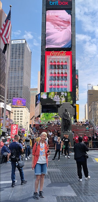
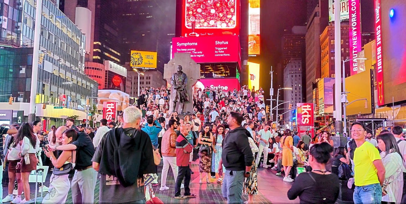
Maria the receptionist was our introduction to the unique NY repartee –a rapid exchange of clever replies. After a late rise the next morning, we ambled down to Times Square for a coffee. The place was buzzing with people, many hustling you with some deal or another. Repartee from a bloke looking at my boot: “Are you going to give up kick boxing now?”
Cool Annie at Times Square.
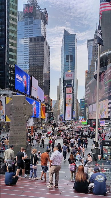
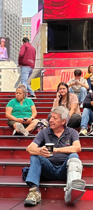
We took a seat on the red stairs to have our coffees. The red stairs are famous because they serve as an iconic landmark and cultural hub in the heart of Times Square, offering a popular gathering spot with excellent views.
View towards Broadway.
Completed in 2008, these 27 ruby-red glass steps have become an internationally recognised symbol, featured in media and attracting thousands of visitors daily who use them as a stage to observe and experience the surrounding urban spectacle. The Red Stairs were designed by Australian architects Choi, Ropiha after they won an international design competition in 1999 with their winning concept.
Not so hip Dirk enjoying the vibe.
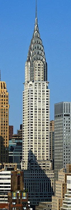
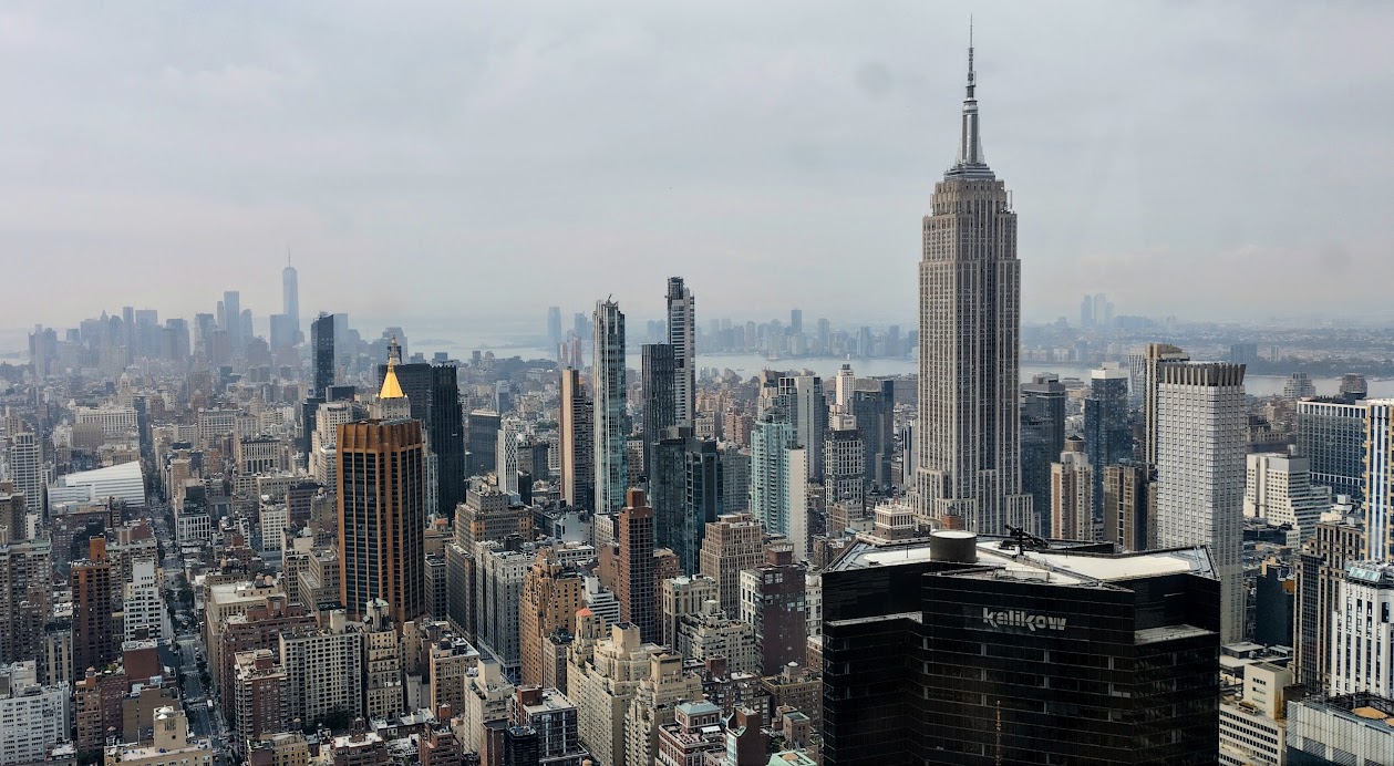
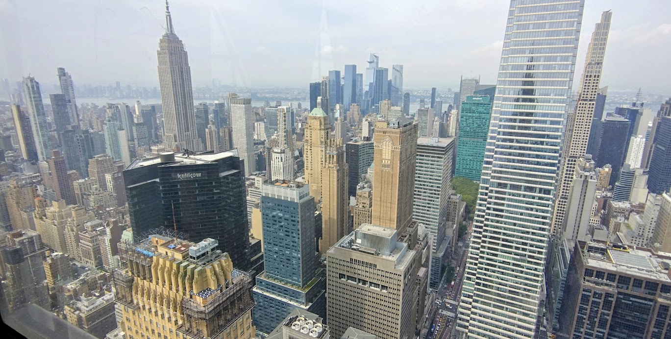
On Wednesday we took a taxi to the Chrysler building on Lexington Avenue where Michelle our daughter, arranged for us to meet her friend Eleni Christodoulou, who works on the 71st floor (The former viewing floor). This floor is unique and expensive real estate, and is occupied by a leading Artificial Intelligence software development company that she works at. It offers unsurpassed views of the city.
Chrysler Building (Getty Images)
The Chrysler Building is a 1,046-foot-tall, Art Deco skyscraper and is the tallest brick building in the world with a steel framework. It was completed in 1930 and was the tallest building in the world, before the 102 storey Empire State Building’s completion in 1931.The Empire State Building is 1,250 feet tall.
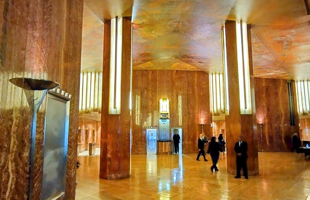
Chrysler Building, entrance lobby.
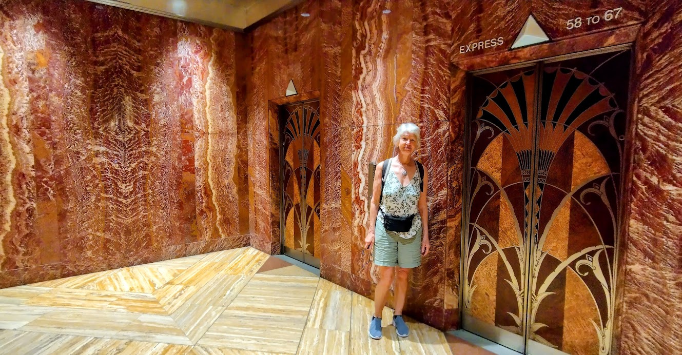
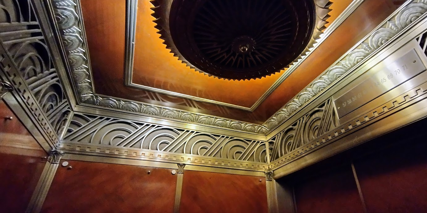
Lift lobby.
Lift car interior – they don’t make lift doors and cars like this anymore, hey Ron?
View of the Empire State building from the 71st floor.
Another view – too many to show!
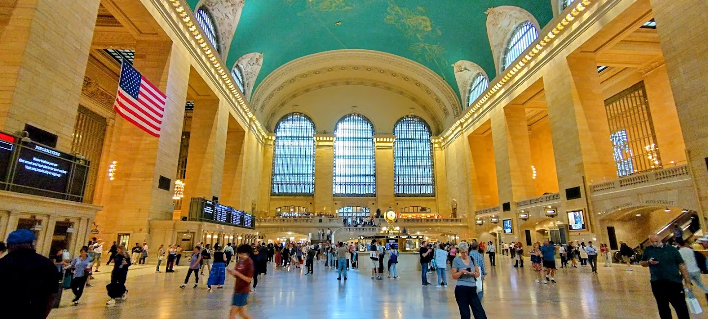
Just a block away is Grand Central Station, or Terminal. It has 44 platforms on two levels and during morning rush hour, a train arrives every 58 seconds.The iconic Main Concourse is the geographical centre of the 3,300 m2building. The ceiling is beautifully painted with the constellations of the Astrological Zodiac. The station is truly GRAND by design. We took a train from here, back to Times Square.
Grand Central Station.
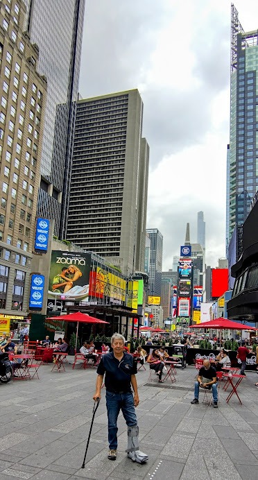
Back at Times Square – the Lone Ranger acquired a walking stick.
Annie then walked to the Museum of Modern Art after lunch and immersed herself in the exhibits for five hours, until closing time.
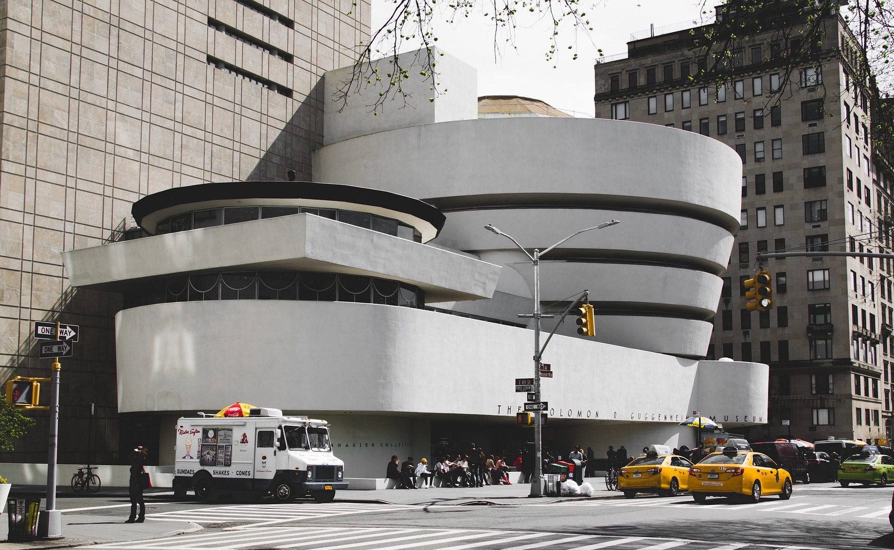
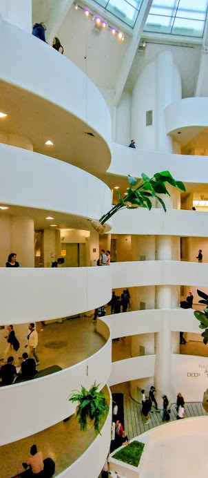
On Thursday we challenged ourselves with using the MTA app for New York. We planned to visit the Guggenheim Museum on Central Park, by combining tube and bus transport. We ended up in Queens on the other side of the East River, took the tube back to Manhattan and jumped on a taxi which got us there. The building was designed by Frank Lloyd Wright and is truly amazing and beautiful for its time.
The Guggenheim.
Interior, ground floor.
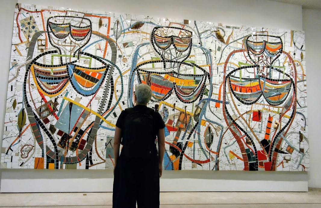
The permanent exhibition of Impressionists painters was very good, but we were disappointed with the contemporary work displayed on the spiral ramp. Picture graffiti with nonsensical words spray painted on mirrors and…. Fire the curator!! We caught a taxi back to the hotel for lunch, before Annie ventured out again. My boot, despite the walking stick is very heavy and tiring and requires a Nanna nap.
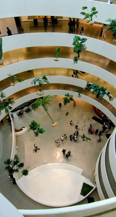
Looking down from the 6th Floor.
Halfway down the ramp.
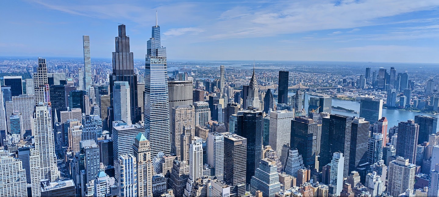
The following day was the first day of our 48 hr BigBus tour pass. We did the red loop of Manhattan downtown area. Manhattan Island between the Hudson and the East rivers is quite large – 21.6 km long and 3.7 km wide at its widest point.The Lenape native Americans lived on the island and called it Manahahtaan. They sold the southern tip of the island to the Dutch West India Company for 60 Guilders ($24) in 1624, to establish a fur trading post and a new town, New Amsterdam. The British took control in 1664, renaming the colony New York after the Duke of York and establishing it as a major port.
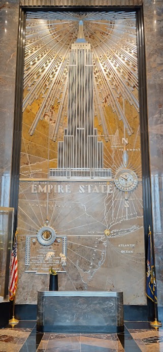
Empire State entrance lobby.
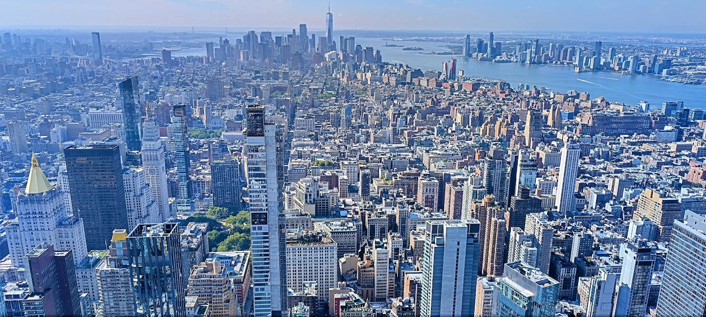
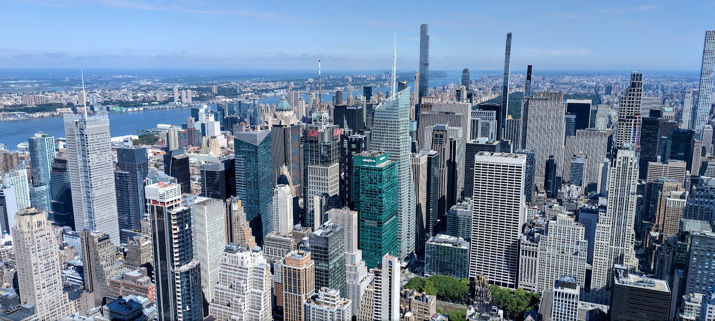
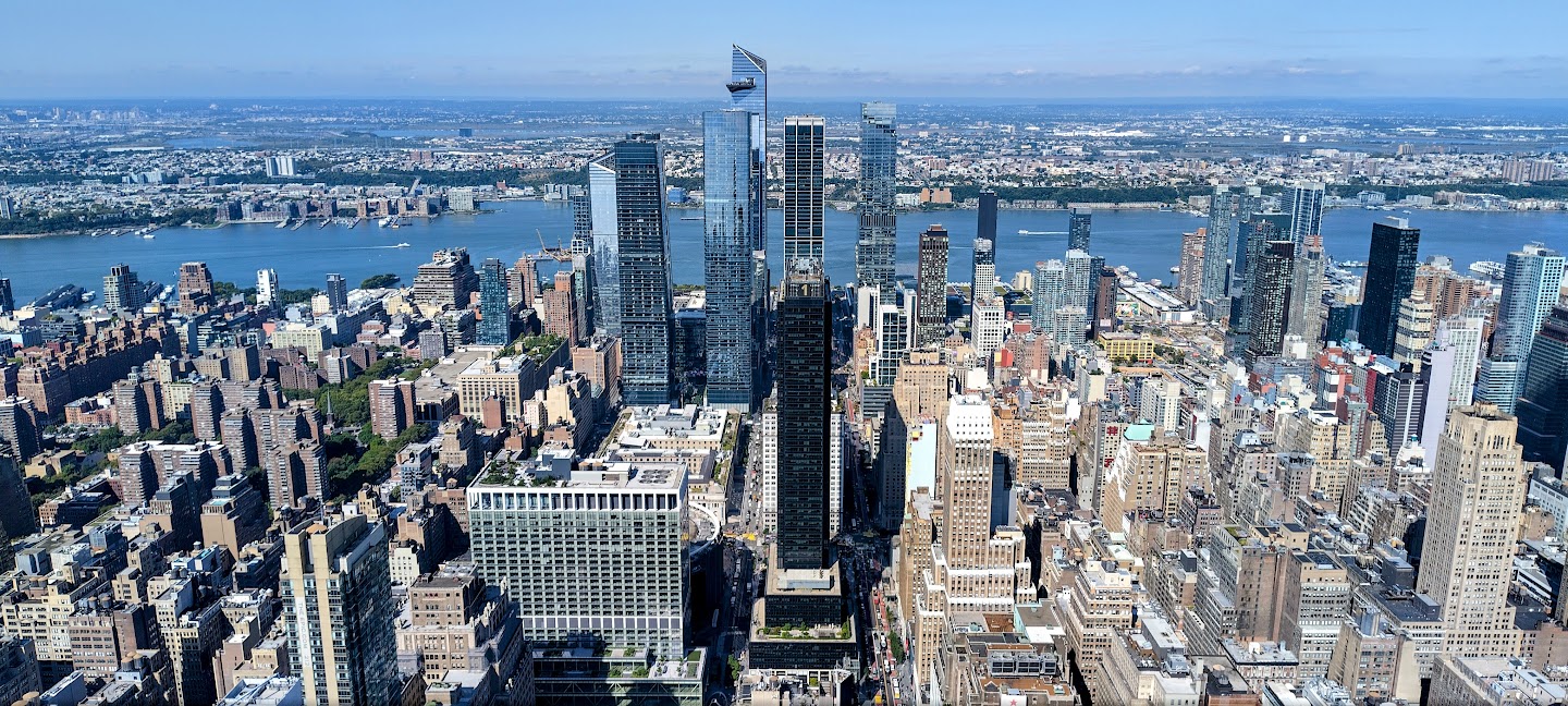
Our first stop on the tour included tickets to visit the viewing platform on the 84th floor of the Empire State Building. After visiting the Chrysler Building, we thought this not necessary, but it turned out to be a good idea, as the weather was much better for viewing.
View South – One WTC in the distance.
View South East – note the pencil thin buildings!
View towards the Brooklyn Bridge.
View west across the Hudson river to New Jersey.
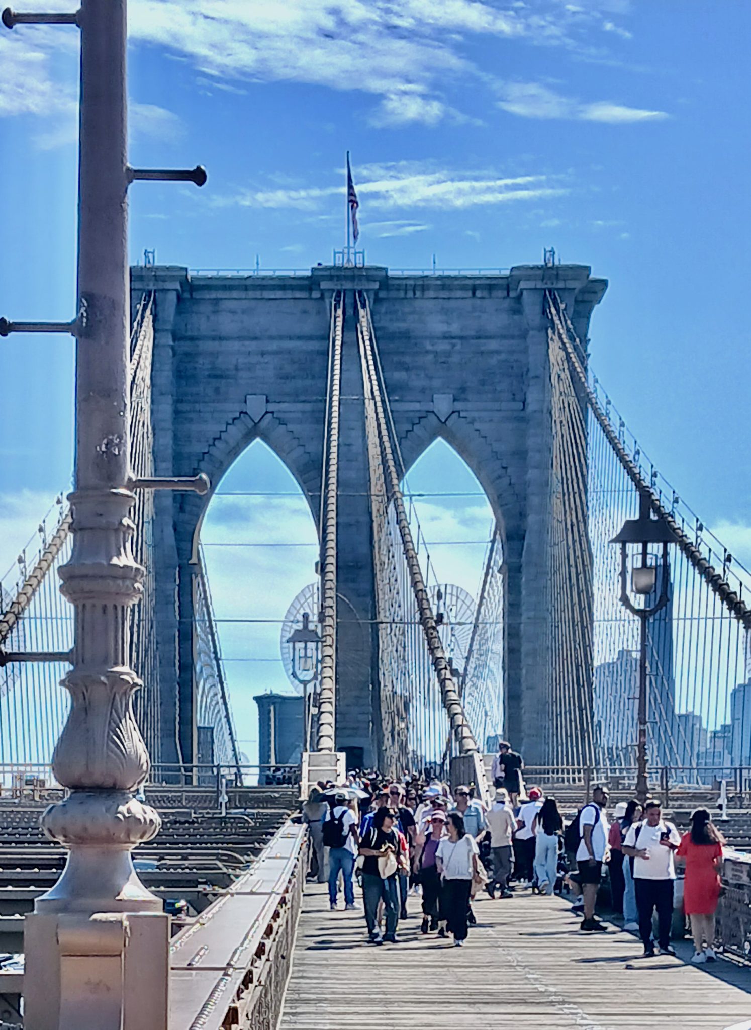
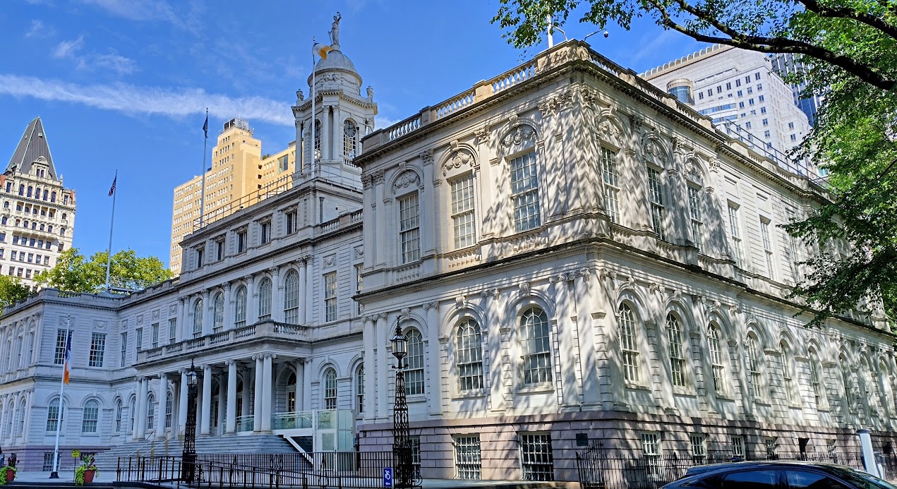
After Wall Street, named after the wall that separated the Dutch Colony from the rest of the island, we hopped off at the Brooklyn Bridge which Annie walked over while I visited the New York City Hall and watched the passing show at a Veterans Street market.
The Brooklyn bridge.
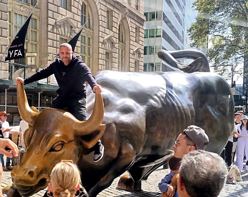
Wall street bull – Sergei posing for his girlfriend.
New York Town Hall.
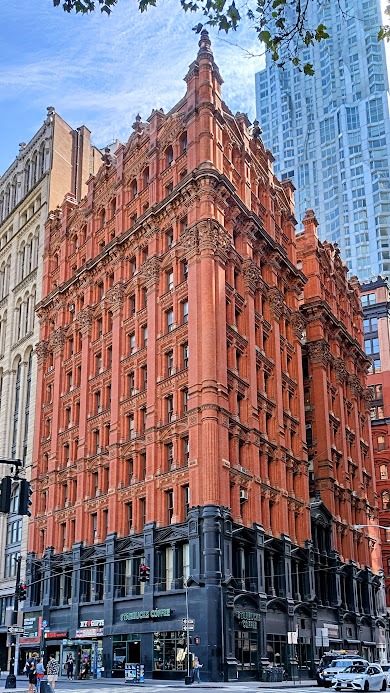
Beautiful Victorian brick building near city hall. Note the Gaudi-esqe ripple facade of the modern building behind.
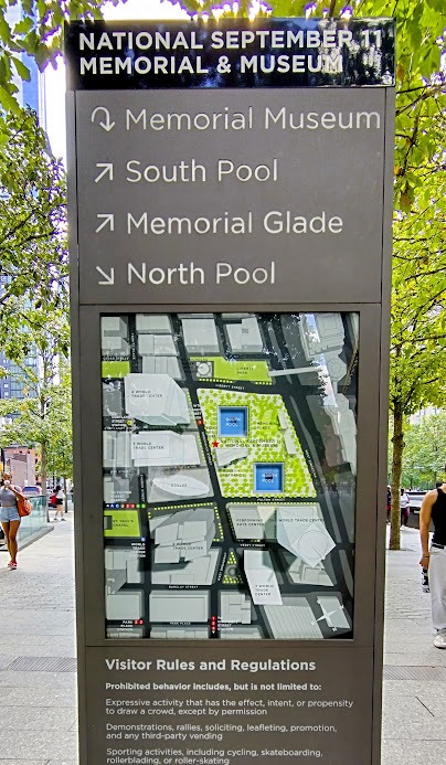
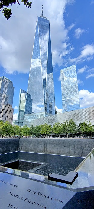
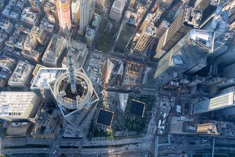
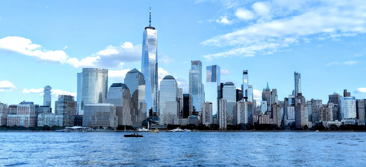
Our next stop was at the 9/11 memorial site and the new One World Trade Centre. This area of devastation has been beautifully redeveloped as a tranquil area of reflection with two pools indicating the footprints of the Twin Towers set in a tree canopied park.
Site layout.
The new One World Trade Centre building is a beautiful faceted glass tower, making the building, including its spire, reach a total height of 1,776 feet (541 m). Its height in feet is a deliberate reference to the year when the United States Declaration of Independence was signed.
One WTC across a pool.
Aerial view of One WTC. Note how the floor plan twists 45deg from the ground floor to the top. (Getty Images)
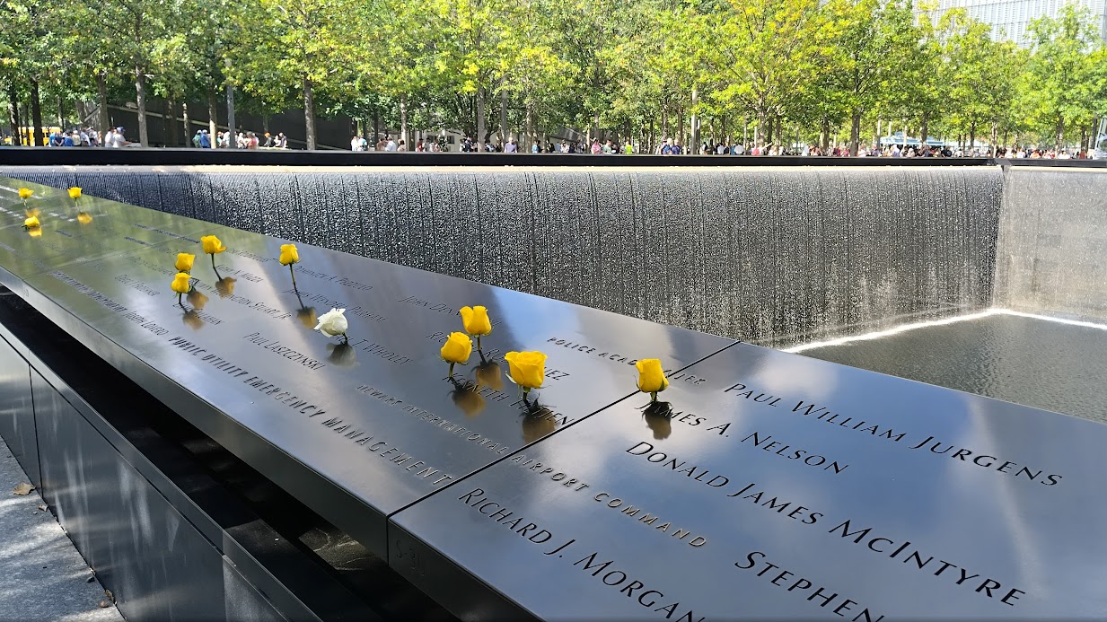
The names of 2,976 people who died on 9/11 inscribed around the two pools. Roses placed by relatives and friends are touching.
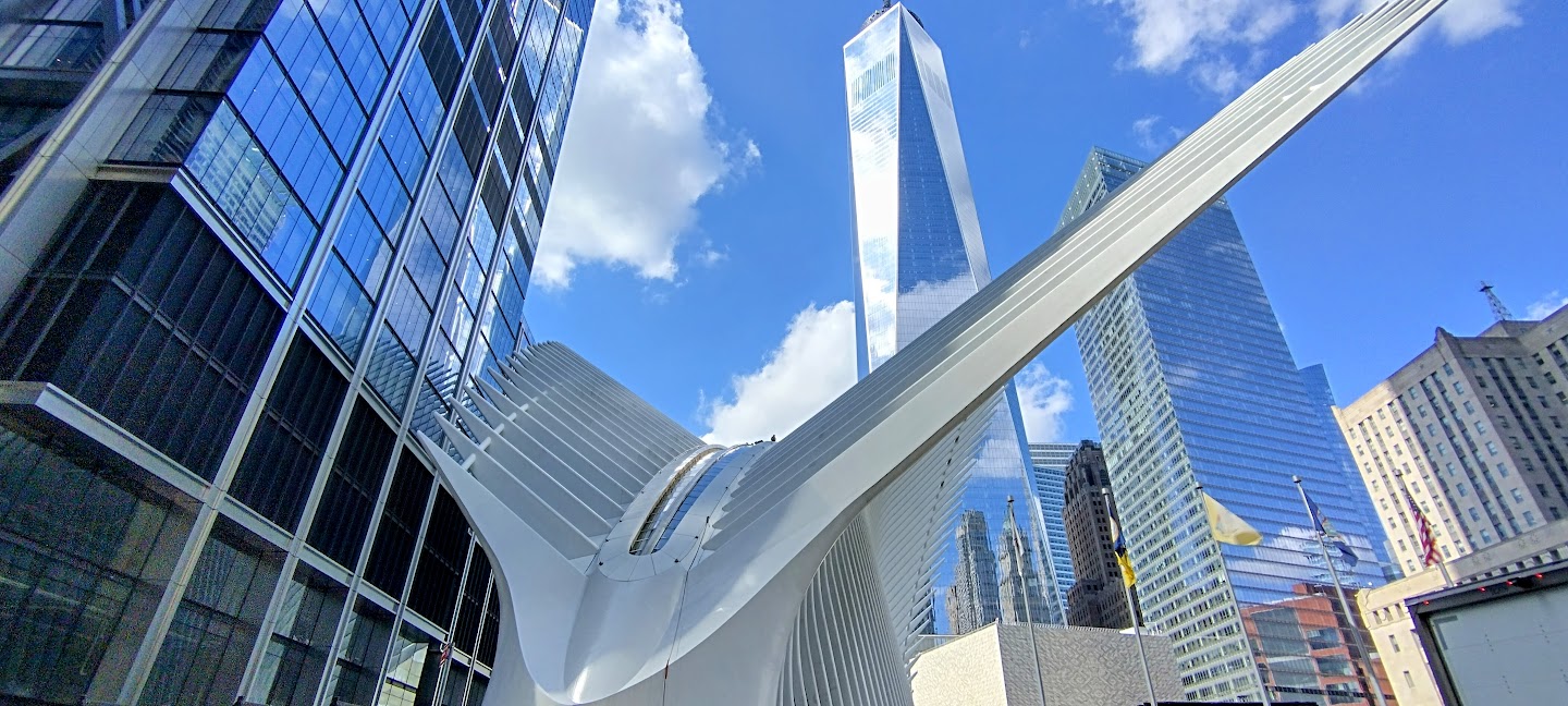
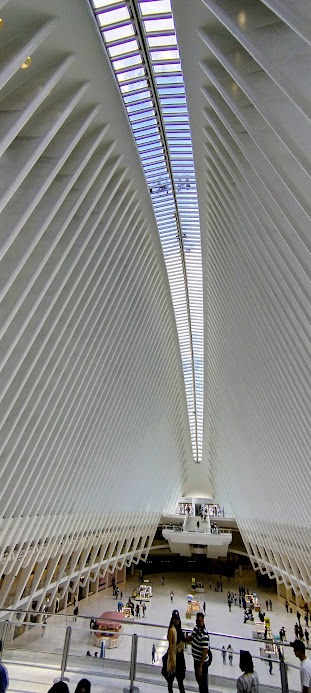
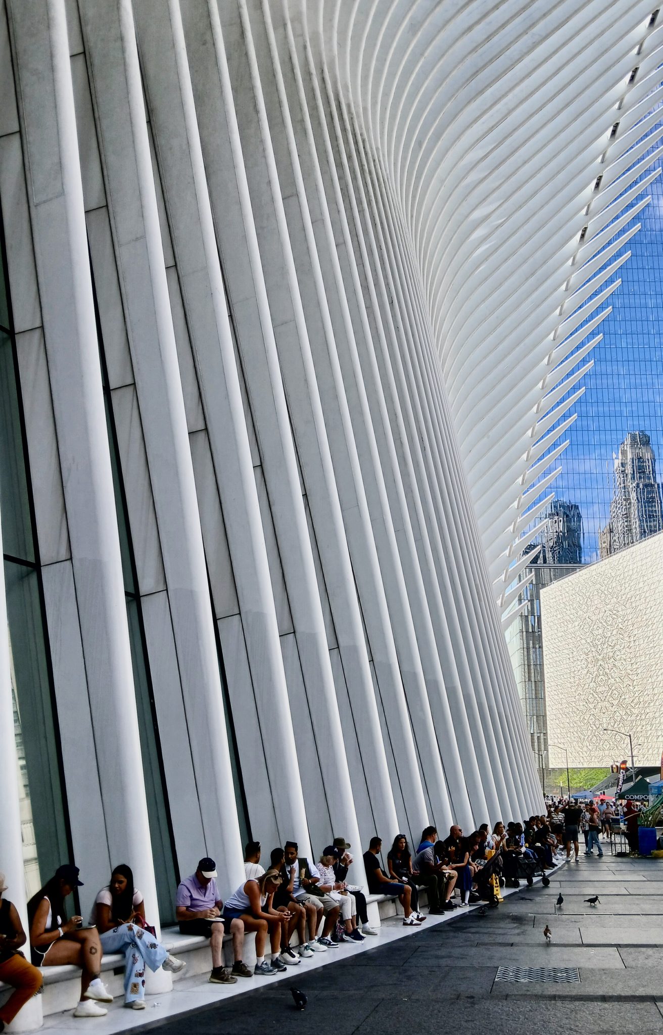
To the one side is the new Oculus structure, which is the transportation hub and shopping mall at the World Trade Centre, designed by Santiago Calatrava. Its wing-like architecture is meant to symbolise hope and rebirth after the 9/11 tragedy, resembling a bird taking flight. In addition to housing subway and PATH train lines, it serves as a retail centre and a space for art and public events.
The beautiful Oculus with One WTC behind.
Interior of the Oculus.
Oculus seating put to good use.
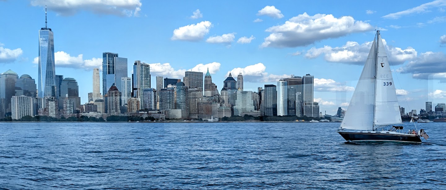
Our final stop included tickets for the Circular Boat Line for a trip down the Hudson River to view Ellis Island and the Statue of Liberty. We got back to Times Square and our hotel at 6pm for a quick shower before walking to meet Fergus and Kate at the Vanguard Wine Bar for drinks and dinner.
Cruising down the Hudson – the money shot: Empire State Building in the gap!
South Manhattan with One WTC.
Thinking of Esprit at this moment.
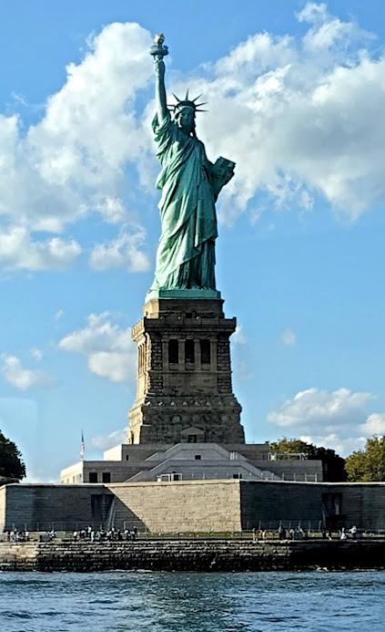
The Statue of Liberty – a gift from France.
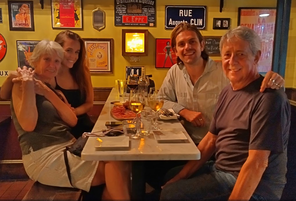
Kate and Fergus arrived in NYC a month ago from Sydney, after Fergus was transferred by Grimshaw Architects to their New York office as Associate Architect. We had a great time and after walking back to our hotel, we had clocked up 7 km for the day, despite the boot, for a good nights sleep.
Drinks with Kate and Fergus.
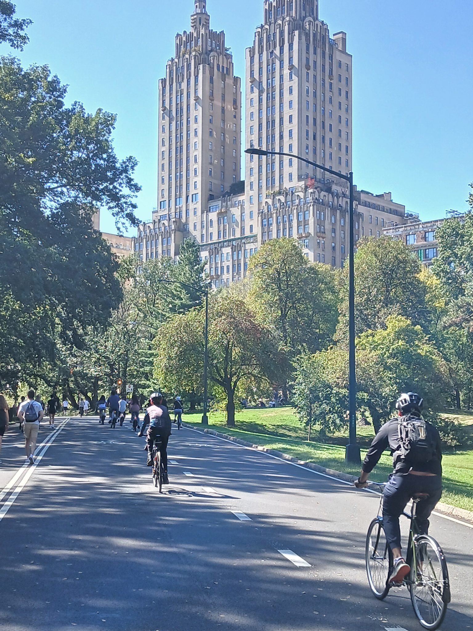
On Saturday we made a late start to get on the BigBus tour to North Manhattan and Central Park. This time we sat on the top deck to view the attractions, never once getting off the bus at the various stops.
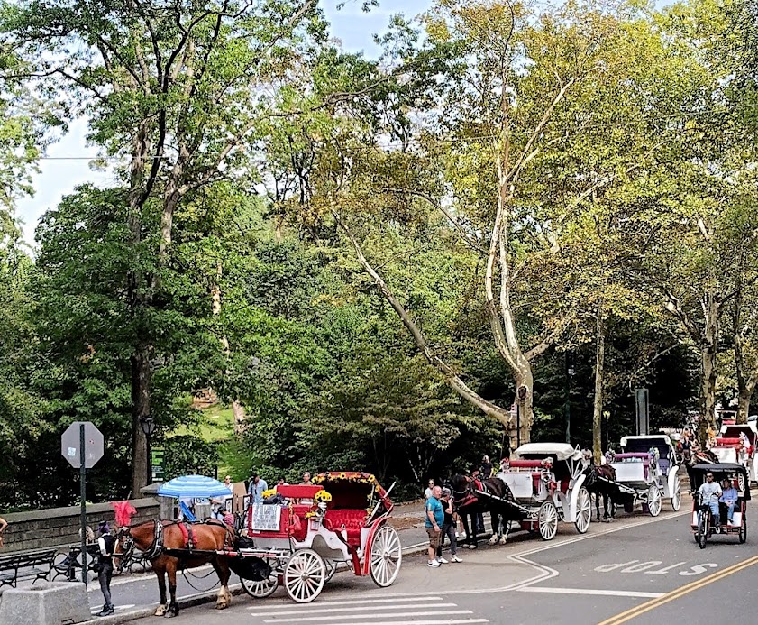
Horse carriages in Central Park.
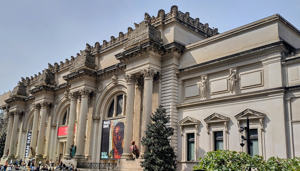
The Metropolitan Museum of Art (The Met) the largest art museum in America, is located on the East side of Central Park.
A Nanna nap in the afternoon perked us up for a walk around Times Square at night, which is even more crowded than during daytime.
Times Square at night.
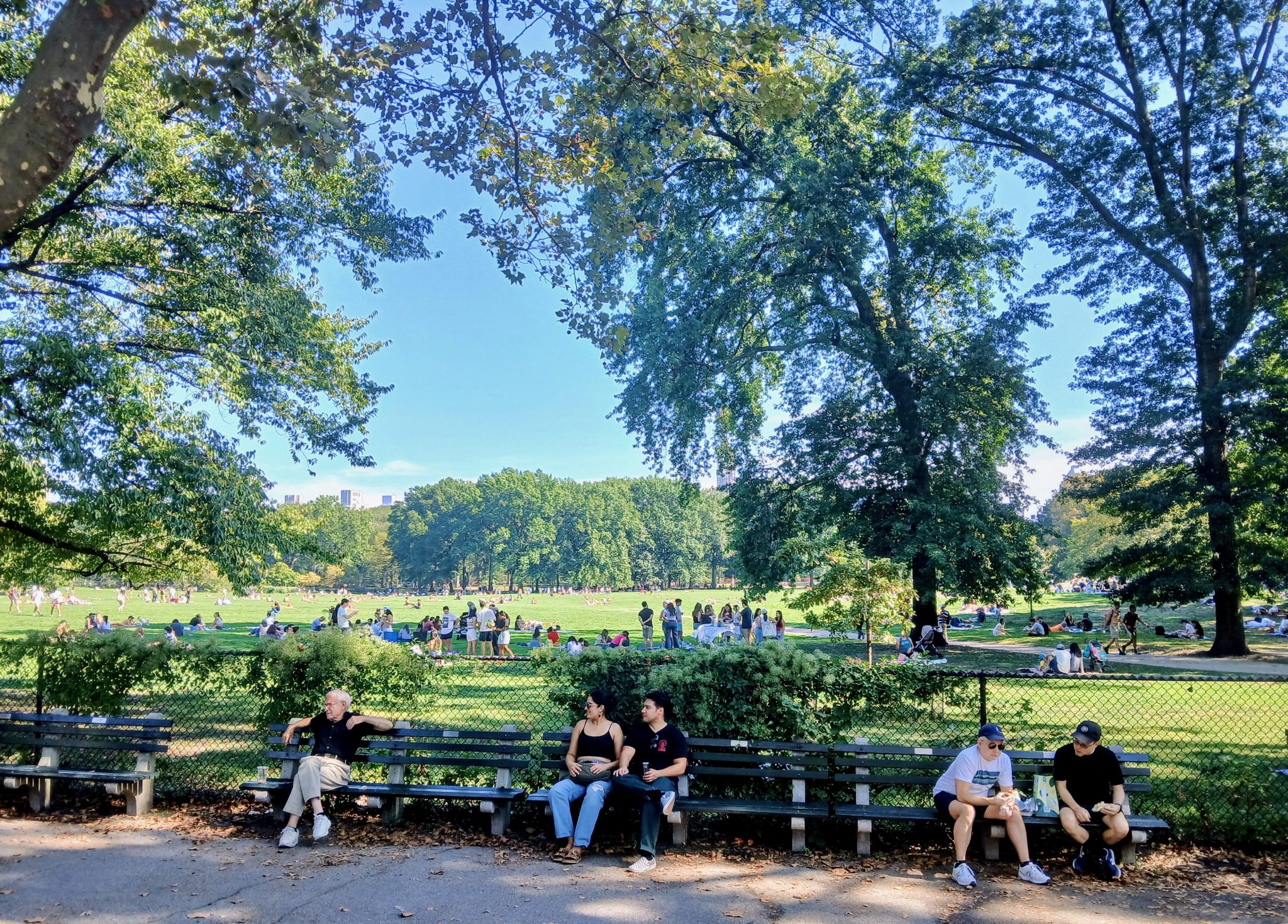
Sunday 28th September was our last day after a week in New York before flying to Toronto on the Monday. Annie took the subway to the Chelsea Markets, then a bus to Central Park, where she rented a bicycle to cycle through this enormous park, measuringapprox. 4 km (2.5 miles) long from north to south and 0.8 km (0.5 miles) wide from east to west.
Annie and her cycling buddies in Central Park.
People enjoying the park.
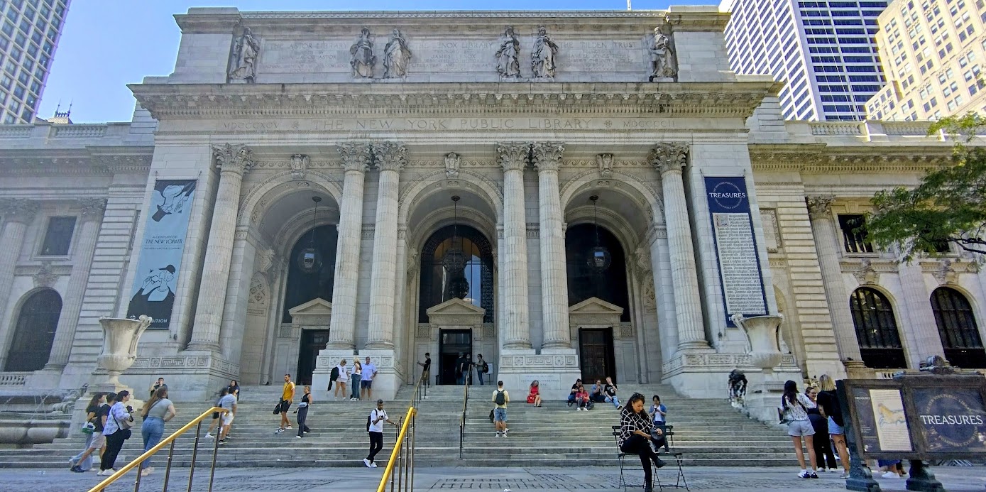
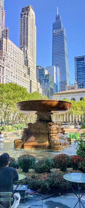
I had a relaxed walk to Bryant Park to visit the New York Public Library, enjoy a coffee in the park and later returning to the hotel to write up this account for our next post.
The daunting highways leading into Portland looked like plates of spaghetti on Google maps. So, we pulled off about 10km from the city centre for breakfast, to fill up with petrol and study the route to Avis, in case Google malfunctioned. All went well however and Evan picked us up and took us to their apartment.
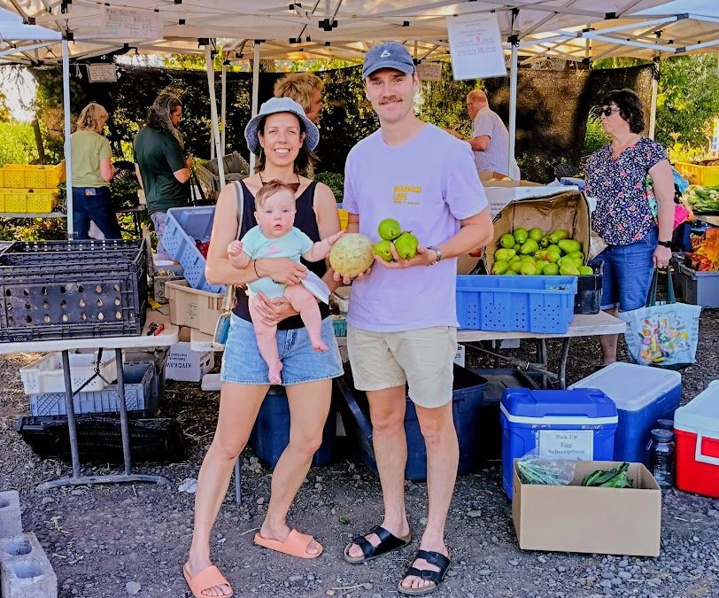
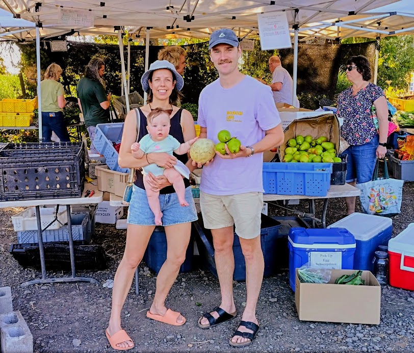
Karen, Nina and Evan at the fruit and vegetable market.
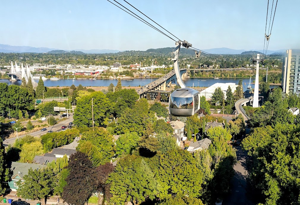
Our first impression of Portland was of a modern and clean city with not much city traffic, once off the highways. The lack of traffic is due to an efficient public transport system, called Trimet – trains, trams and busses. A $5.25 day ticket will take you anywhere you need to go in Portland. Just S-W of the city is Marquam Hill.
Aerial tramway up Marquam Hill to the hospitals.
For some strange reason the city planners decided that Marquam Hill was the ideal location for not one, but three hospitals. The biggest, the OHSU (Oregon Health Services University) is huge and covers all facets of health care training. Then there is the Shriner Children’s Hospital where Karen is currently working, and finally the US Veterans Hospital for US service personnel.
View fro the aerial tramway towards downtown.
Karen and two other Australian Orthopaedic Surgery Registrars, Benji and Sarah, live in modern apartments next to the hospital. When we booked our apartment nearby, we didn’t realise how steep this hill was when walking to Karen and Evan’s apartment, This challenge and more long walks in the city, resulted in painful left calf muscles for me, which by the end of the week was excruciating. Fortunately, we also discovered the aerial tramway which lower station was a block from our accomodation and took four minutes up to the hospital.
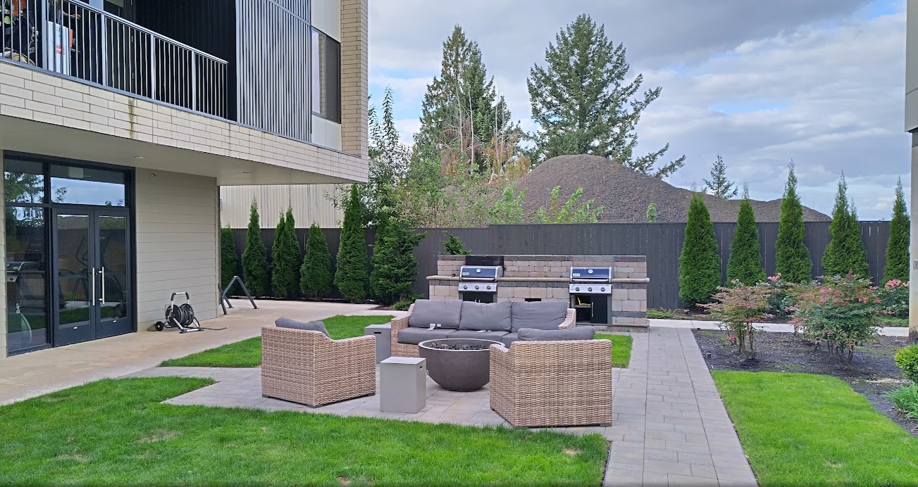
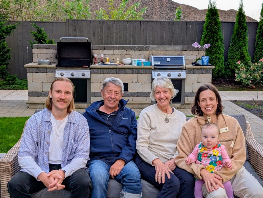
Outdoor BBQ facility at Karen and Evan’s apartment.
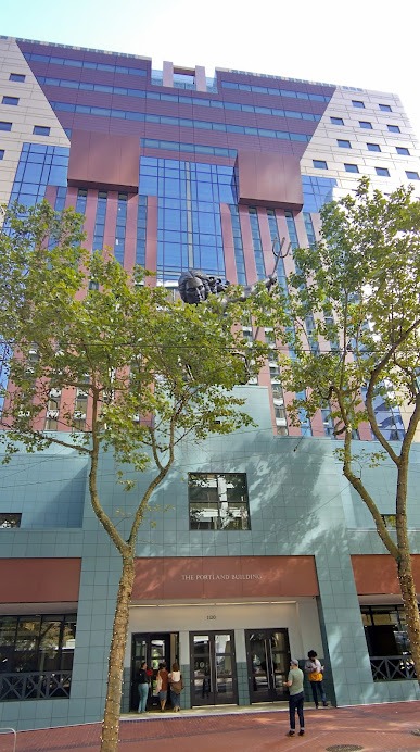
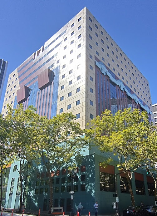
We however explored much of the city and a bookshop called Powell’s City of Books, which covers an entire city block over four floors and is the world’s largest independent bookstore. Back in 1982 the Portland Building was completed – the first example of Postmodern Architecture by Michael Graves – is still looking impressive after refurbishment in 2020.
Main entrance to the Portland Building, Portlandia above.
Rear of building – it covers an entire block and houses the city administration.
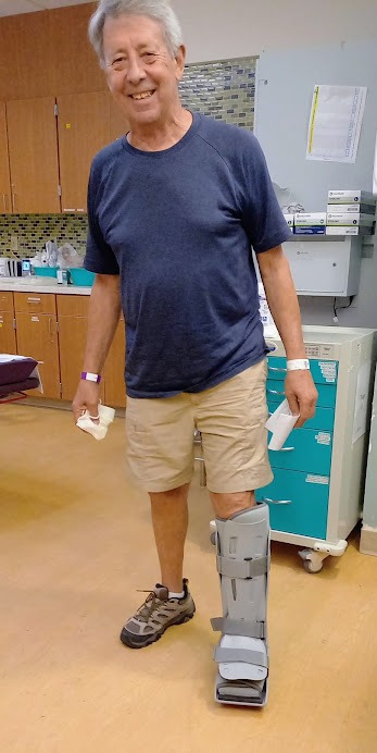
Early Saturday morning Karen and Annie dragged me to the OHSU emergency room where after triage, ultrasound and a MRI scan, my sore calf was diagnosed as a partially torn Achilles tendon. I walked out in a cumbersome boot on my left lower leg, which I have to wear for two months – aargh!
The ridiculous boot.
On Sunday we celebrated Karen’s 37th birthday with coffee and pastries in the morning and a BBQ with her fellow registrars in the evening. A good time was had by all after meeting Benji from Sydney and Sarah from Canberra.
Birthday coffees.
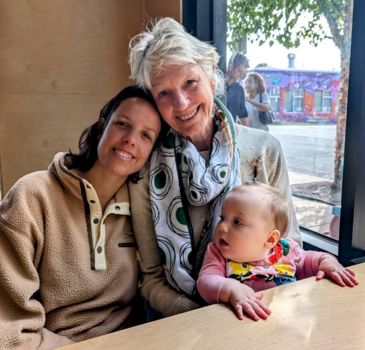
Three generations.
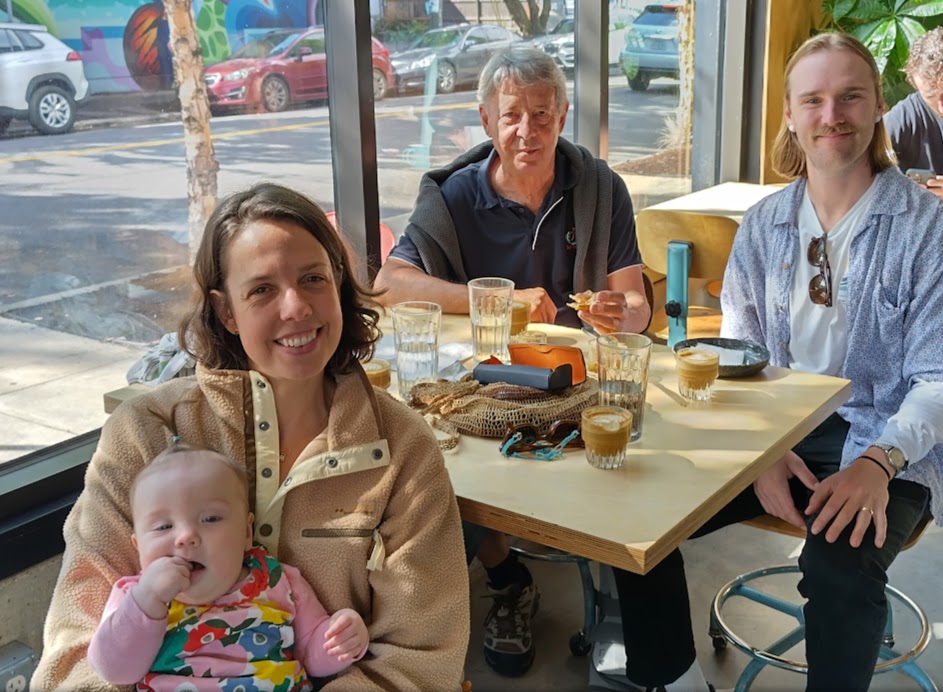
Birthday BBQ – the family.
After a lovely week of catching up with Karen, Evan and Nina– who’s is developing in leaps and bounds, we caught an Uber out to the airport on Monday morning, for our flight to New York. Having hobbled all the way to the departure gate, the lady at the gate insisted on booking a wheelchair for me at Newark Airport NY. Just as well!
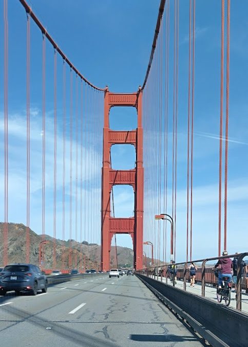
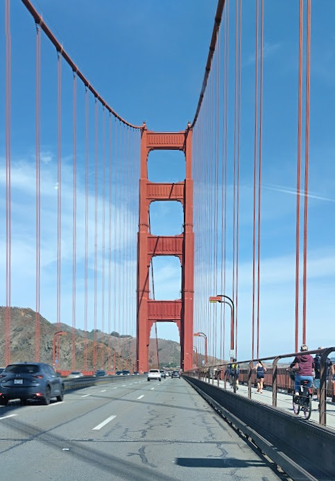
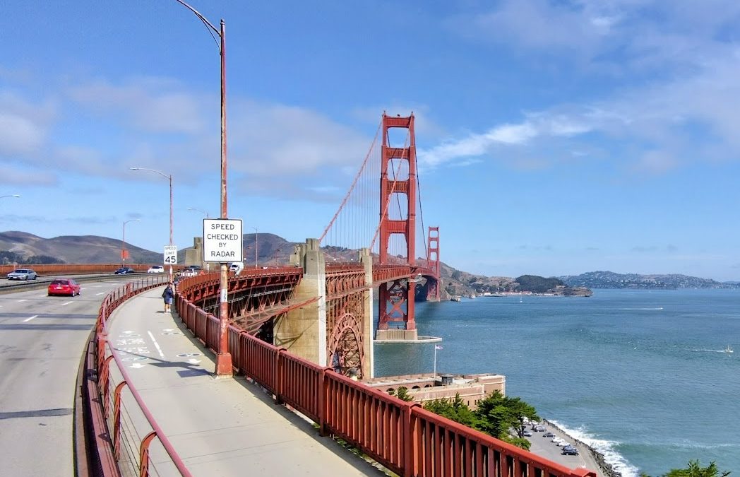
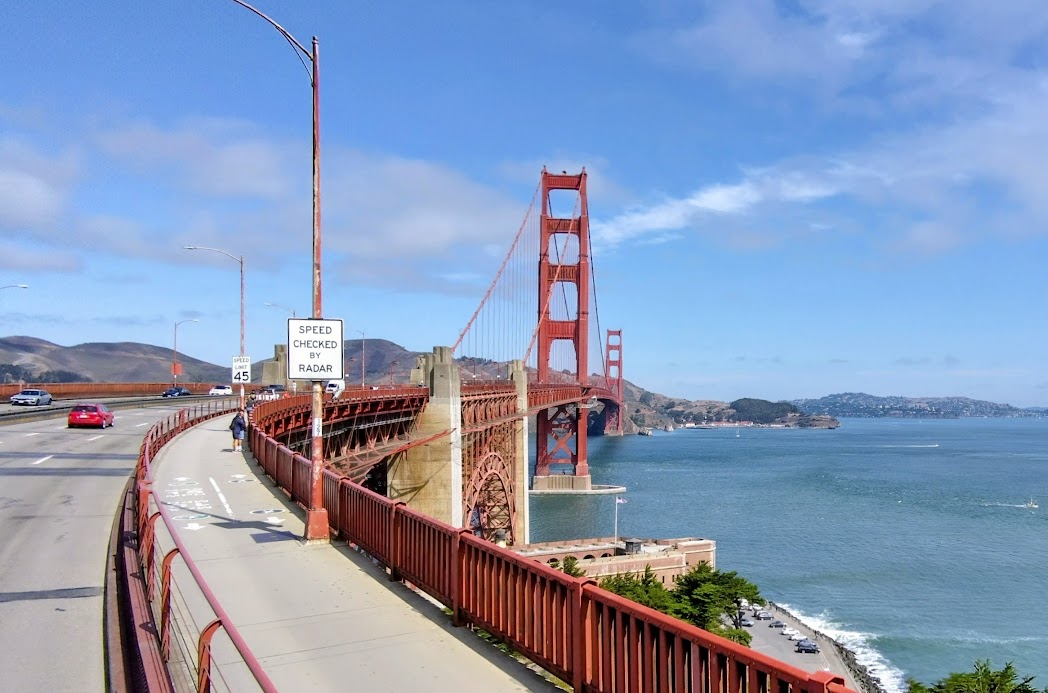
Leaving San Francisco over the Golden Gate bridge.
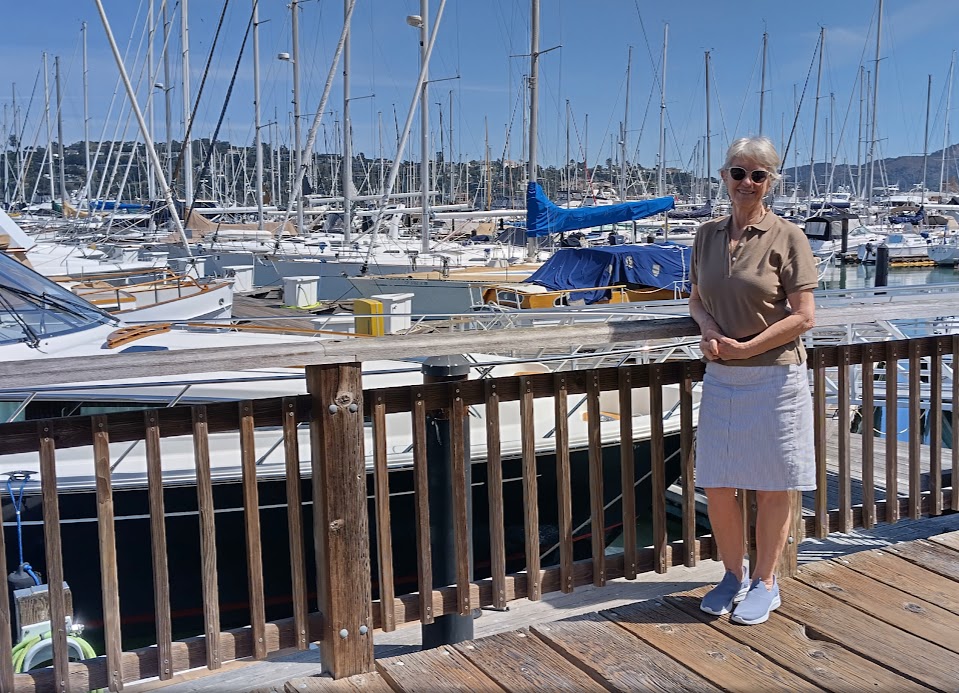
On Sunday 8th September we picked up a car at Avis and headed north out of SF to see the Redwood forests enroute to Portland, Oregon. Our first day was quite a long drive with a stop in Sausalito for coffee on the waterfront, before turning off Interstate 101 to take the old no. 1 coastal route. This twisty scenic drive was quite hectic, so we rejoined the 101 at Santa Rosa, driving through miles of vineyards to Mendocino. We arrived at the Seaview Motel in Fort Bragg at 6pm, after 200miles.
Sausalito waterfront.
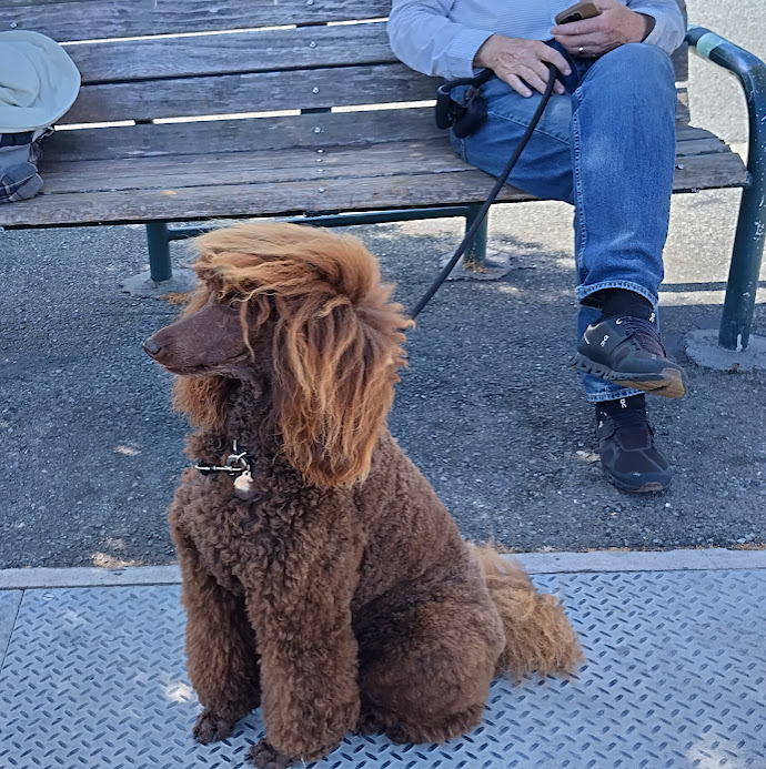
I couldn’t resist this cutie – a Sausalito poodle with a Tina Turner hairstyle.
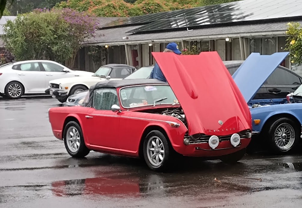
The motel room was so well appointed and spacious after the small hotel room in San Francisco, that we decided to stay for two nights to explore the area. The same afternoon a group of classic British Triumph sportscar owners arrived with 14 cars, mainly TR4, TR5 and TR6 models. In my view the TR4 model is still the prettiest.
Next morning, after discussing all things Triumph and comparing engines, a red TR4A has to jumpstart a blue TR6.
Mendocino streetscape.
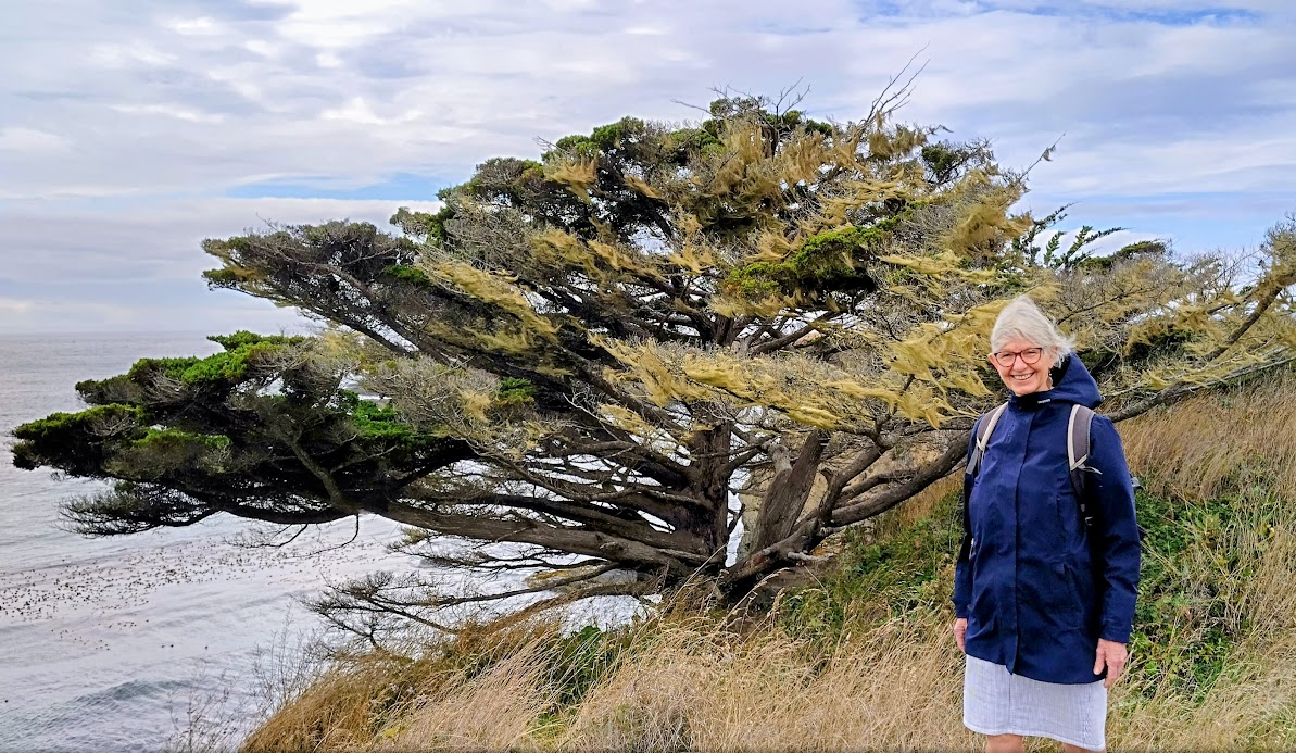
Mendocino clifftop walk. The trees battle against the Pacific Ocean winds.
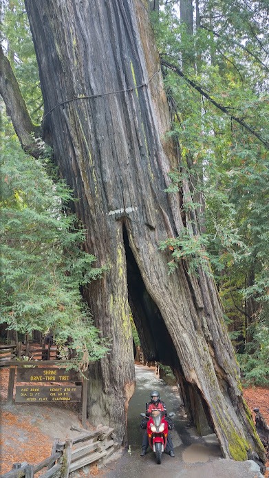
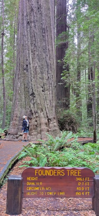
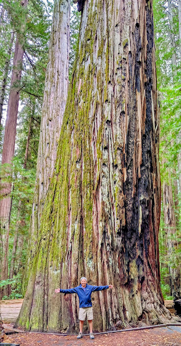
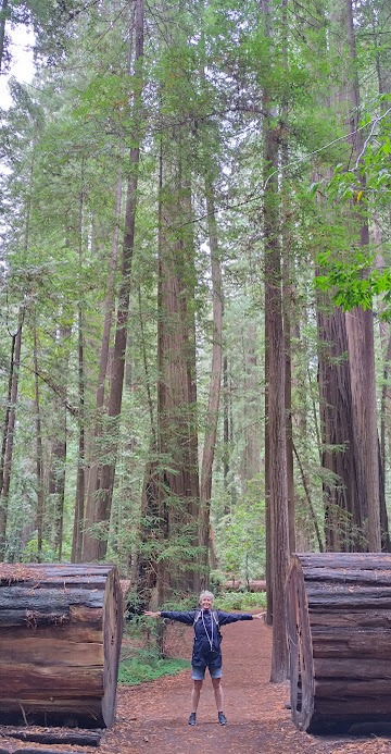
From here, we headed north along the coast to rejoin US-101 at Leggett, before turning off onto Route 254, the famous “Avenue of the Giants” through the Redwood forests. Our first stop was at Myers Flat to look at the “drive through tree”. Then, the Founders Tree at Founders Grove, where we did a 5km hike through the forest. A narrow, twisty road took us to the 10km Big Trees Loop trail, where we were gobsmacked by the Giant Tree, The Tall tree and the Flatiron Tree.
The drive through tree.
The Founders Tree. You do the metric conversions!
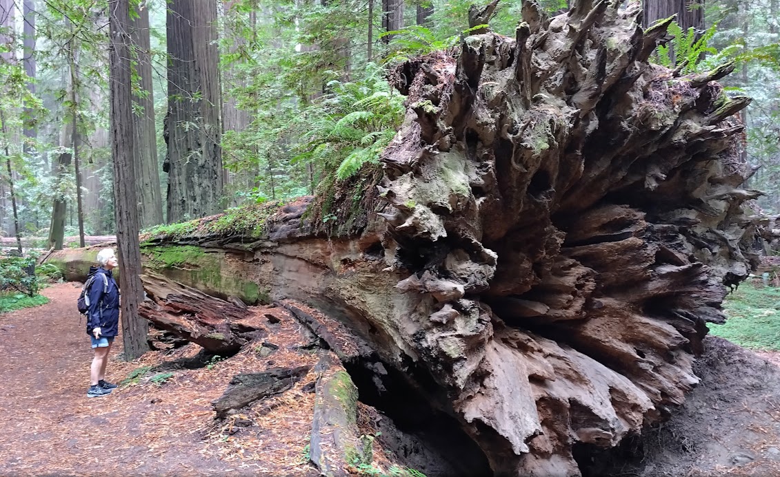
A fallen tree, showing the root system.
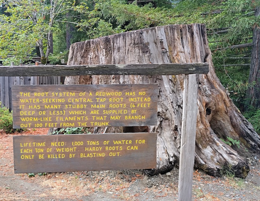
Some background on Redwoods.
The Giant tree.
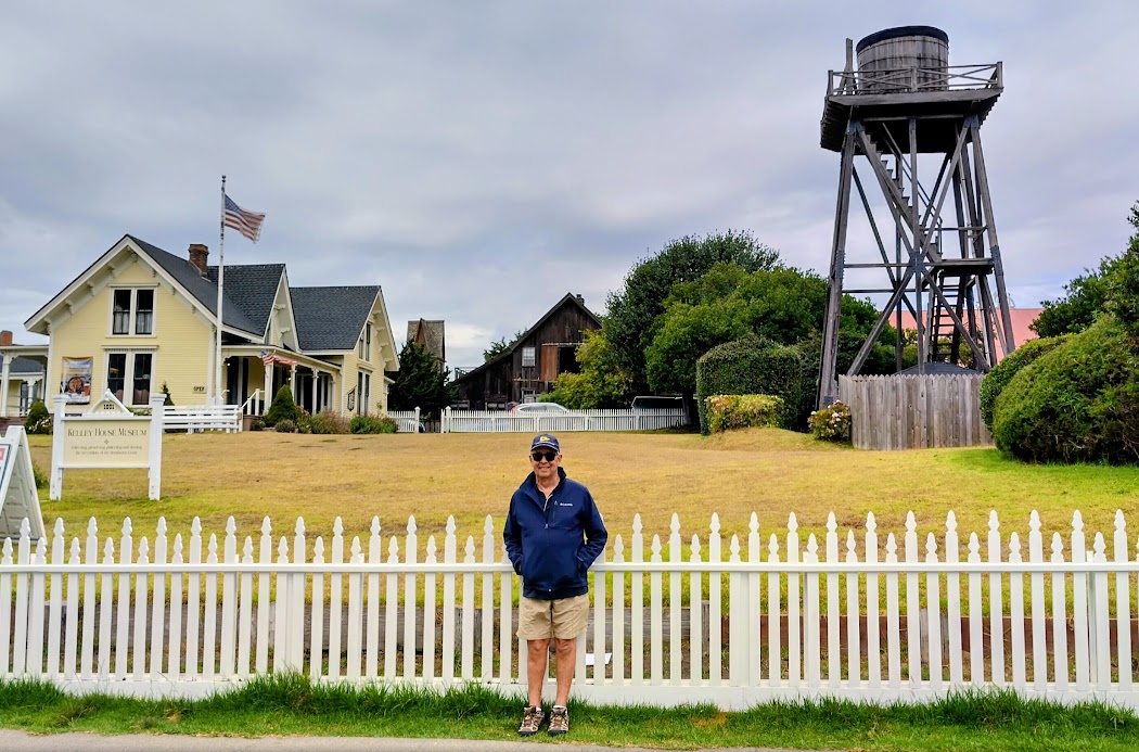
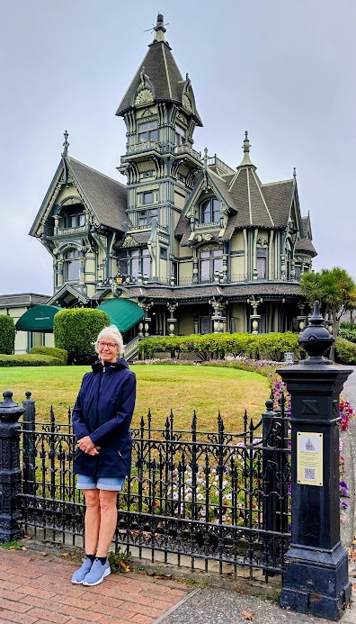
Late afternoon, we arrived tired and scenically overloaded at Eureka on the coast. Our Travelodge Motel was a block away fro the beautiful Old Town, where we spent the next morning admiring the well preserved Victorian buildings on 2nd and 3rd streets. The Carson House and Pink Lady mansion were outstanding. The Carson family moved to the Bay Area in 1940 and by 1950 the house was in disrepair.
The Victorian Carson House.
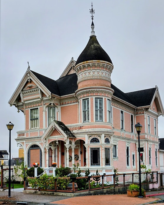
The Carson family offered the house to Eureka City for $1, but they declined the offer and decided to demolish the house. A group of concerned citizens clubbed together and offered the family $35,000 for the house including the contents and artworks. Today it is a private club for those citizens, whose sole purpose is the preservation of the house!
The Pink Lady mansion.
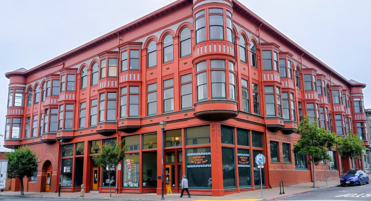
Victorian office building.
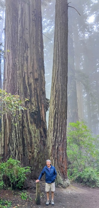
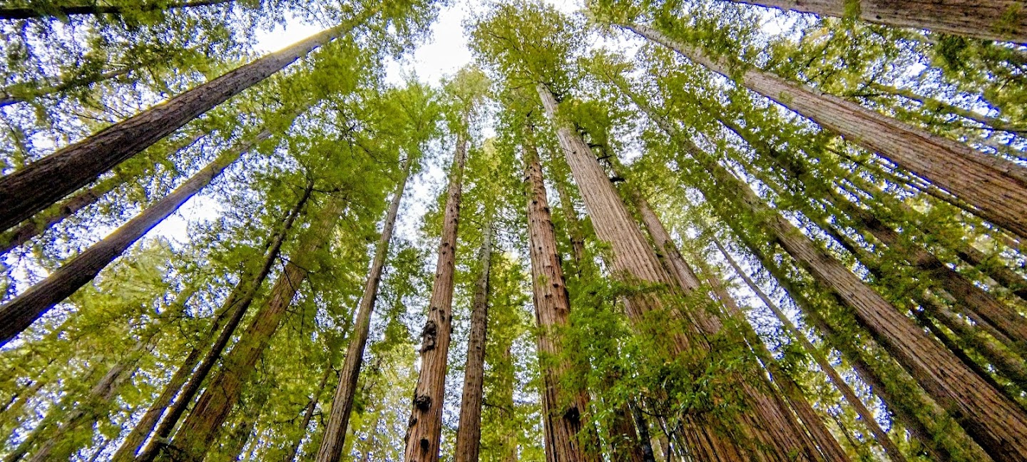
Our journey continued north through the Humboldt State Forests until we stopped at the Lady Bird Johnson Grove Trial. The 7km hike is truly spectacular, particularly on this day, when there was a thick, eerie mist covering the tops of the Redwoods.
Lady Bird Johnson grove.
Annie cut a tree.
Finally, a Redwood canopy looking up.
The next stop later that afternoon, again knackered after all the walking, was in Crescent City’s Beachside Inn motel. For dinner we had tasty turkey and salad wraps from the nearby Safeway supermarket, washed down with a bottle of Australian Lindeman’s Chardonnay. Cheaper than the Napa Valley wines and cheaper than in Australia! How does this work?
At 10:00am on Thursday 11th September we crossed the state line from California into Oregon and filled up with petrol in Brookings, where the petrol is cheaper than in CA. The regular unleaded price per gallon is equivalent to $1 per litre here – In Australia, usually nearly $2/litre. Not complaining, we drive an EV back home. We arrived in Gold Beach at 11:00am, too early for our motel, so had a late morning hearty breakfast at the Indian creek Cafe. Annie went for a coast walk to soothe her hamstrings, while I chilled, planning the rest of our trip.
View from Annie’s coastal walk.
Friday was an easy three hour drive to Florence through beautiful plantations, but no longer redwood trees. The main timber species found on the Oregon coast are Douglas fir, Sitka spruce, and pine trees. Forestry plays an important part in the Oregon’s economy – we frequently passed trucks laden with timber logs and some timber sawmills with mountains of logs and sawdust outside.
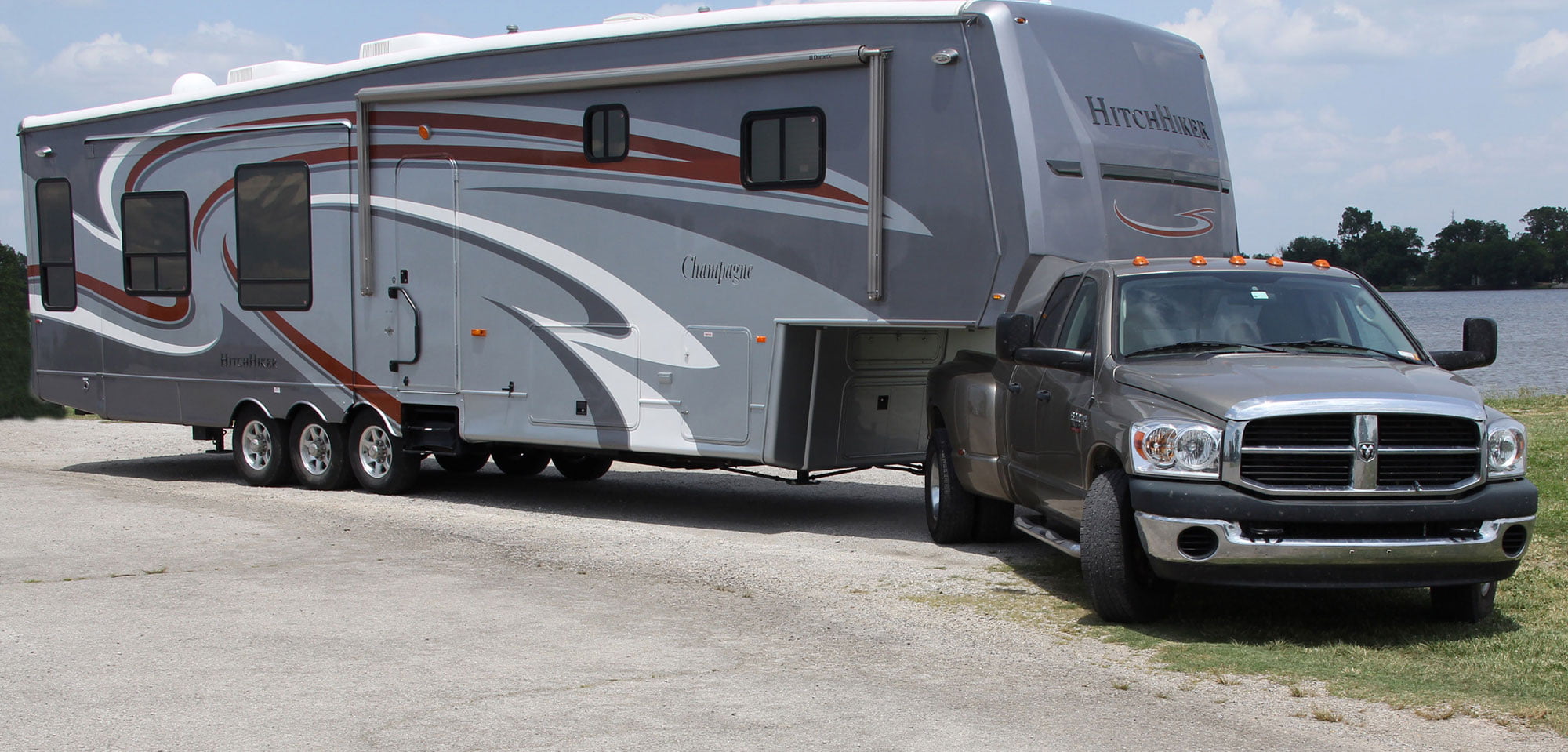
The most amazing thing for us to see, was the large number of RV’s on the road. These ranged from caravans as we know it in Oz, to what they call fifth wheel caravans which hitch onto the load tray of a ute (called a truck here). These trucks are usually 6.6 litre, V8 monsters. I can only imagine what their fuel consumption must be.
A fifth wheel caravan.
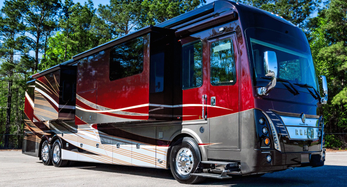
The fifth wheelers however, pale in comparison to the camper vans that look like municipal busses in Oz. Imagine the stress driving and manoeuvring these behemoths. Their engines must be enormous, because they cruise at the regular 60mph speed limit (100km/h). At the local regular petrol price of around USD1/litre (down to 50c/litre further inland!), I suppose its not too much to pay, if this vehicle is your home. Nine times out of ten, a camper van like the one below, would also be towing a car – not a Mini, but big Jeeps or trucks!
A camper van – a complete house on wheels!
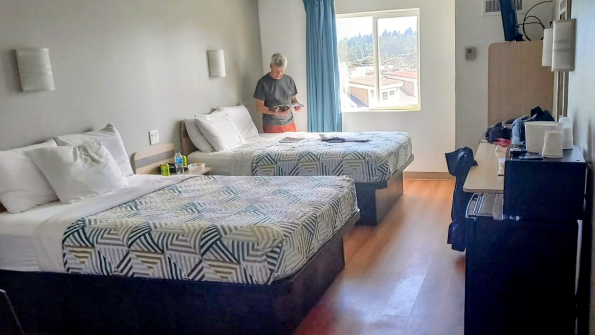
While researching our trip along the coat of California and Oregon, we soon discovered there were dozens of RV or caravan parks in or near every town. The cost of renting a RV was much higher than a car and when we realised that the overnight charge for a campsite was about the same as a motel room with bathroom in every town, it was a no-brainer to rather use the motel option. Motels are cheap, but a standard room has two queen size beds which is a bit of a waste on us. Occasionally we were able to get one king size bed.
You could have a party in here.
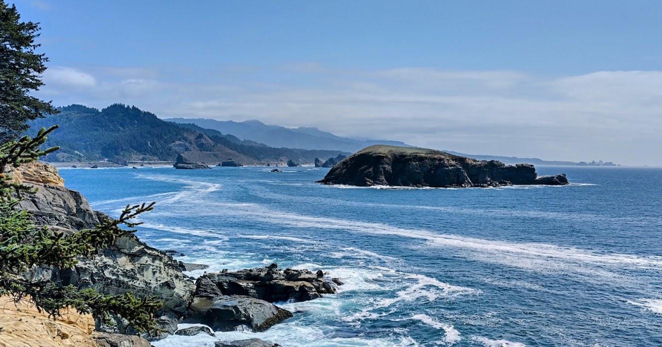
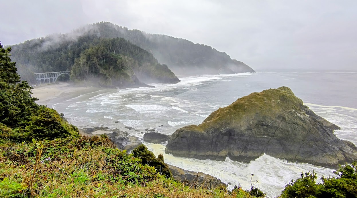
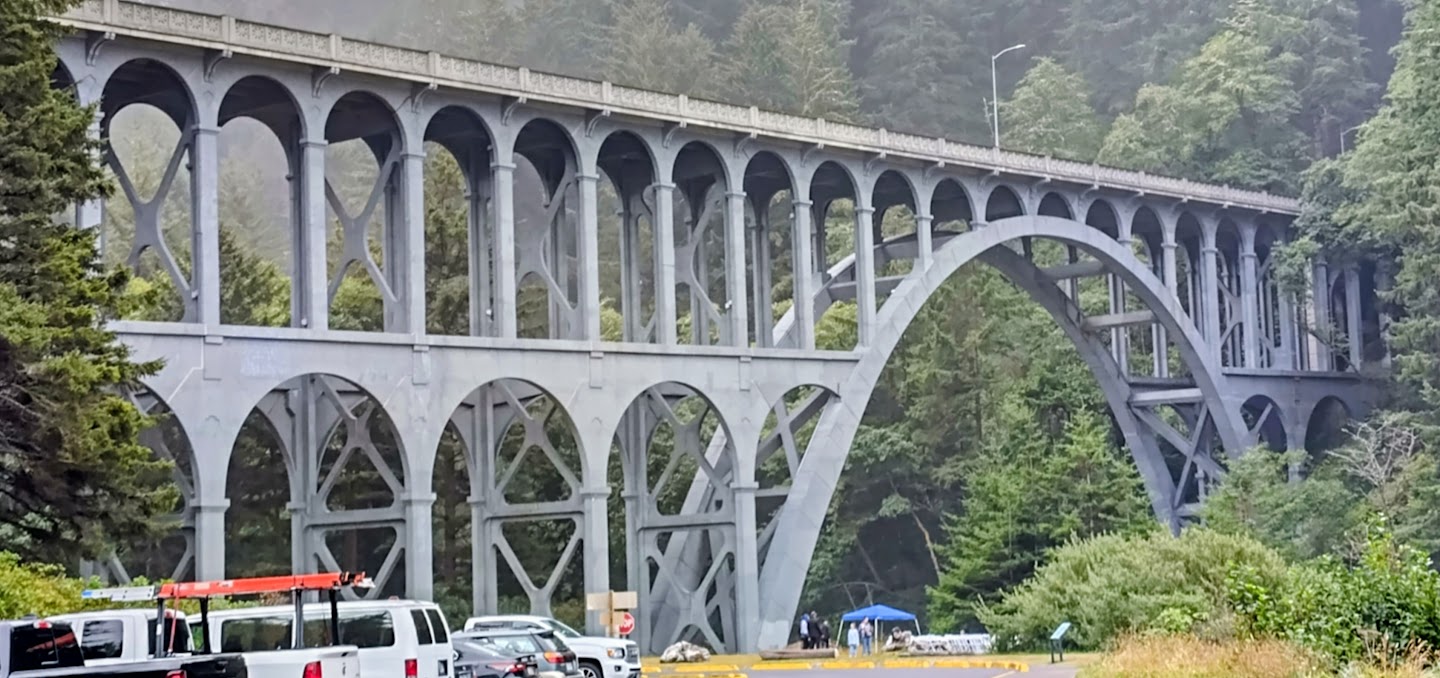
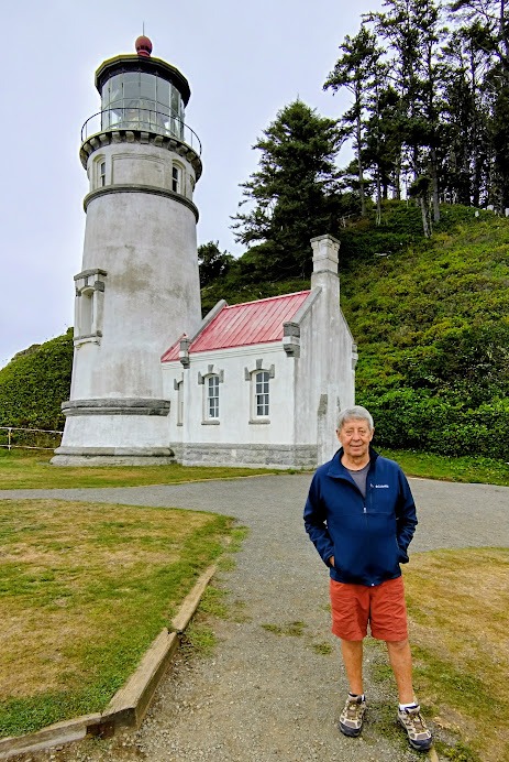
Walking along the Oregon coast to the Heceta Head lighthouse.
Starting the walk from the road bridge at the river mouth.
The Heceta head lighthouse.
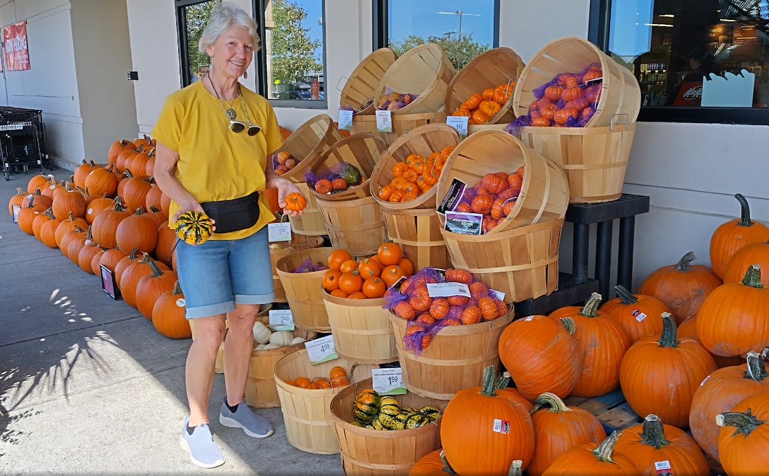
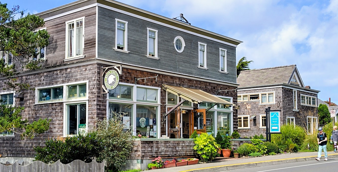
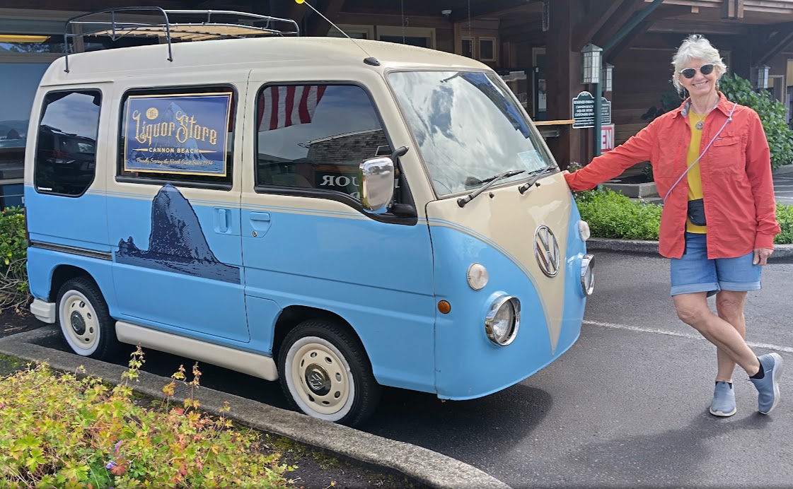
For our last two days on the road we stayed at Lincoln City and Cannon Beach, with walks along the way. I must say the coastal scenery in Oregon is beautiful and the roads a pleasure to drive on. We drove into Portland on Monday the 15th of September and dropped off the car (a Jeep Compass) at Avis, where Evan picked us up.
Lincoln City: pumpkins for sale at the Safeway supermarket.
Cannon Beach: houses in Oregon are mostly clad with Western Cedar shingles.
A clever conversion on a Daihatsu half loaf delivery van.
Inspiration for our garden.
Eight days and 901 miles (1,350 km) travelled and having met very friendly people, we were delighted with the road trip experience. We will report later on the next leg of our trip.
The month of August was relatively quiet, cold and wet. Our first sail outing in a while was on the 16th August to the Basin for a BBQ with the Sail Cruising Division. We had a good turnout as the sailors were keen to get out and socialise again.
But enough of sailing – this is after all a sailing and travelling blog. So let’s start travelling.
Annie and I spent some time on the internet and booking.com organising visas, accomodation and rental cars for a trip to the USA, Canada and New Zealand during September and October. We’ve been everywhere, but believe it or not, not the USA! (or Russia)
We flew out of Sydney to San Francisco on the 3rd of September. Fortunately for you, we can’t bore you with selfies of us sipping champagne in the first class lounge, because we still fly economy. The risk of a sumo wrestler sitting next to you!
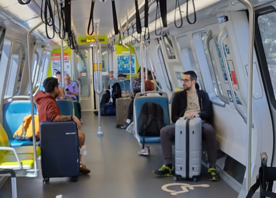
The Bart system – still modern today and very fast.
Arriving in San Francisco, I was excited to ride on the Bay Area Rapid Transit system (BART). The system was brand new in 1974 when I did my thesis for a degree in architecture (An integrated transport hub for mainline trains, underground rail, busses and a parking garage for cars). I received information from various underground systems from around the world – the most comprehensive information I received was from BART.
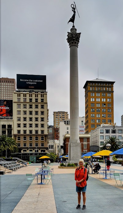
Union Square.
We checked into an hotel close to Union Square, which is central to the city. Our first day out, we explored by foot, covering 12.5km up and down hills – SF is famous for its steep topography and cable trams. A nice downhill walk through the financial districtgot us to the Port of San Francisco, from where we followed the shoreline past all the piers to number 39, which is the famous Fisherman’s Wharf. We stopped for lunch there and I had my first clam chowder, which was delicious.
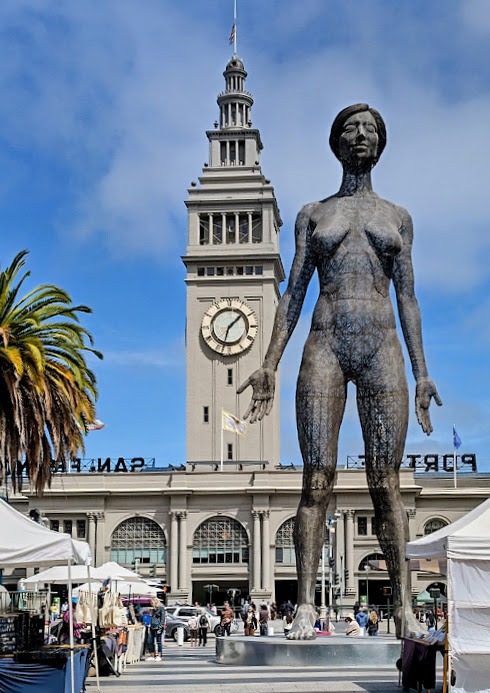
Main entrance Port of San Francisco.
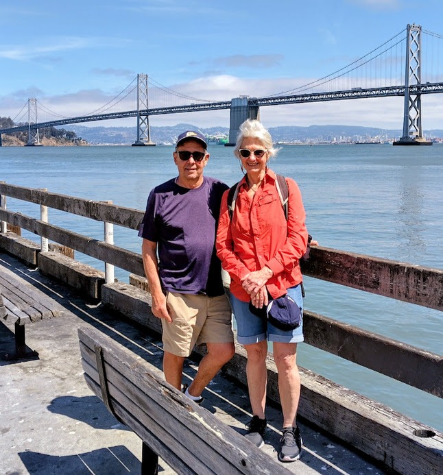
Looking across the bay with the Bay bridge behind us.
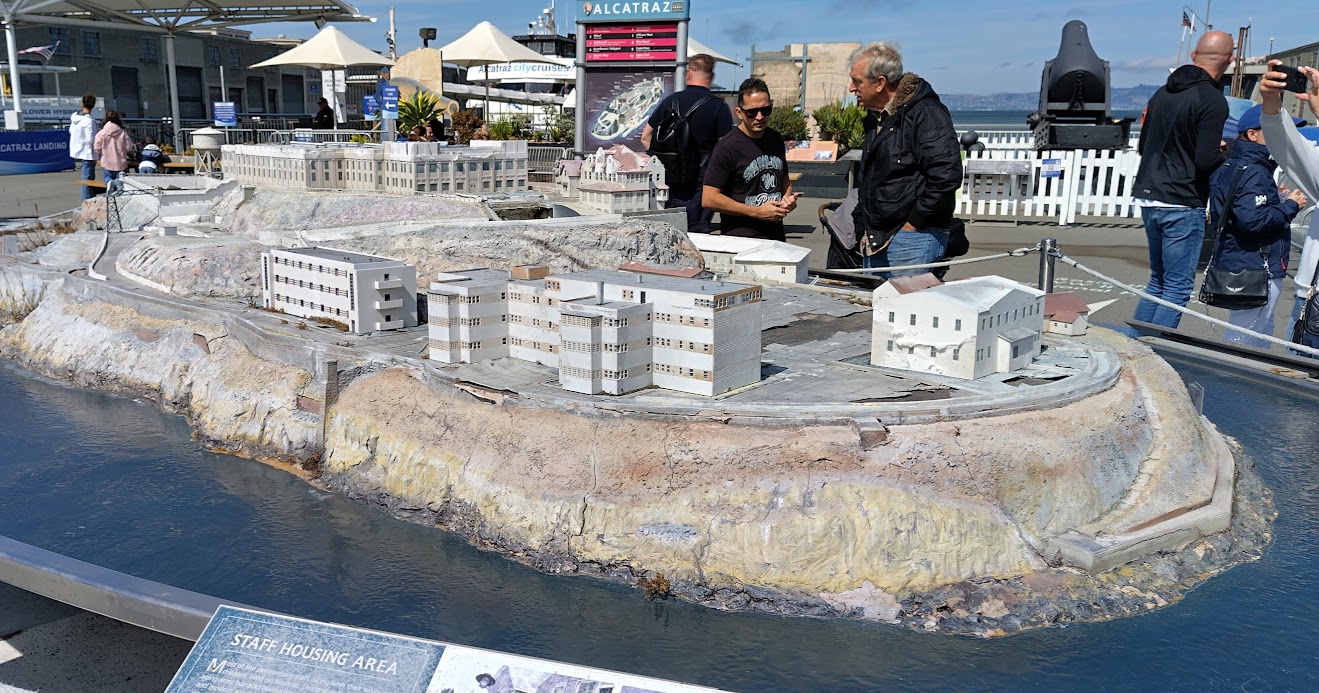
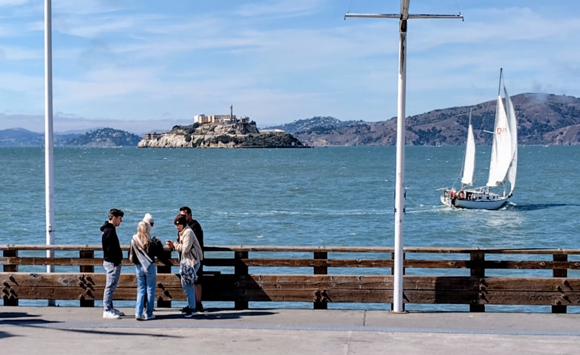
Model of Alcatraz island at Pier 35.
Looking out to Alcatraz.
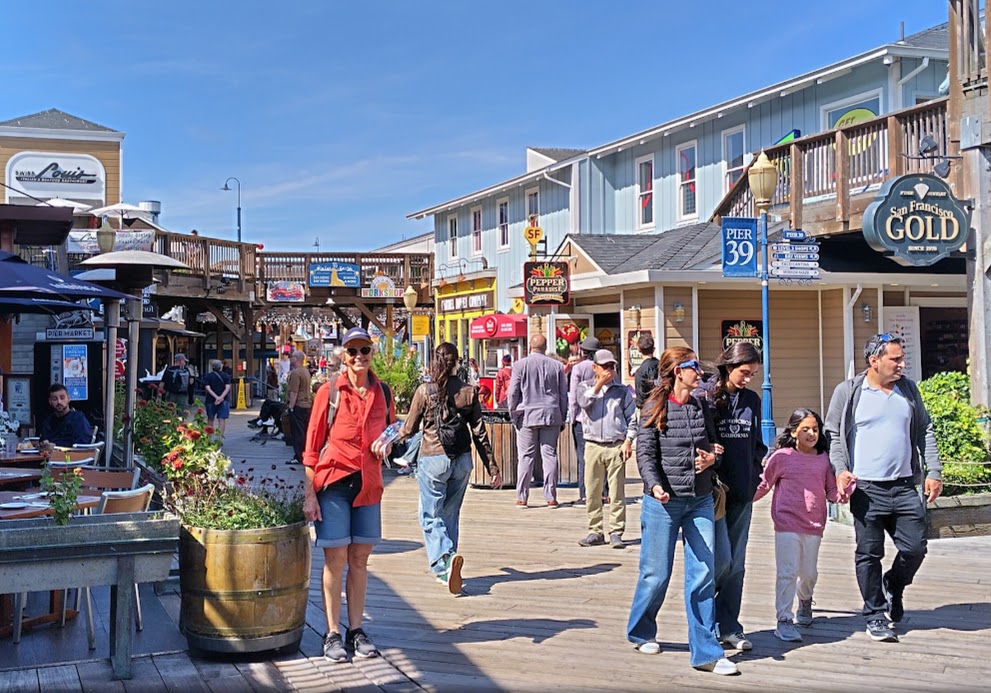
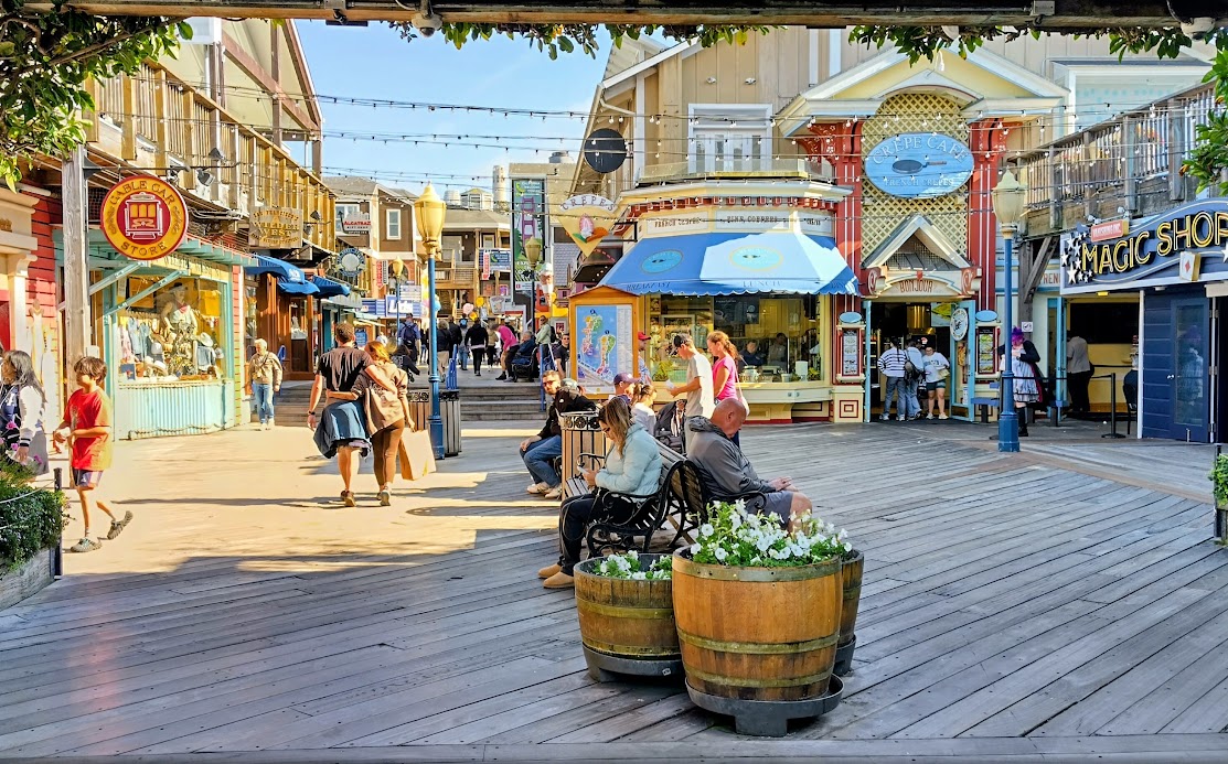
Fisherman’s Wharf.
Then, up and down the hill back to our hotel for a shower, snacks and a bottle of tasty Napa Valley Chardonnay. What was clear after our day out and seeing the locals, is that SF is the world capital of alternative genders – but everyone is laid back and accepting. I was happily humming the lyrics of the Kinks 1970 hit Lola:
Well, I’m not the world’s most physical guy
But when she squeezed me tight, she nearly broke my spine
Oh, my Lola
Well, I’m not dumb, but I can’t understand
Why she walks like a woman and talks like a man
Oh, my Lola……
Fisherman’s Wharf – another view.
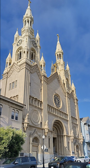
Saints Peter and Paul church on top of the hill.
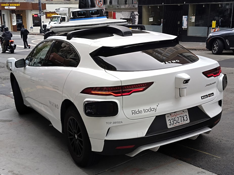
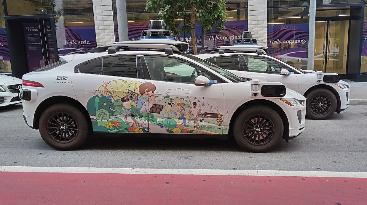
The other interesting thing about SF, is the many driverless Waymo electric robotaxis on the road. There are currently more than 300 of them in service and they are quietly and efficiently doing on average, 4,300 trips per day currently, accounting for 23% of the taxi market share in SF. The whole fleet are Jaguar electric vehicles.
A Waymo robotaxi.
Clearly, nobody behind the steering wheel.
The next day, we took the Big Red Bus hop-on, hop-off essential day tour, to rest the legs. This was an excellent way of covering all the popular areas including the Haight Ashbury area where the hippies hung out in the late sixties. I used to dream of being there for the summers of peace and love, but it was hard enough paying for Uni, never mind travelling.
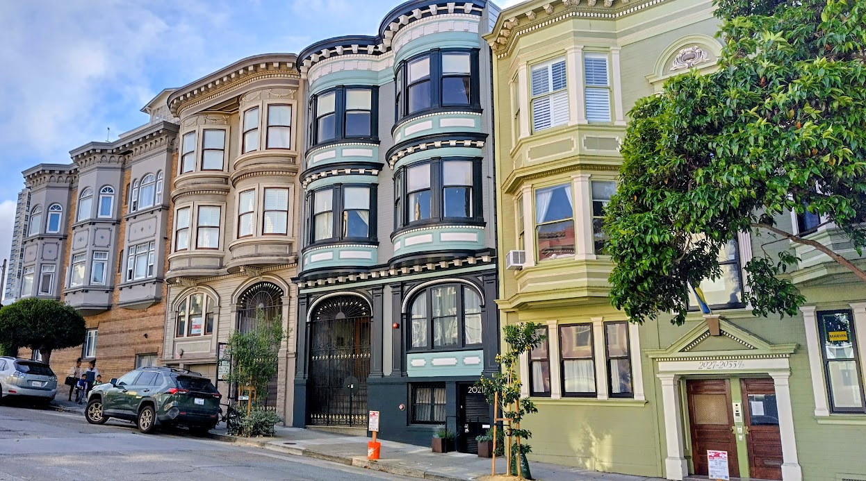
Beautiful “Painted Ladies” on the way to Haight Ashbury.
Turning into Haight Street.
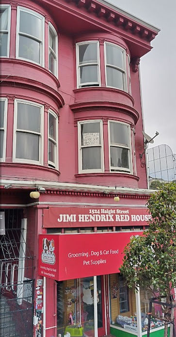
Jimi Hendrix’s pad.
Having played in a band at school and being a bit of a music tragic, I followed the SF scene with Janis Joplin, Jimi Hendrix, Jefferson Airplane, the Grateful Dead, Santana, Crosby, Stills etc, all home grown SF musicians. This time around, I was humming Scott McKenzie’s 1967 “Summer of Love” hit, San Francisco:
If you’re going to San Francisco
Be sure to wear some flowers in your hair
If you’re going to San Francisco
You’re gonna meet some gentle people there (and so on)
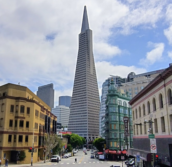
The Transamerica Pyramid completed in 1972.
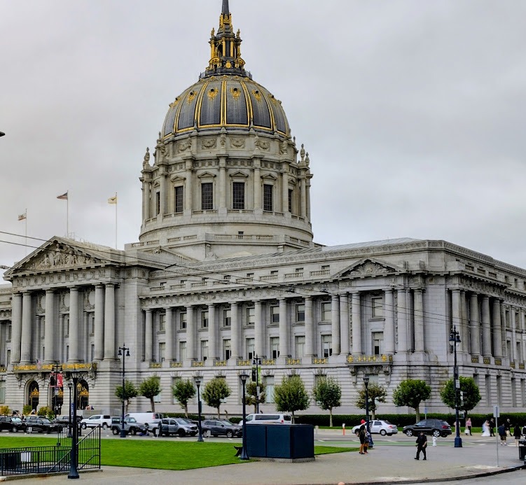
San Francisco City Hall. The United Nations Charter was signed here in 1945.
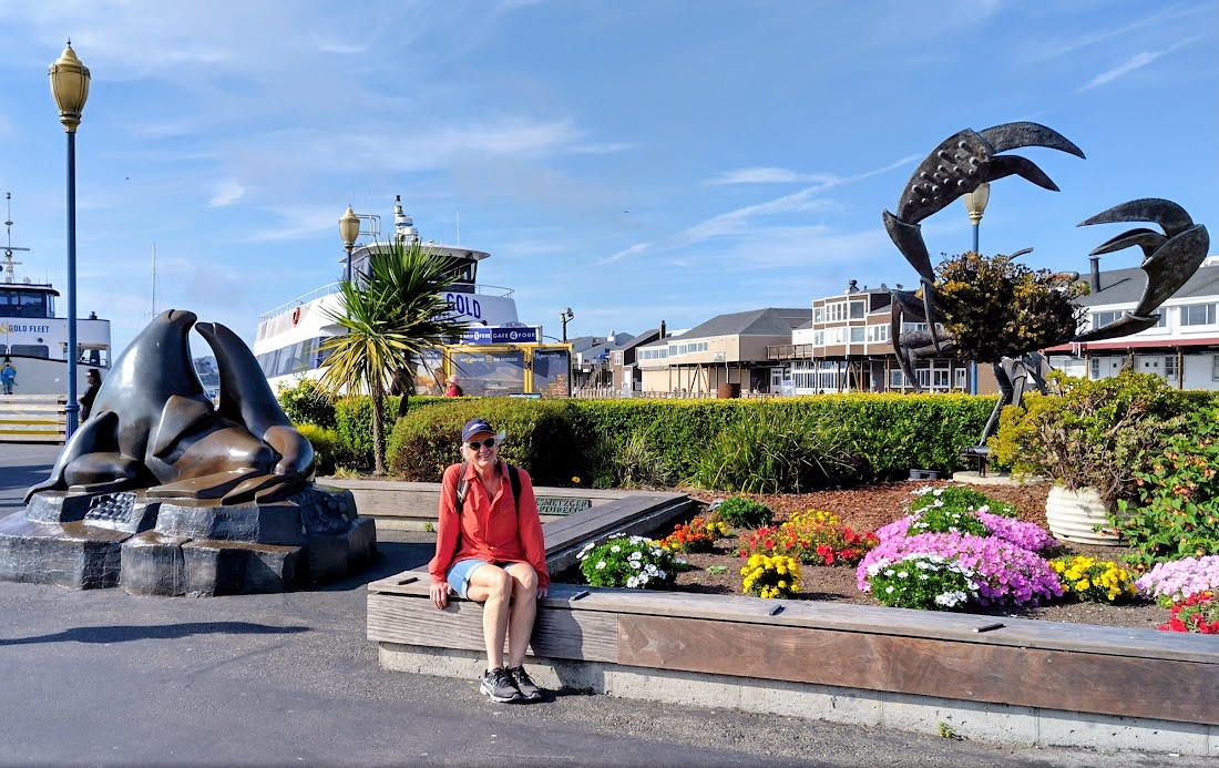
Passing th harbour front again – interesting sculptures.
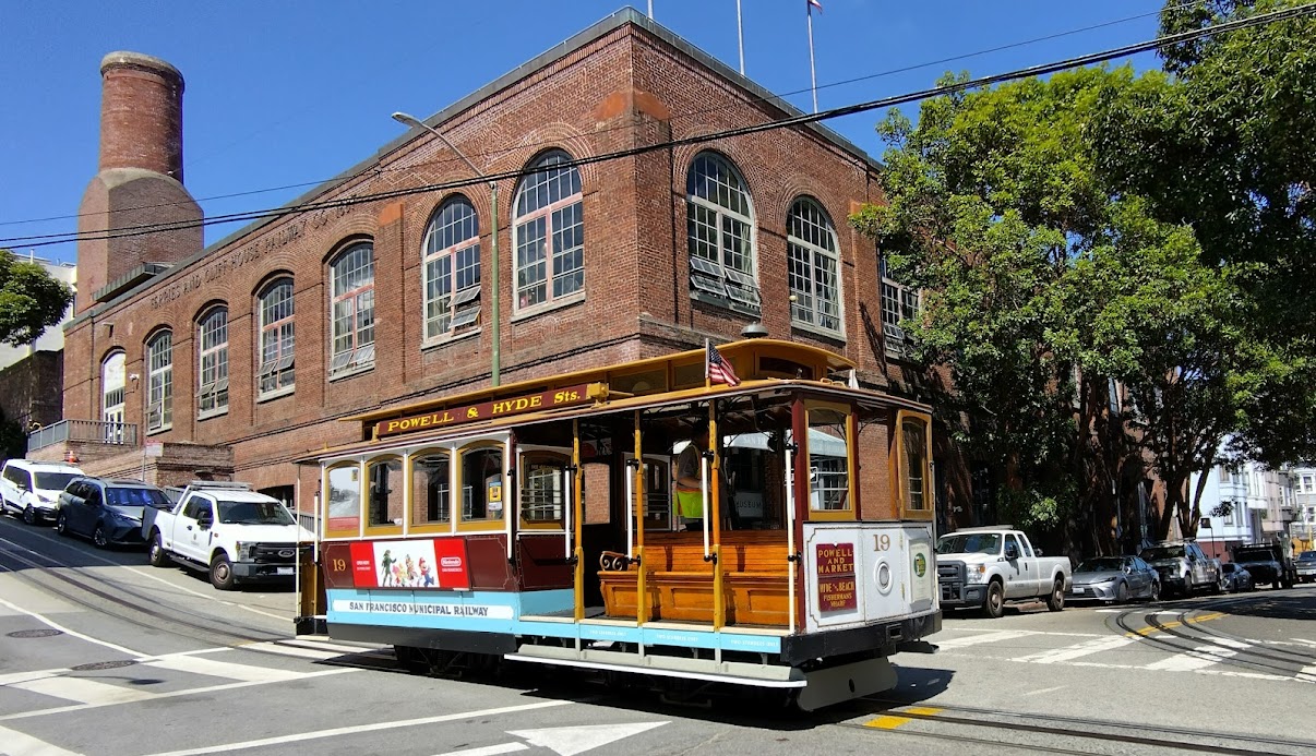
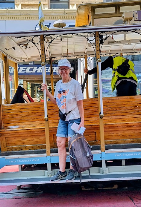
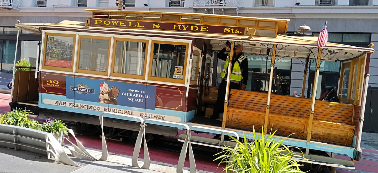
On Saturday our second last day, we tried the cable car (tram) system. For $15, you can ride the trams of the four lines for 24 hours, San Francisco’s cable cars were invented by Scots-born engineer, Andrew Smith Hallidie in 1873 to overcome the city’s steep hills, which horses struggled with on the wet and slippery cobblestone roads.
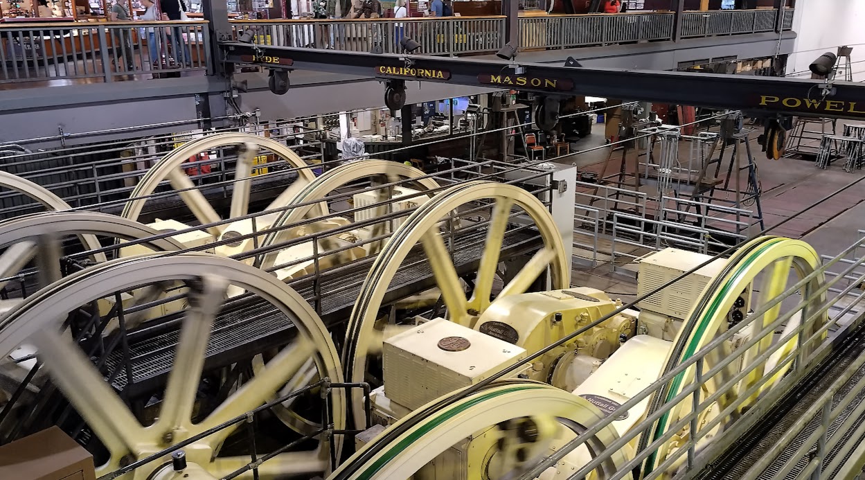
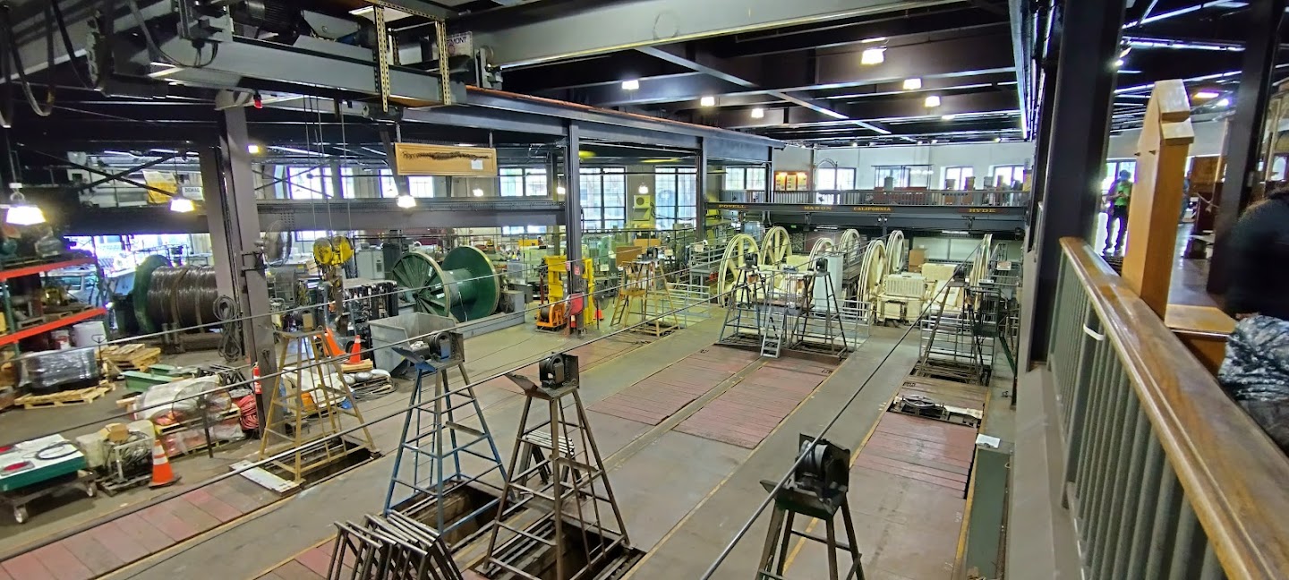
The central powerhouse and museum – the heart of the cable car system. Four lines run out from this powerhouse.
The four sets of winding wheels with their electric motors in the powerhouse.
From here the cables head out into different routes.
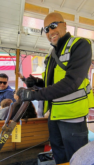
San Francisco’s cable cars work by being pulled along by a continuous, underground 32 mm steel cable, rather than having their own engines or exposed electrical cables. The longest looped cable on the California line is 6,600 (6.6km) long. The cable is moved by giant winding wheels in the central powerhouse. A crew member, the gripman, operates a lever to open and close a clamp (grip) on the car, which bites onto the moving cable to pull the car forward.
A friendly driver or gripman.
Annie stepping off a tram.
The same tram at the bottom of the hill and the end of its loop.
And now a bit of background on the 1906 SF catastrophe, which destroyed the cable car system: The 1906 San Francisco earthquake, which struck on April 18th 1906, was a catastrophic event that triggered a three-day fire from broken gas lines, destroying over 80% of the city, leaving around 250,000 people homeless. The earthquake destroyed over 500 city blocks, leaving 28,000 buildings in ruins.
Caused by a violent rupture along the San Andreas fault, the earthquake damaged infrastructure, including the crucial water system, which prevented effective firefighting efforts and allowed the ensuing fires to consume the city. While the death toll is estimated to be around 3,000 to 3,500. The disaster led to major changes in building codes, improved disaster response, and a dramatic, rapid rebuilding of the city, although the disaster also exposed social inequalities.
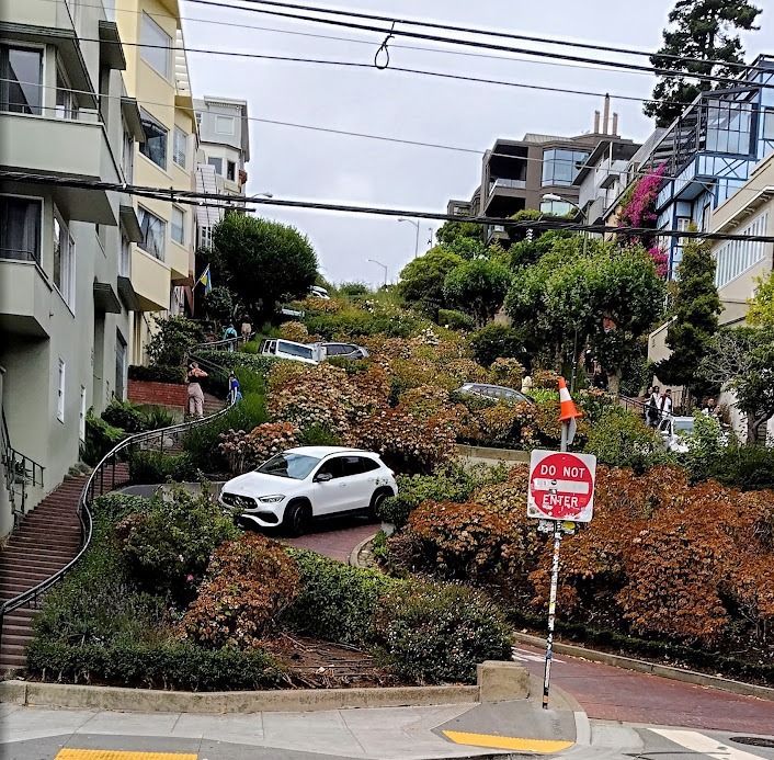
Afterwards, I nearly busted my gut walking up this section of Lombard Street – twisting because its so steep.
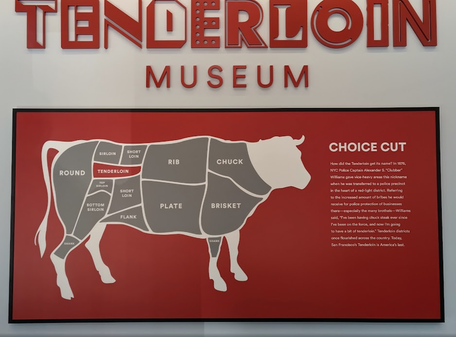
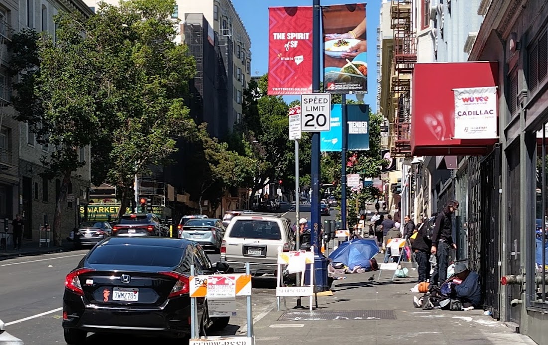
After the cable car rides, we walked to the Tenderloin Museum in Eddy Street.The term “Tenderloin” was originally applied to vice-ridden districts in cities like New York and later San Francisco, where it was said that police officers could afford better food (like tenderloin of beef) on bribes, than they could earn on regular salaries. This museum is very informative, but the surrounding area lives up to its reputation: drug addicts living on the pavements, openly using meth and fentanyl.
The tenderloin museum entrance.
People living on the pavement just outside the museum.
After a busy and wonderful time in San Francisco, on Sunday the 7th September we picked up a car at Avis and headed north out of SF to see the Redwood forests of California, enroute to Portland, Oregon. We will report back after our visit to Portland. Cheers for now.