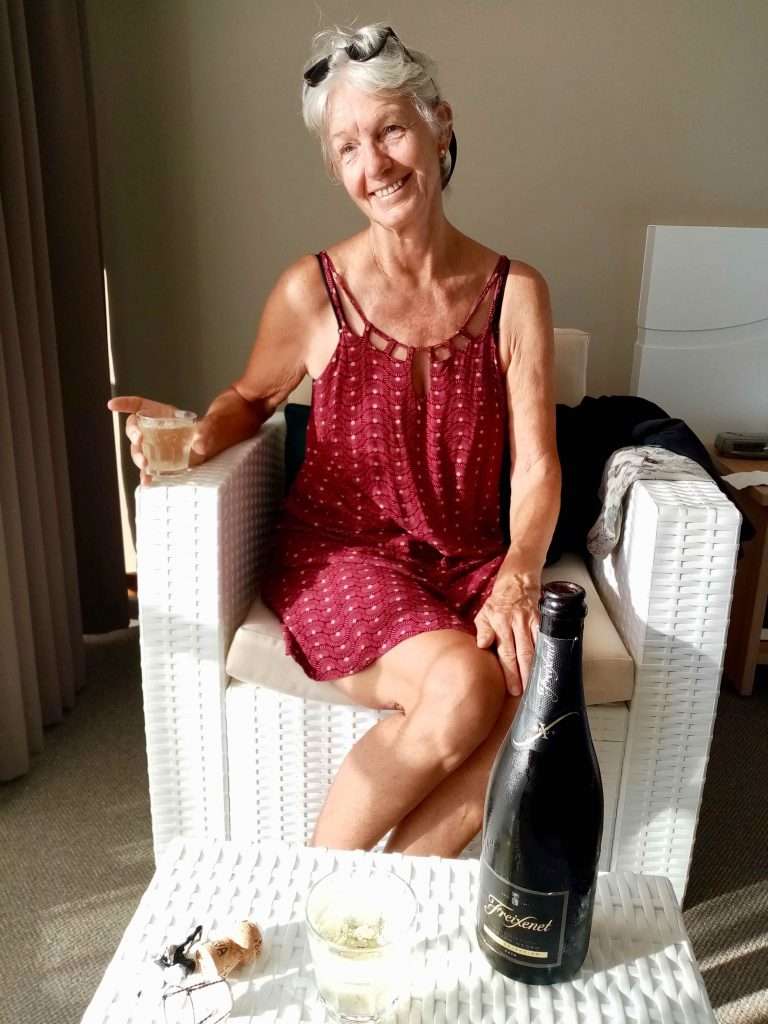
Celebrating our Pacific crossing with a bottle of bubbly in our hotel room.
Fourteen days quarantine in the Pacific Hotel in Cairns was compulsory for us after our arrival in Far Northern Queensland. We enjoyed the stay and the meals from the 28th July to the 10th August 2021, but not the cost of $4,130 plus $1,894 for a marina berth while we were in quarantine.
Catching up with emails.
The hotel deserves compliments for their meals which were excellent, albeit a tad too much, considering that we could not exercise to shake off the results. We had fast internet access and a balcony that we could go out on, with a view of the city and the sea. The hotel arranged live music by Craig Phelps on the pool deck with free pizzas delivered to our rooms on Friday nights, which we enjoyed on our balconies.
Music on the pool deck.
Craig Phelps playing Jack Johnson.
Pizzas with Craig singing in the background.
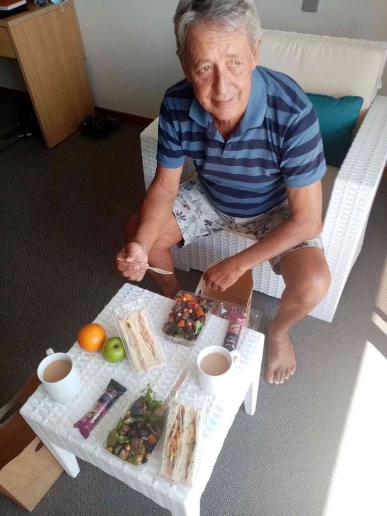
Lunch – salads and chicken mayonnaise sangers.
During our stay we had three PCR swab tests with negative results during the 14 days, before we could leave the hotel. Upon discharge, we met with a Department of Agriculture Biosecurity official to have our boat checked for timber bug infestations. For this we had to pay a charge of $310.
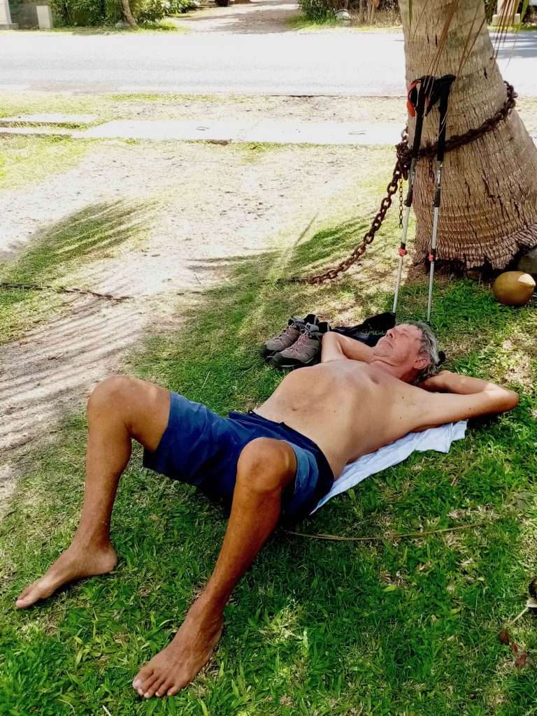
Annie’s morning exercise routine.
Another curved ball was a Customs law dating back to 1901, which required us to re-import our boat after more than a year abroad. We didn’t know that we actually exported the boat in the first instance. The cost of a Customs broker was another $480, to have the boat released from Customs.
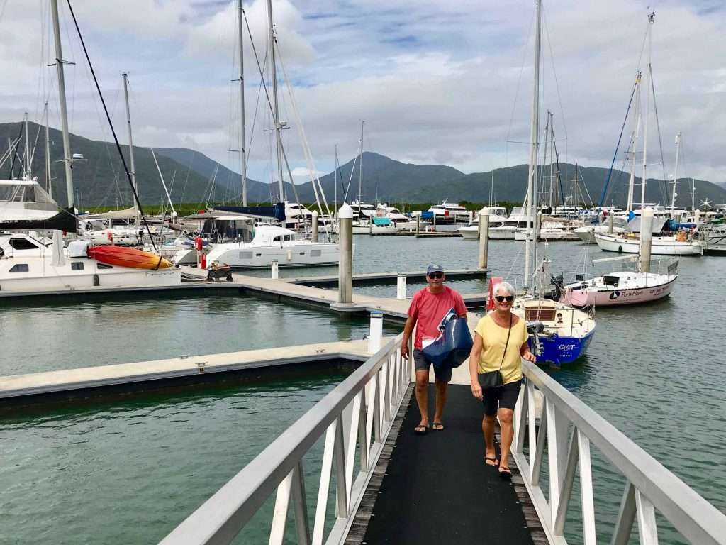
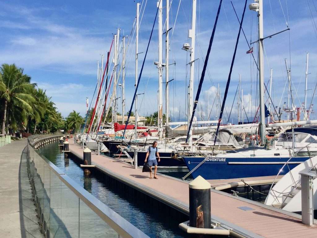
Cairns Marina with our neighbours, John and Raewyn Lemberg.
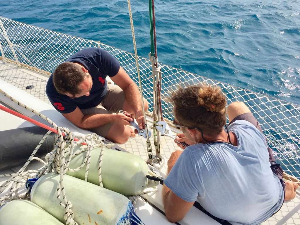
We were haemorrhaging money, as there were also numerous repairs to be done after the long ocean crossing: torn jib sail, torn spray dodger, the forward toilet mounting screws stripped, requiring the replacement of the toilet, etc. We set about doing this as soon as we got back to the boat.
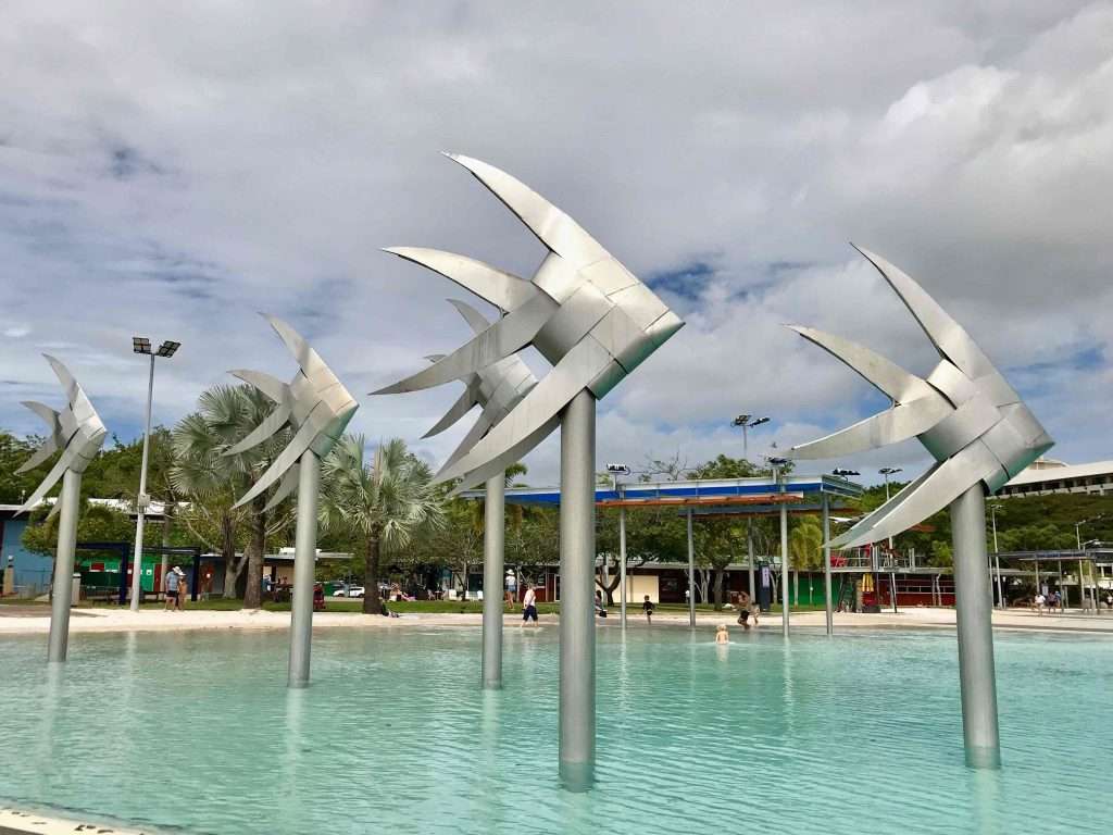
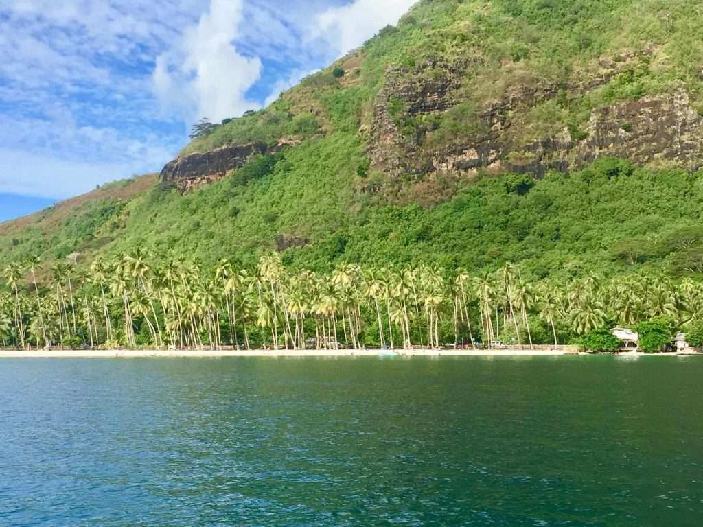
Cairns foreshore.
Two days before our release from 14 days quarantine in the Pacific Hotel and after our third negative Covid PCR test, we were advised that Cairns will go into lockdown for three days because of a new Covid-19 case in Cairns. This meant getting back to our boat, but not being able to go anywhere for a day.
Walk along the foreshore.
We then spent a pleasant week in beautiful Cairns enjoying the tropical Far North Queensland parks and gardens. The council goes to great lengths to make the town tourist friendly with well planned and clean facilities. The tropical trees were different to the ubiquitous eucalyptus trees of NSW.
Tropical trees, not seen in Sydney.
Excellent BBQ facilities in the parks.
Our mobile SIM cards for Australia expired during our absence, so we had to get new ones and I had to get my iPhone repaired due to water ingress. We hired a car and stocked up with food, booze and gas before we departed on the 18th August, after filling Esprit up with diesel.
Statue in front of the RSL.
Waterfront art.
Shallow pool for the kids.
More tropical trees.
We will now motor sail the 17 nm to Fitzroy Island south-east of Cairns, to tie up to a Parks Board mooring and will report on our journey south, as we progress. Cheers for now!
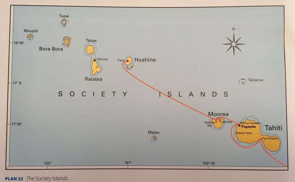
We set sail from Maupiti, French Polynesia on Monday 28 th June 2021, to sail directly to Cairns, Australia. We had almost three months in this lovely Pacific nation which gave us the opportunity to explore all the major places. Some cruisers hang around here much longer, because they love the culture, or, because of Covid-19, they cannot continue west to the other Pacific nations. These boats sail up and down French Polynesia like the mythical Flying Dutchman. Australia and New Zealand are also closed to international sailors and only allow their citizens back.
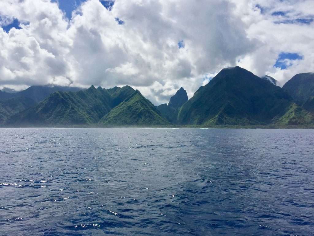
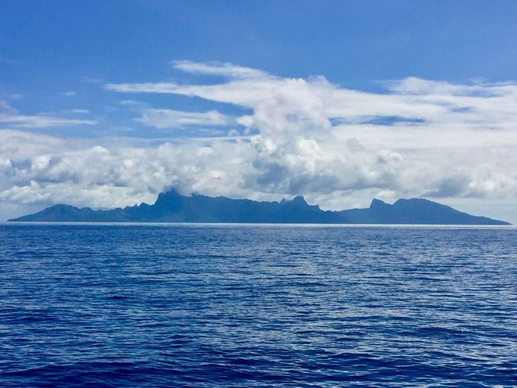
Our last view of land for 28 days.
In a previous post I referred to some problems with officialdom and now that we have left French Polynesia, we can tell you more about this: Despite us hoping to spend a year cruising the numerous Pacific Islands, between Panama and Australia, only French Polynesia and Fiji were open in terms of Covid-19 protocols. Back in December 2020, Annie submitted an application to the French Polynesian authorities for a standard 3 month visa to cruise these islands. By the end of January 2021 she had not had a reply, despite cruising friends who had applied during January, receiving their approvals.
She again emailed them for the visa, but some official had filed and forgotten our application. In the first week of February a new case of Covid had arrived in FP by plane from the USA, so the authorities immediately closed the FP borders. On further enquiry from Annie we were advised that our application to enter FP had been refused. We now had to leave Panama for Australia, facing a hell of a long passage going home, with nowhere to stop but in Fiji!
Annie contacted an agent in Nuku Hiva, FP who said: “For US150 I will sort this out”. A week later we were advised that we could enter FP for 4 days to rest and replenish our water, fuel and provisions! Arriving in Nuku Hiva, the agent took us to the Gendarmerie to have our passports stamped and other French documents signed. It turns out the Gendarmerie passport stamp is valid for the standard 90 day stay in FP.
In five years of cruising, we found that the more layers of bureaucracy (and the French have many), the easier it is to find a solution to these ad hoc bureaucratic decisions. There is a vast difference between arrivals by plane from Covid hotspots and sailors who are effectively in quarantine for 27 days, sailing from Panama to FP, without a living soul in sight.
After four days, we set sail for the Tuamotus. Bad luck provided the solution, when a stay in Esprit’s mast rigging started unwinding. We were now forced to stop in Tahiti for repairs and time marched on – four days turned into four weeks. Not a sign of patrol boats or officials – only friendly locals happy to welcome us. We kept a low profile and had the balance of our 90 day visas to see the rest of the Society Islands, which was a wonderful experience.
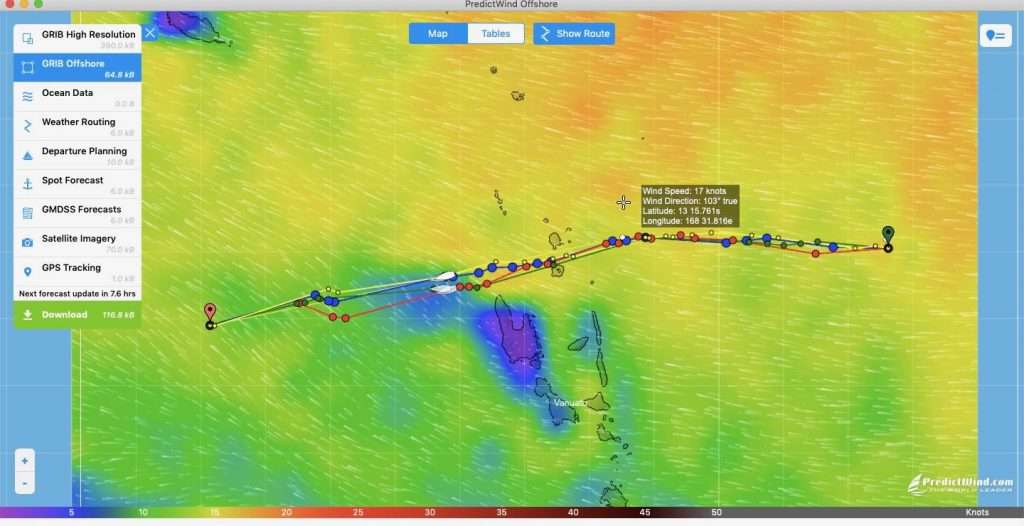
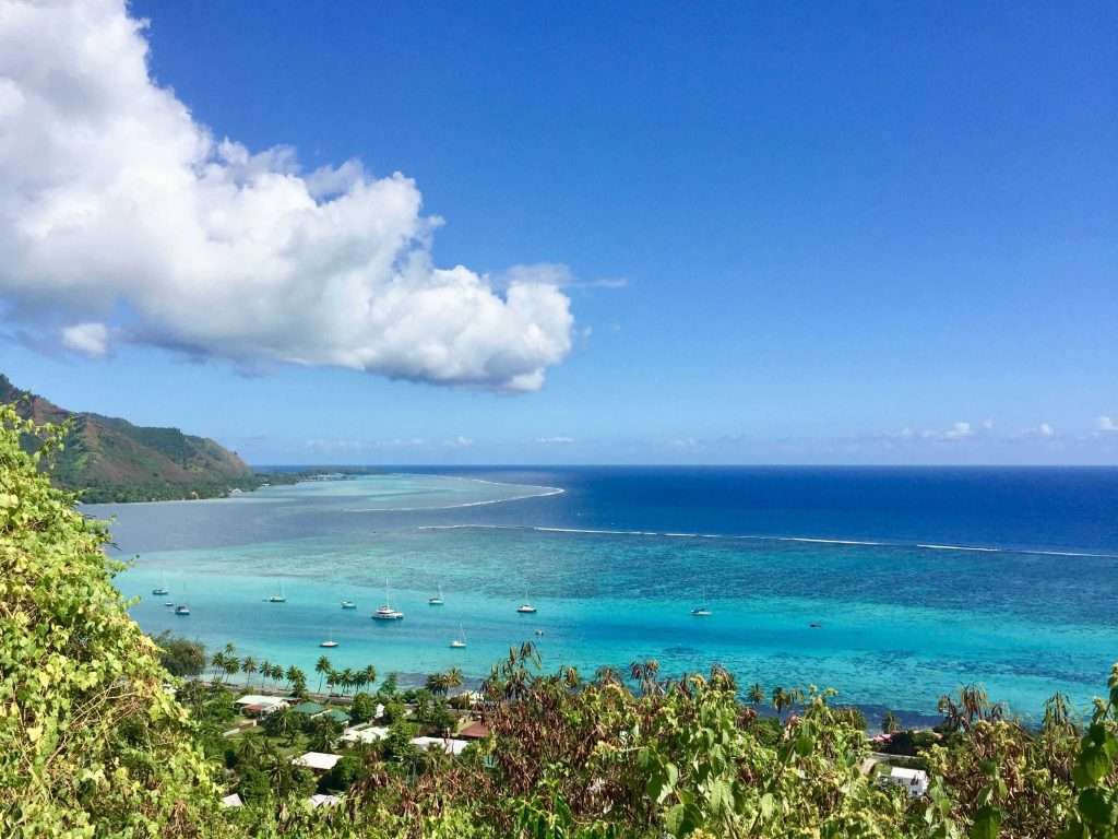
Esprit’s track from Maupiti to Cairns.
Now, we are back to take two: Pacific crossing from Maupiti, FP to Cairns, Straya. As the crow flies, it is 3,600 nm (6,667 km) for this leg, but in reality it will be longer, as the boat sails. For example, in take one: Panama to Nuku Hiva, FP is 3,800 nm (7,038 km) as the crow flies, but as the boat sails, it was 4,028 nm (7,460 km).
Bob in Auckland advises us that this leg of the Pacific crossing may be more challenging due to the shifting SPCZ (South Pacific Convergence Zone). Also, as a result of high westerlies down in the roaring forties, a huge low (no wind) has settled below Samoa, directly on our route to Cairns. He suggests we take a northerly route above Samoa to avoid the low.
Low, south of Samoa.
This will be longer, but at least we won’t have to motor (or so we thought). To summarise: Days 1 to 5, we have wind from the North-east, but, with lots of wind and rain squalls and lightning around us. We know that lightning is not our friend, as one lightning strike to a yacht mast can toast the electronics. At the moment, there isn’t another yacht mast for hundreds of miles around us.
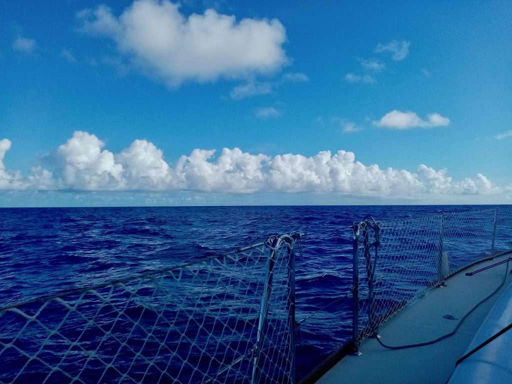
The clouds marching by.
The weather gods have also decided they will only send these squalls at night, as it delivers amusing mayhem, with lots of shouty shouties (to quote circumnavigators Wayne and Barry on SV Nauty Buoy). Say no more. Despite this, we clock up 710 nm, average 142 nm/day for the 5 days. Once we reach latitude 12 south, the rain abates and we continue west slowly from day 6, due to light winds. We started motoring on Sunday arvo day 6, as the low has now moved further north into our intended route. We take the sails down as they are slapping uselessly in the little wind that there is.
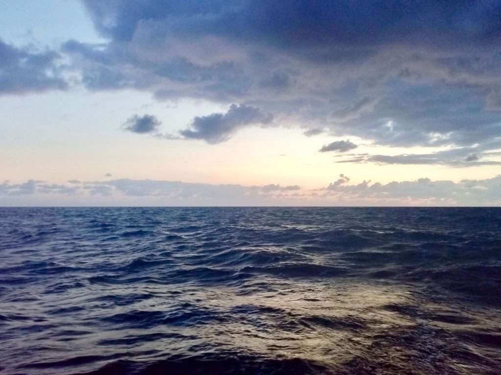
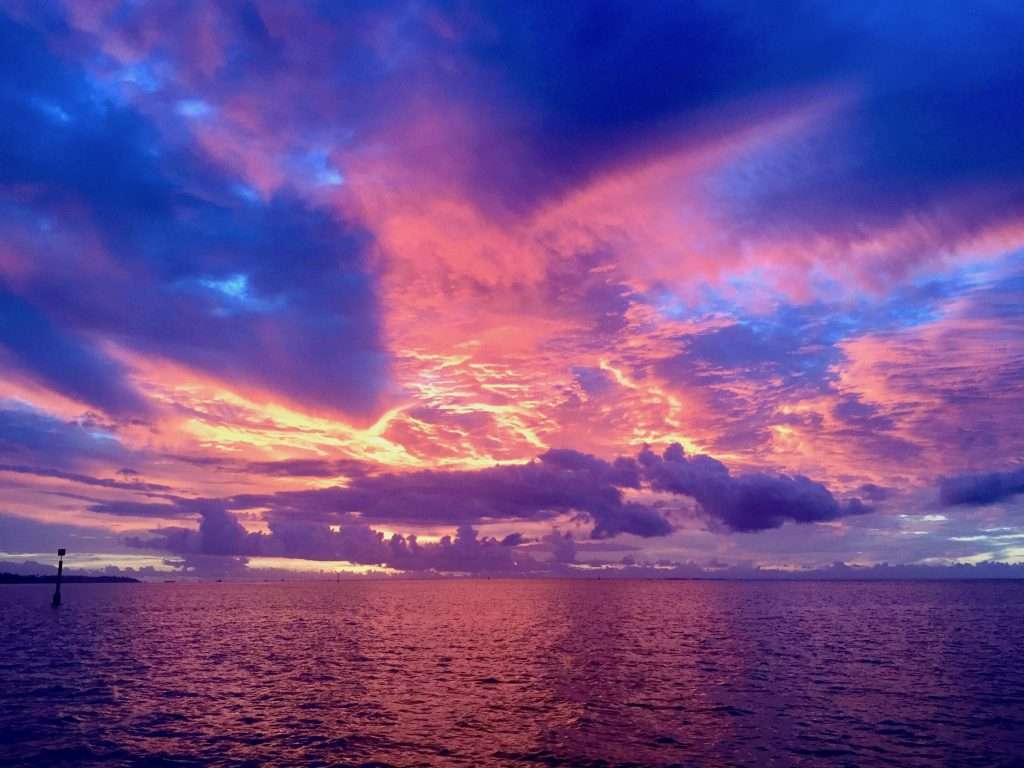
Sun rising in the east.
We end up motoring for 40 hours until Tuesday the 6 th July (Day 8), burning 80 litres of diesel. At 07:00 on day 8, a light 10 knot S-E kicks in, we hoist the sails and cut the engine – hallelujah! We are now directly north of American Samoa and the American navy and air force spot us on AIS. We get visited by both a warship and a plane, not once, but two days in a row – good on them!
Samoa with wind to the south, but zilch where we are.
We re-set our course to the south-west to head for the French Islands of Wallis and Futuna, 510 nm away. Short lived excitement – we sail for 95 nm and then have to motor again for 21 hours. Getting a bit worried about our diesel.
On Day 11 we get into the easterly wind and set the pole up to run downwind. With winds between 18 – 24 knots, we are flying with 3 reefs in the main and 30% of the jib. We sail 164 nm in the next 24 hours and pass Wallis Island.
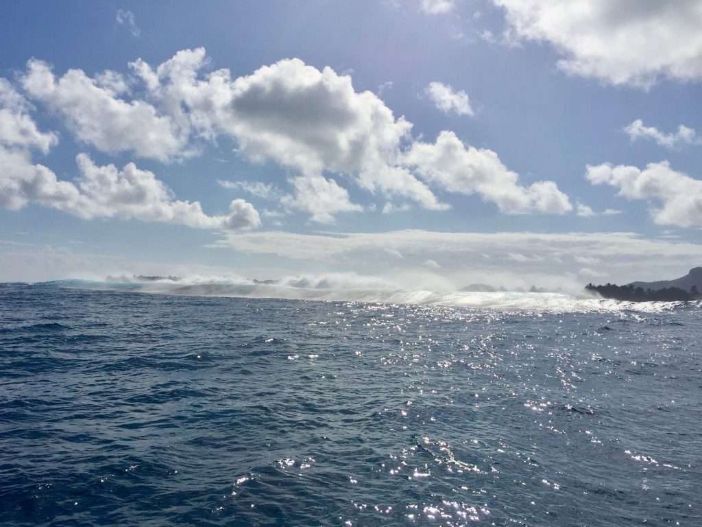
At 03:00 am on Day 13, we cross the International Dateline at 180 degrees of longitude and miss one day as we sail into the Eastern longitudes. At 07:00a 40 knot rainstorm hits us for an hour and everything on the boat is wet. We have 1,954 nm to go to Cairns. Days 14 to 17 have repetitive 18 – 22 knot SE winds with very unsettled 3 – 4 m seas and occasional rain squalls.
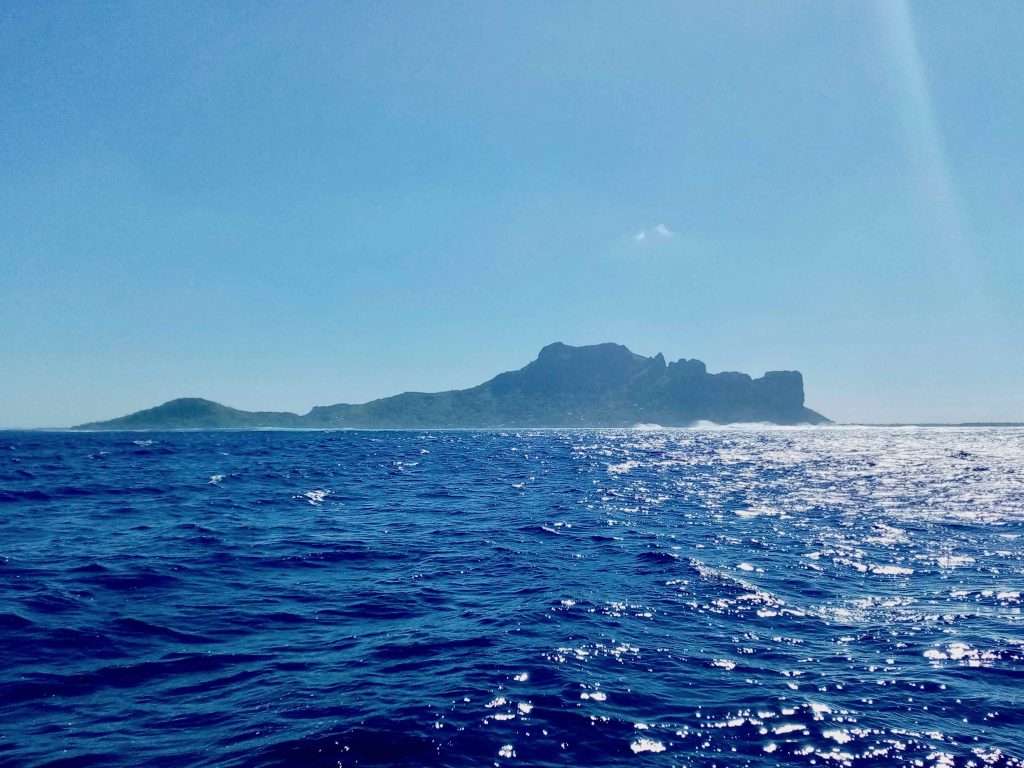
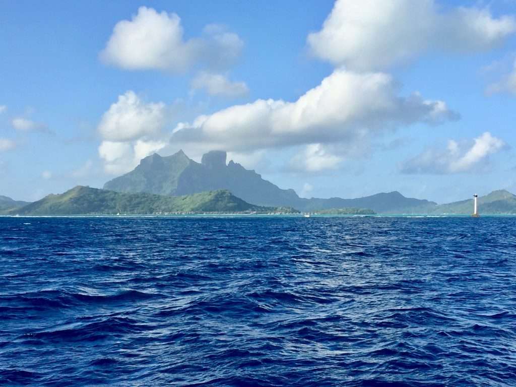
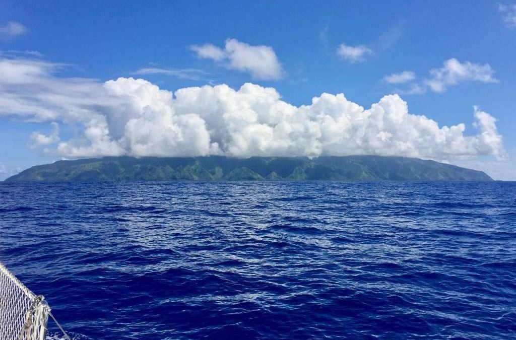
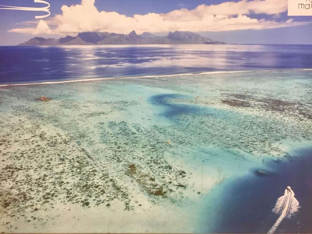
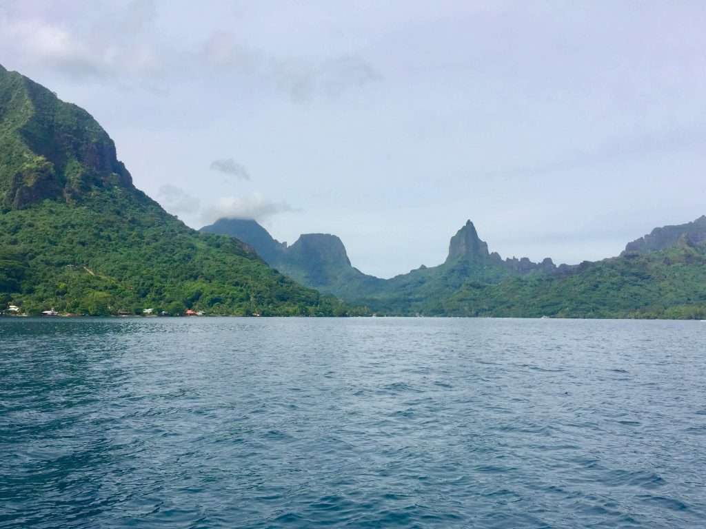
Vanuatu (previously New Hebrides) is ahead of us and on Day 18 we round this large group of islands to the North. We drop the sails behind the small uninhabited cluster of Rowa Islands for an hour, to run our water maker and fill the aft tank. The Coral Sea is ahead and we set our final course to Grafton Passage in the Great Barrier Reef and on to Cairns – still 1,150nm away.
The weather around Vanuatu.
The wind, rain and wave conditions are variable over the next 5 days, as we slowly reduced the distance to the North Queensland coast. At longitude 163E we encountered a squall line which stuffed us around and had us on our toes for 12 hours.
The bird life out at sea is fascinating – from big gulls to small pigeon sized birds, they manage to survive miles from nowhere, on what they can get from the waves. The night of Day 23 saw 7 blue face boobies settle on our solar panels for a rest and a free ride. I only discover them at 06:00 in the morning and managed to chase them away. They left a huge mess which took me nearly an hour to scrub off, so that we can harvest solar power again.
Day 28: Our last sunrise on this crossing.
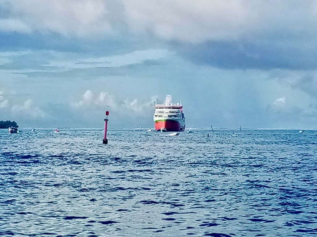
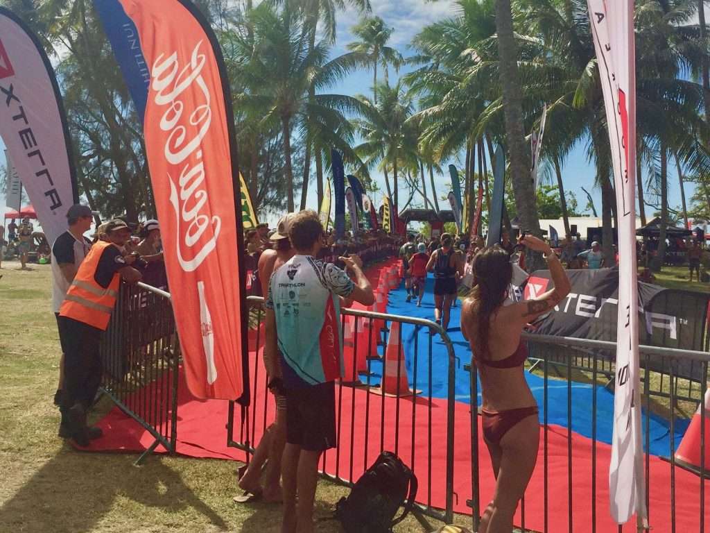
Waypoint 2 came up outside the Great Barrier Reef on Day 28, Tuesday 27 July at 10:00 and from here we motored through the Grafton Passage in the reef for the long dredged approach channel into Cairns.
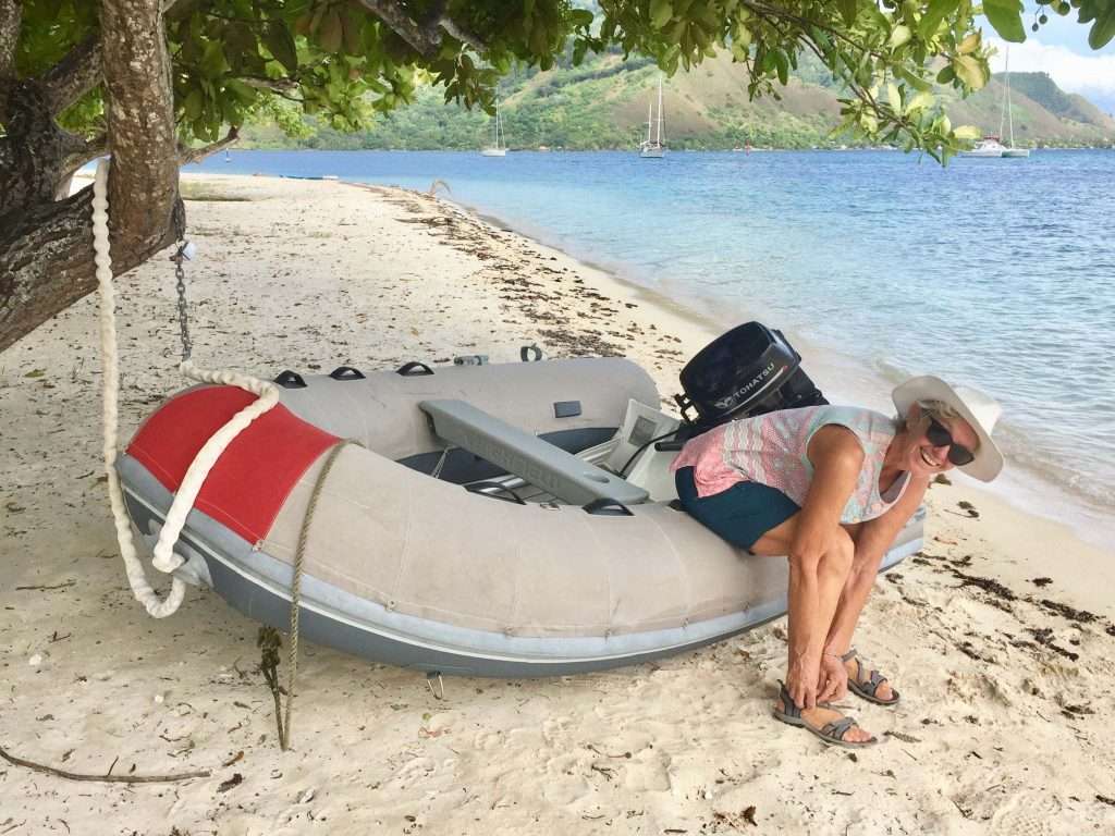
Approaching Cairns – Annie getting the fenders ready.
April 2017: Dirk’s 70th at the Prawn Star, just before we left Cairns on this trip.
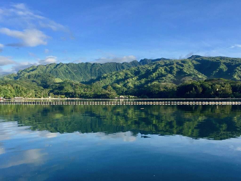
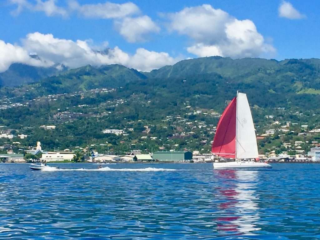
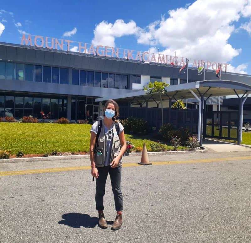
We tied up at Cairns Marlin Marina on Tuesday the 27 July 2021 at 15:00, to complete our circumnavigation of the world – 5 years and 2 months since departing Sydney in 2016, having sailed 37,321 nautical miles x 1.852 = 69,118 km.
Esprit’s route around the world.
It may now be appropriate to quote the Chuck Berry song: “C’est la vie said the old folks, because you know, you never can tell”
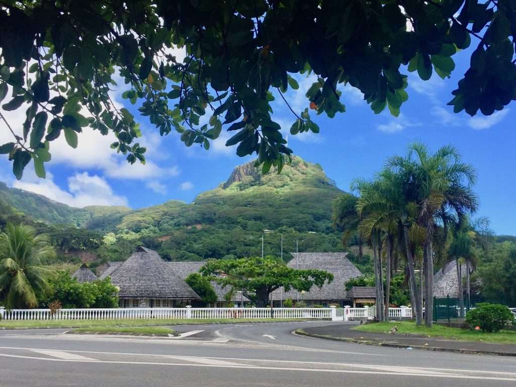
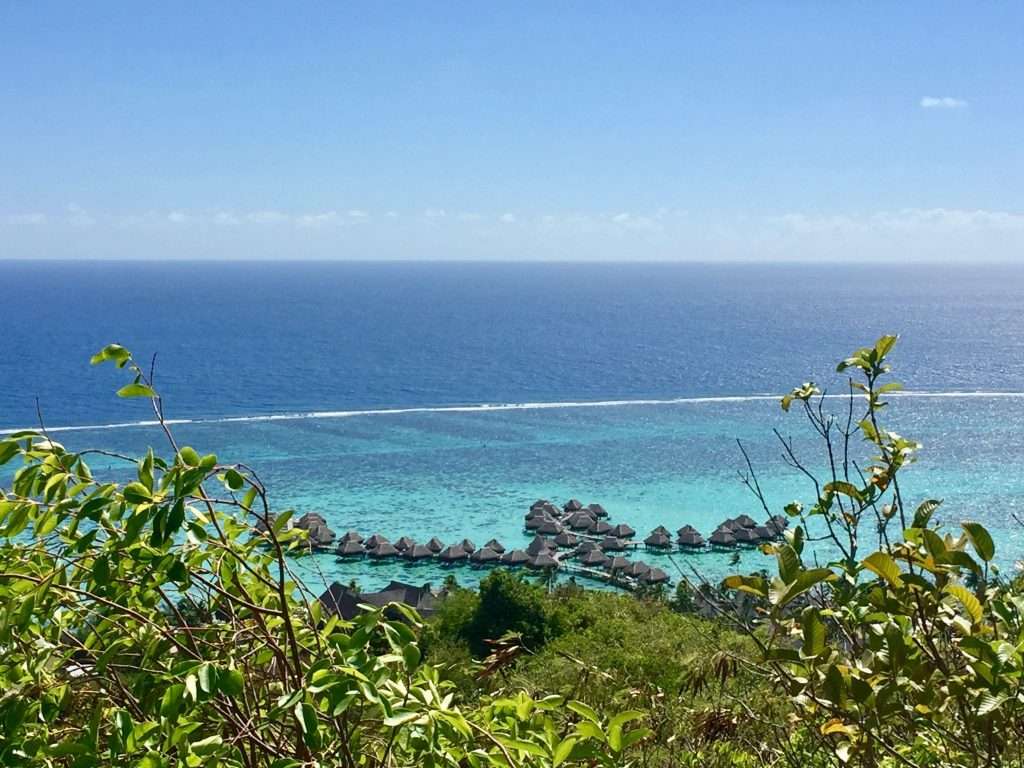
Our second leg across the Pacific from Maupiti in French Polynesia to Cairns in Australia took us 28 days over a distance of 3,874 nm, (7,175 km), and was more difficult than the first leg from Panama to the Marquesas. You may ask why we made our landfall in Cairns instead of Brisbane which is a shorter distance? As we can’t visit the other Pacific nations due to Covid-19, we decided to again cruise in the Whitsunday Islands off northern Queensland and slowly make our way back to Sydney for the rest of the year.
The complete Pacific crossing.
Most importantly, The SICYC (Shag Island Cruising Yacht Club) annual rendezvous is on again at Gloucester Passage north of the Whitsundays, from the 26 to the 29 August 2021. This is party central for yachties, which we enjoyed 5 years ago. We made a lot of new friends then, who we hope to catch up with again. Watch our blog!
SICYC Rendezvous 2016.
Annie enjoying the SICYC Pirates party.
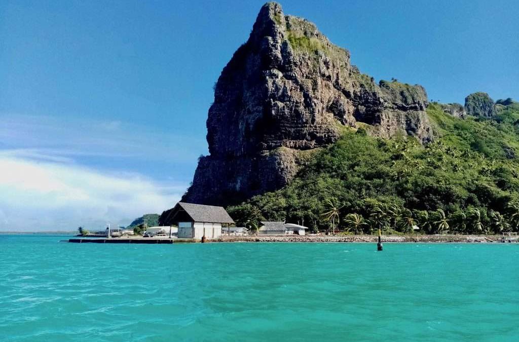
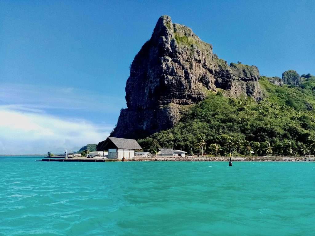
But first, we have to spend 14 days in quarantine in the Pacific hotel in Cairns at a cost of $4,130 for the two of us and leave our boat in the Marlin marina for that period at a cost of $1,895. A nice welcome home for Aussies due to the Covid-19 pandemic. At least we could come back, as other nationalities can’t get in.
Cairns – view from our hotel room.
We will keep you posted on Australia’s beautiful east coast as we sail back to Sydney, so stay with us. Cheers for now!
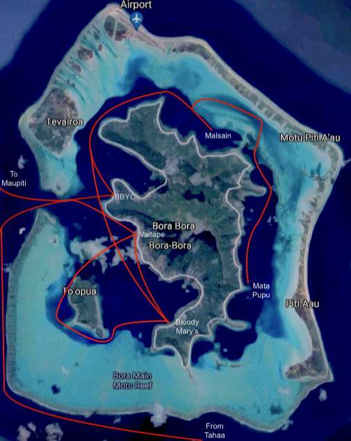
We arrived in Bora Bora around 5pm on the 19 th June 2021 after a pleasant sail from Tahaa Island. We picked up a mooring next to Andrew and Carolyn on Askari and joined them for drinks aboard. The next day wet tied up our dinghy at the Bora Bora Yacht Club and walked the 2km to Vaitape, the main town on the island. Being a Sunday, the town was quiet, so we walked back to BBYC for happy hourat the club.
On Monday morning Annie cycled back into town to start the check out process at the Gendarmerie and was told our zarpe document will be ready by Wednesday morning. Bob McDavitt our weather router, indicated that a low over Maupiti will delay our departure until the next Monday. The upmarket timber and grass roofed bungalows had us gawking.
Blue water and pools above it!
Bungalows on the water
The reefs don’t allow a passage around the south of the island, so we sailed down the west side of the island, picking up a mooring and visiting the famous Bloody Mary’s bar and restaurant, dating back to the 1950’s. There are numerous rolls of names at the entrance to the restaurant of the rich and famous who had been to Bloody Mary’s.
Bloody Mary’s jetty.
Roll call of the rich and famous.
On the Thursday we took the dinghy in to Vaitape to complete our check out. We also bought last minute provisions for the trip to Cairns, Australia. The documents hadn’t come through from Tahiti yet, so we anchored in a lovely spot behind Motu Toopua for another night.
Fruit and veg from sidewalk stall.
How to recycle tyres
Proud gardeners
Farmer’s market
Background music.
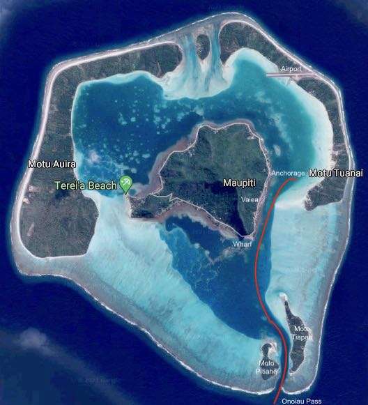
Friday morning proved successful at the Gendarmerie and we were issued with our exit papers and our passports were stamped. We set sail for Maupiti at 10:00 in a 15 knot NE wind and 1m sea. Arriving at the Onoiau pass, Maupiti at 14:30, we were confrontedwith big breaking waves on both sides of the narrow pass. The water was like a washing machine and we had to gun the motor flatout to make 2 knots through the fast out flowing current.
Leaving Bora Bora.
Approaching the pass
Where do we go in?
Maupiti.
Once inside the lagoon the water was flat and we motored up the channel to anchor close to three other boats. We had Andrew and Carolyn Bellamy from Fremantle, on Askari over for drinks. Saturday morning, we walked through the village of Vaiea to a row of low key eateries next to the sports field, where we enjoyed coffees and excellent chocolate cake.
Anchored in Maupiti
Coffee and cake queen
Chewing the fat with Andrew and Carolyn.
Sunday was a big day for Maupiti – the FP government had a new ship built in Spain to service the Society Islands as a freighter and ferry – a real lifeline for Maupiti to the rest of the islands. The celebrations started with music and dancing as soon as the ship entered the pass at 08:00. Everybody was dressed up and the welcoming committee stood ready with flower garlands for all the tourists that got off the ship. Really moving to see this event.
The new ship approaching
The music section.
Welcoming with flowers.
Ship docking
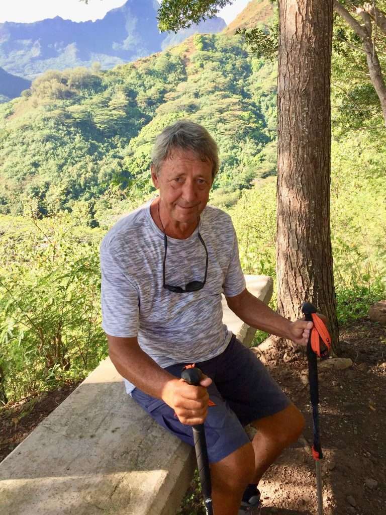
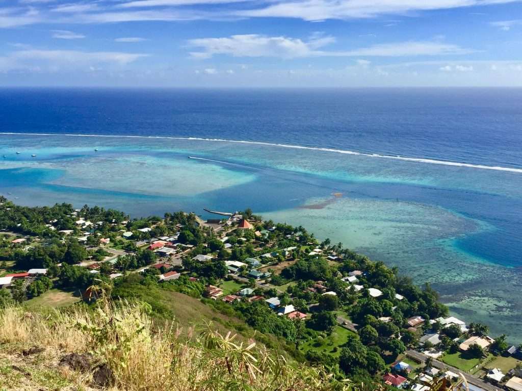
After the welcoming, Annie and I decided to climb the mountain above Vaiea to see the island from the highest point. A tough climb but very rewarding in terms of the view. We got back on board for cold beers and had a swim. The water maker was started and we filled the water tanks for the trip home.
At the top
Cairns is over the horizon.
Afterwards we went ashore to donate all our surplus clothes and linen, kitchenware, books etc. to the islanders, who are doing it tough due to the downturn in tourism. We had farewell drinks on Askari and to post this blog. Wish us luck as we do another long leg to finish our circumnavigation. We should arrive in Cairns in 3-4 weeks and as before, you will be able to follow us on our Predictwind tracking page. Cheers for now!
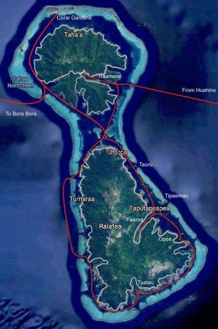
Raiatea and Tahaa Islands are two separate islands, surrounded by vast coral reefs. We arrived here on the 9th June and after entering the lagoon through a northeast pass off Tahaa, we motored into a few bays in Tahaa to find that the bays are all exceptionally deep. We decided to head for Raiatea a short distance away, to look for shallower water, which we found off the Carenage on the north west corner of the island.
Raiatea & Tahaa.
Raiatea is home to three large charter fleets of mostly catamarans of the Sunsail, Moorings and Dream Charter companies. They occupy all the marinas and the surrounding anchorages, forcing us cruisers to anchor further out. Due to Covid-19 their boats are largely unused at the moment.
Anchored outside the Carenage – our neighbour aptly named “Patchwork”
We were anchored just outside the Raiatea Carenage which is the oldest and shabbiest marina on the island. We dropped our big gas cylinder for a refill and took our bikes ashore for the 5 km trip into Uturoa, the main town. We had a successful morning by getting Covid-19 vaccinations. We opted for the Janssen single shot vaccine from Johnson & Johnson, rather than the Pfizer two shot option, which would tie us down here for three weeks.
Raiatea hospital where we got vaccinated.
We also established from the national police that checking out and getting the all important exit papers for the boat (zarpe) would take two days. Not wanting to brave the traffic and cycle to and fro, we motored Esprit to Uturoa and tied up at the wharf behind the Shell service station. Annie stocked up with food at a brand new Super U supermarket in Uturoa. She also found Nicola, a French Canadian who was happy to do our laundry in his washing machine on board his boat for a small fee – amazing.
I like the simplicity of the churches
On the 15th June we set off to sail around Raiatea Island, but the weather was a bit ordinary with rain squalls every now and then. Unusual, the locals told us, as we were now supposed to be in the dry season. Our route down the West coast took us outside the reef for a few miles, as the inside passage was too shallow for our 2.2 m draft. The first night we tied up to a buoy in Tuatau bay, where we sheltered from the easterly wind in a lovely setting.
The rugged West coast of Raiatea.
Our anchorage at Tuatau.
Motoring up the Southeast coast.
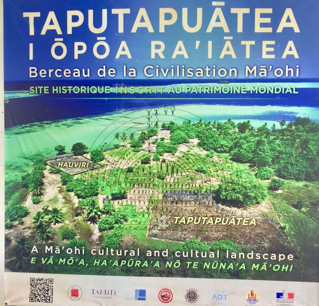
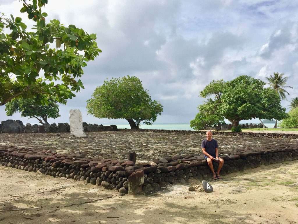
The next day was a wet affair with rain squalls and narrow passages between the island and the reef on the South eastern side of the island. We picked up another buoy in Opoa bay as the sun was coming out and went ashore to visit a UNESCO world heritage site called Taputapuatea. This archaeological site is at the heart of the Polynesian cultural landscape. Inhabited by the ancient Ma’ohi civilisation, it is believed to be the last region to have been settled by human societies in 1000 AD. I have now seen enough Marae old stones.
Anchorage at Opoa Bay.
The ancient site layout.
Old stones 1.
Old stones 2.
Old stones 3.
Where the hell are the buildings?
Our third night was in the lee of a small island Tipaemau, in the entrance of the Iriru pass on the East coast, where we met up with Neill and Heidi on Artemis. They invited us over for a fabulous lasagne dinner and dessert.
Anchored off Islet Tipaemau.
Heidi & Neill with their tasty lasagna.
We left early the following morning as a big squall from the East was heading our way. We outran it, motoring north to Uturoa where we tied up at the Total wharf to fuel up for our second Pacific crossing to Australia. We took on 325 l of diesel in the main tank and back up jerry cans and 30 l of petrol.
Squall from the East.
Then we sailed up to the North coast of Tahaa to visit the coral gardens off the Tautau and Maharare Islands and did a snorkel in the afternoon. The coral was average, as some green weed had started growing on it, but there were plenty of colourful reef fish.
The hamlet of Tiva on the West coast of Tahaa.
Anchored off the coral gardens.
The holiday resort next to the gardens.
Annie going for a snorkel sticky beak.
We were all set to leave this anchorage to sail to Bora Bora the next morning, but a huge northerly weather system set in with a deluge of rain lasting from 7:30 until 12:30. We motored down to the Paipai pass to exit the lagoon and set sail for Bora Bora at 1 pm. Next report from Bora Bora.
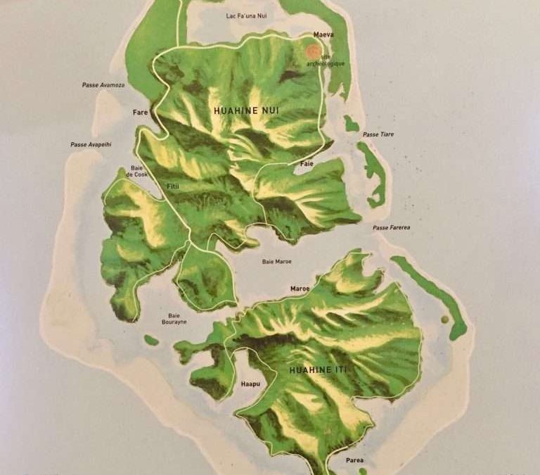
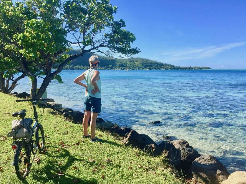
On Monday morning 31st May, we anchored at Fare village on Huahine Nui Island, 90 nm northwest from Moorea. Picture pretty, but without the dramatic mountains of Moorea. Huahine is known for the vanilla bean pods it produces and visiting a vanilla farm, plus cycling around the island was on our to do list.
Huahine Nui and Iti islands.
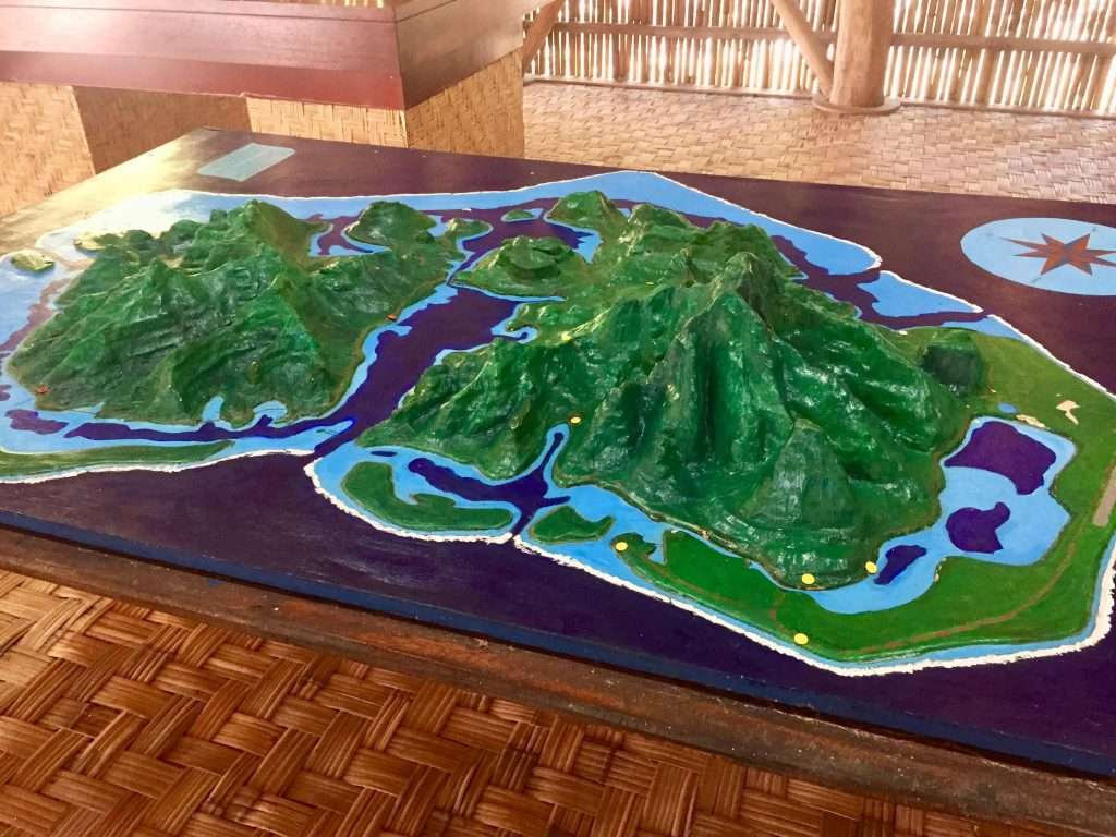
A model showing the topography with the surrounding reefs.
But first I had to research the Covid-19 entry protocols for ports of entry into Australia, as we had given up on Fiji. The latter would have cost us over $2,600 in tests and entry costs into Fiji and limit us to disembarking at only one of the 300 islands of Fiji. Both New South Wales and Queensland on the Australian eastern seaboard, have compulsory 14 day quarantine in place for international arrivals. The cost of quarantine in an approved hotel plus the cost of leaving our boat in a marina, to be paid by us, is around $4,000.
Happy hour at the Huahine Yacht Club.
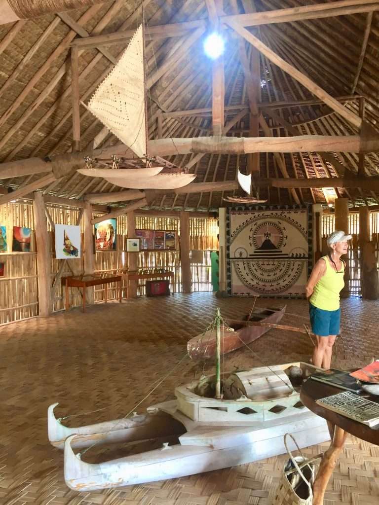
Having registered our sailing plan from FP to Cairns in QLD with the Australian Border Force, we set about enjoying Huahine, which consists of two islands joined by a bridge, Nui (big island) and Iti (small island). We cycled the 23 km route around Nui visiting the original settlement of Fare Pote’e near Maeva on the north-east corner of the island.
The locals are proud of their sidewalks.
Fare Pote’e museum.
Inside the more than 200 year old museum.
The little daughter of the supervisor, showing Annie the fish.
This was the original capital in ancient times. There is an interesting legend of the Princess Hotu Hiva who escaped an arranged marriage on the nearby island of Raiatea by hiding in a barrel and floating across to Huahine.
The legend of Hotu Hiva – click to enlarge.
Hotu Hiva arrives by barrel.
The spot where she reputedly landed.
There are numerous Maraes (sacred sites) here and the original fish traps of the ancients in the river –still in use today. We also stopped at a stream which teemed with 2-3m long eels. The hills from Faie to the Bay of Maroe were quite steep, so we had to push the bikes.
A nearby Marae.
Ancient fish traps.
Public toilets near the sites – note the timber shingles and woven palm frond walls.
Push Annie, push!
At the top – totes sweaty.
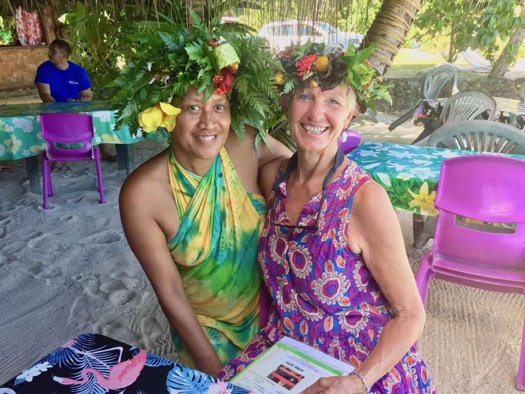
We met Daniel from Berlin at the Huahine Yacht Club, who told us about Avea Bay at the southern tip of Iti, the small island. The next day I met four lovely ladies having lunch at the yacht club, wearing their traditional Tahitian flower crowns called “Hei Upo’o” which are worn to celebrate the beauty of everyday life in these islands of paradise. The embodiment of “The Happy Life”
Lovely ladies at the yacht club.
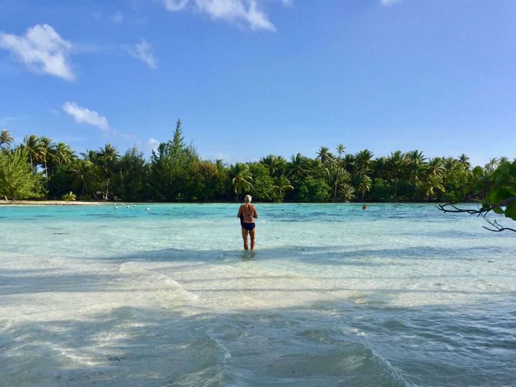
Tara, one of the ladies has a restaurant “Chez Tara” at Avea Bay and she invited us to lunch on the Sunday. We motored the 8 nm down some narrow channels to Avea Bay on the Friday, which has the clearest water we have seen – anchored in 10 metres depth, we could see every link of the anchor chain on the white sand. It was a 50m swim to the kilometre wide reef, only 1.5m deep.
Esprit anchored in the clear blue water.
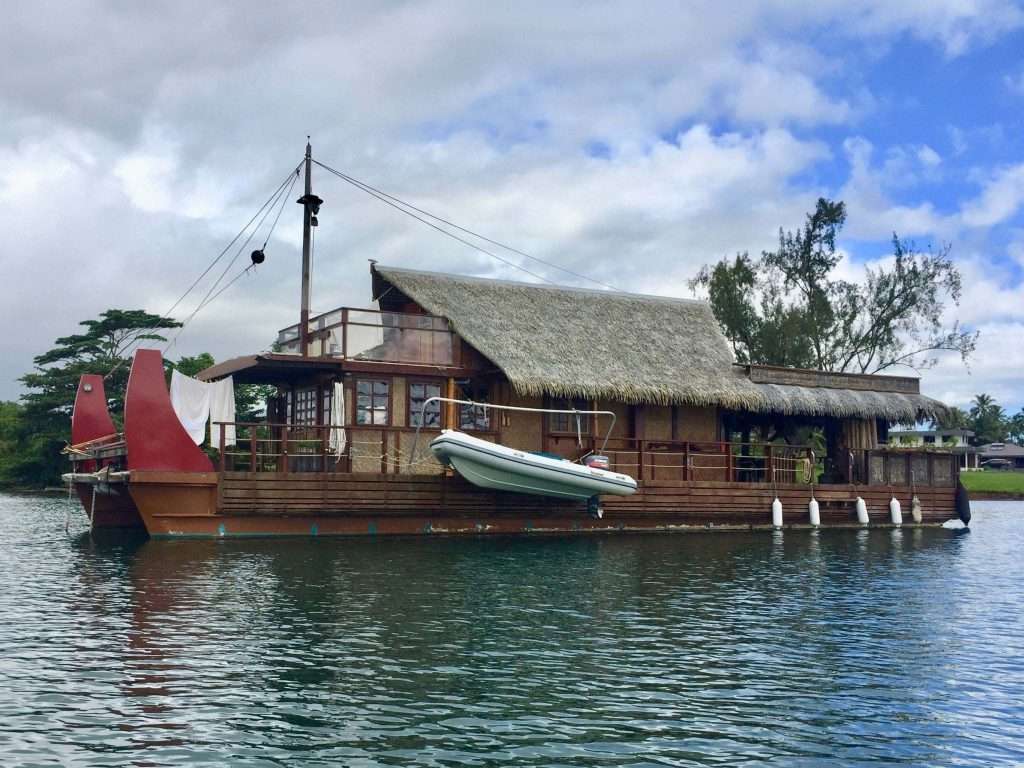
A traditional house boat anchored near to us.
Me, celebrating the achievement of having swum the 50m to the reef and back.
On Saturday we cycled the 16km up the east coast to Tehoro in the north and back, followed by a short 10hm cycle up the west coast to Ha’apu Bay and back on Sunday morning, finding the vanilla farm closed. Spruced up after a swim and a beer on the reef, we settled down at Chez Tara at 12:00 for lunch.
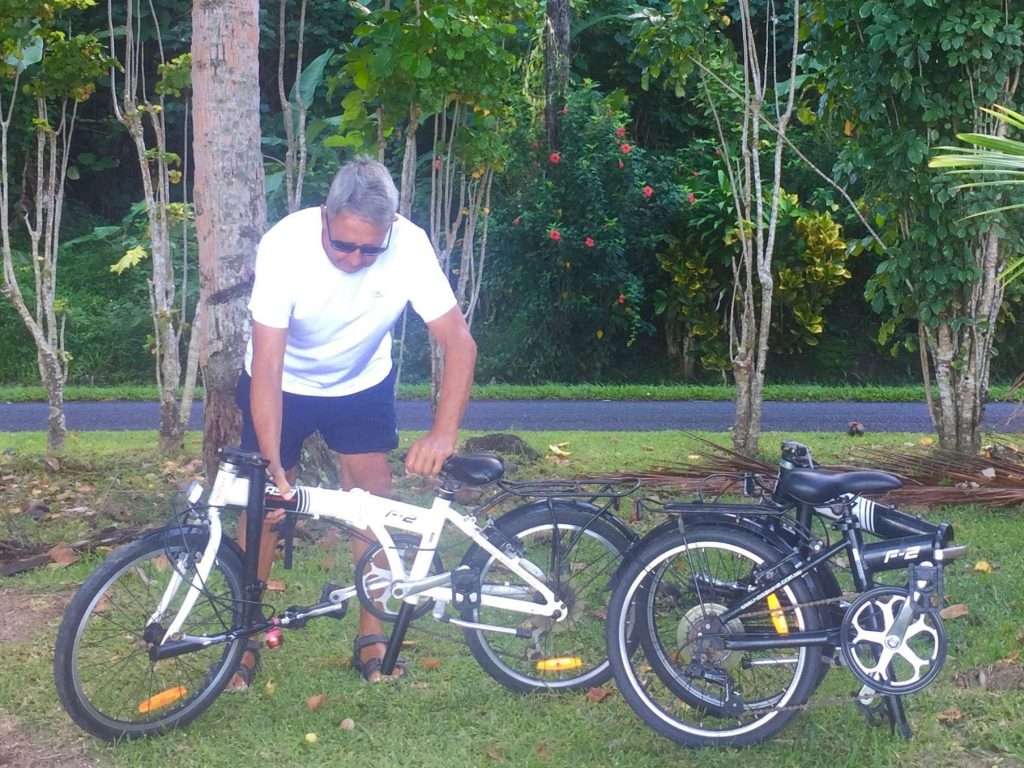
Time to assemble the bikes again.
So that Ms Armstrong can take off again.
Palm trees along the road.
Bananas growing wild along the road.
So, this is how they keep the verges trimmed.
Some parts of the island have been inundated by these creepers taking over the trees.
A pity the vanilla farm was closed on a Sunday – we will try another farm on Tahaa island.
Marea near Avea Bay – how did the ancients move these stones?
At the top of a hill – no Sweaty Betty, this one.
Back at Avea Bay before lunch.
We were welcomed like old friends with hugs and Annie was presented with a fresh “Hei Upo’o” and a bunch of bananas, as I had mentioned earlier she wanted to bake a banana bread. The freshly grilled Mahi Mahi fish, chips and salads washed down with the local beer, went down a treat, resulting in a long Sunday afternoon Nanna nap.
Two lovely ladies.
Well fed and lubricated.
I begged Annie to take off her “Hei Opo’ou before she went to bed.
On the Monday we motored back to Fare in the rain, anchored and at 5pm joined a bunch of German, Dutch, Swedish and British sailors for a convivial happy hour, half price, drinks session at the yacht club. Tuesday was perfect for recovery as it was raining most of the day.
Next stop Raiatea island.
Wednesday morning the 9th June, we set sail for the short 22 nm sail to Raiatea and Tahaa Islands.
It was a slow passage in light winds from Fakarava to Tahiti, where we arrived after 48 hrs and 250 nm (motor sailing for 24 hrs), in the southern anchorage of Phaeton Harbour. We arrived on the 28 th April 2021, which was my 74th birthday, so celebrations that evening were in order. To misquote the Beatles to Annie: “Will you still need me, will you still feed me, when I’m 84?”
Esprit’s route to Tahiti (click to enlarge)
Sailing up the rugged west coast of Tahiti.
Entering Phaeton Harbour with its extensive oyster farms.
A sight to warm the heart – kids sailing their Optimist dinghies.
Polynesian house boat anchored next to us.
There were no riggers at the shipyard in this port, so after shopping at the Carrefour supermarket and buying a new SIM card, we headed for Papeete on the 30th, motor sailing the 38 nm. Neither of the two marinas had a berth for us, but Port Control gave us clearance to enter the harbour and cross the airport runway approach, to anchor outside the runway, but inside the fringing reef. There were quite a number of boats at anchor, including two Aussie boats, who came over to welcome us.
From a poster: we were anchored inside the reef, just to the right of the speedboat. Moorea in the background.
View from our anchorage to the airport.
That evening, we had sundowners until late on Esprit, with some British and Scottish cruisers, getting all the inside info on Tahiti. Including possibly free Pfizer Covid vaccinations at the town hall – we were there first thing Monday morning. The doctor on duty wouldn’t vaccinate us without residence permits, so we tried other vaccination centres on the Tuesday and Wednesday with the same result – clearly we missed the bus!
Papeete Marina.
Papeete ferry terminal.
Fiji is of course keen for us to visit, but require PCR tests in Tahiti before we leave at AUD 295 a pop (a growth industry) with another PCR test on arrival in Fiji at AUD 205 (despite a 14 day passage). The Covid vaccinations wouldn’t change this rule, so we decided to ignore the possible vaccinations and enjoy the Society Islands.
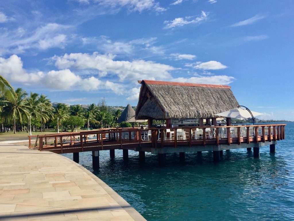
Coffee shop over the water on the foreshore.
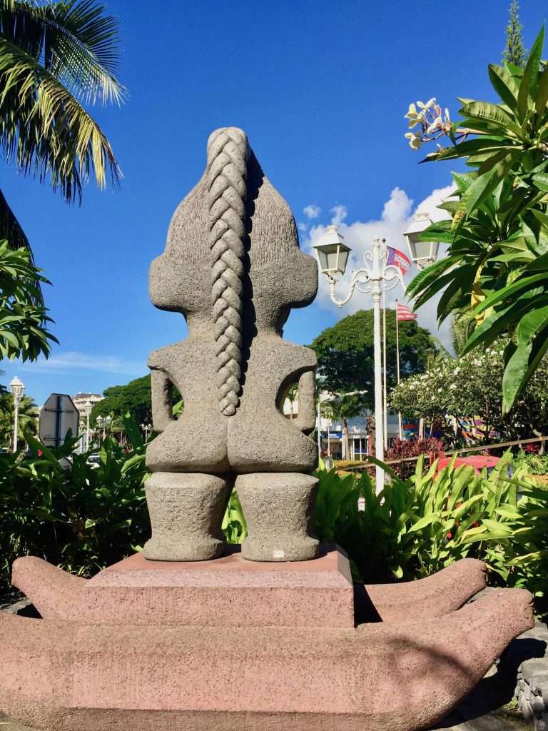
The cute rear view of a tiki.
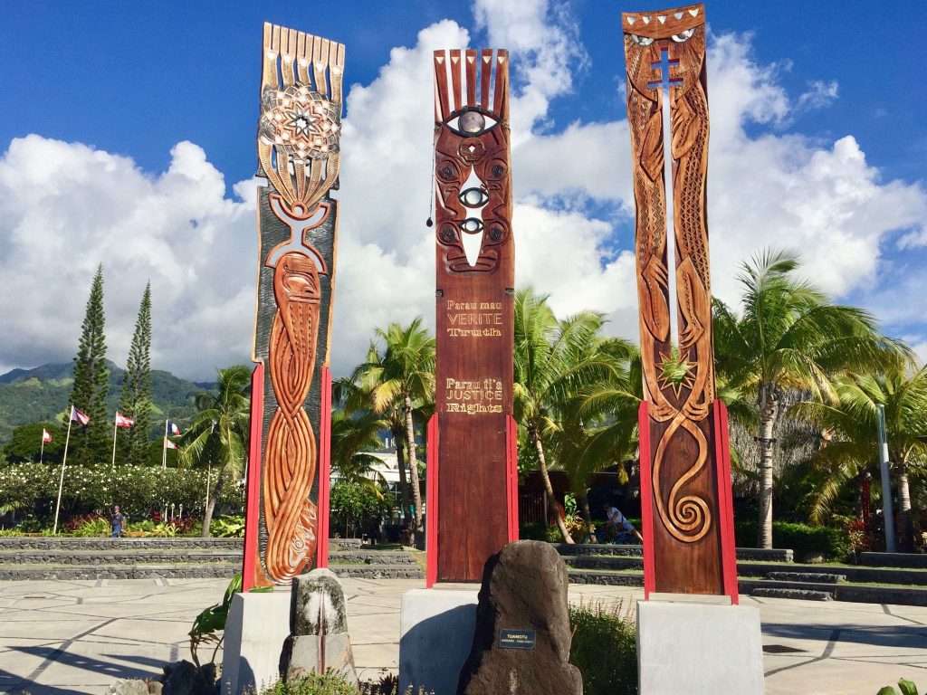
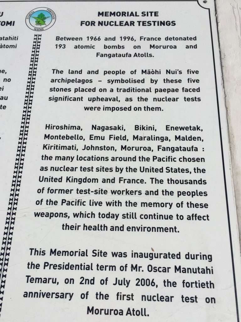
Nuclear testing memorial site, with beautiful carvings.
Very sad, the way these friendly and peaceful people were treated.
On Friday 7 th May Jonathan from Mat Rigging and his offsider Juan, came on board to install the two new inner shrouds they had fabricated and to tune our rigging – only a week after we had arrived. We were told that to get a measure, quote and fabrication done in a week, is nigh impossible in Tahiti.
Juan and Jonathan the riggers.
Fine tuning the tension of the stays.
A restaurant on the Faa beachfront.
The timber carvings are intricate.
The colonial De Ville hotel.
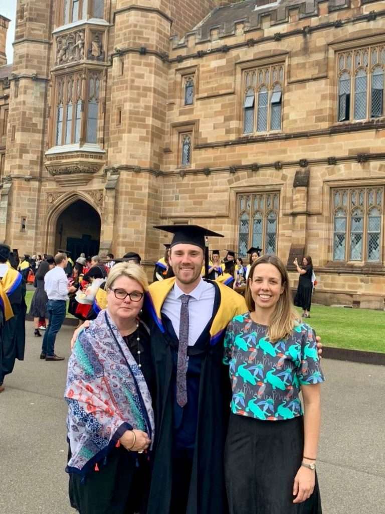
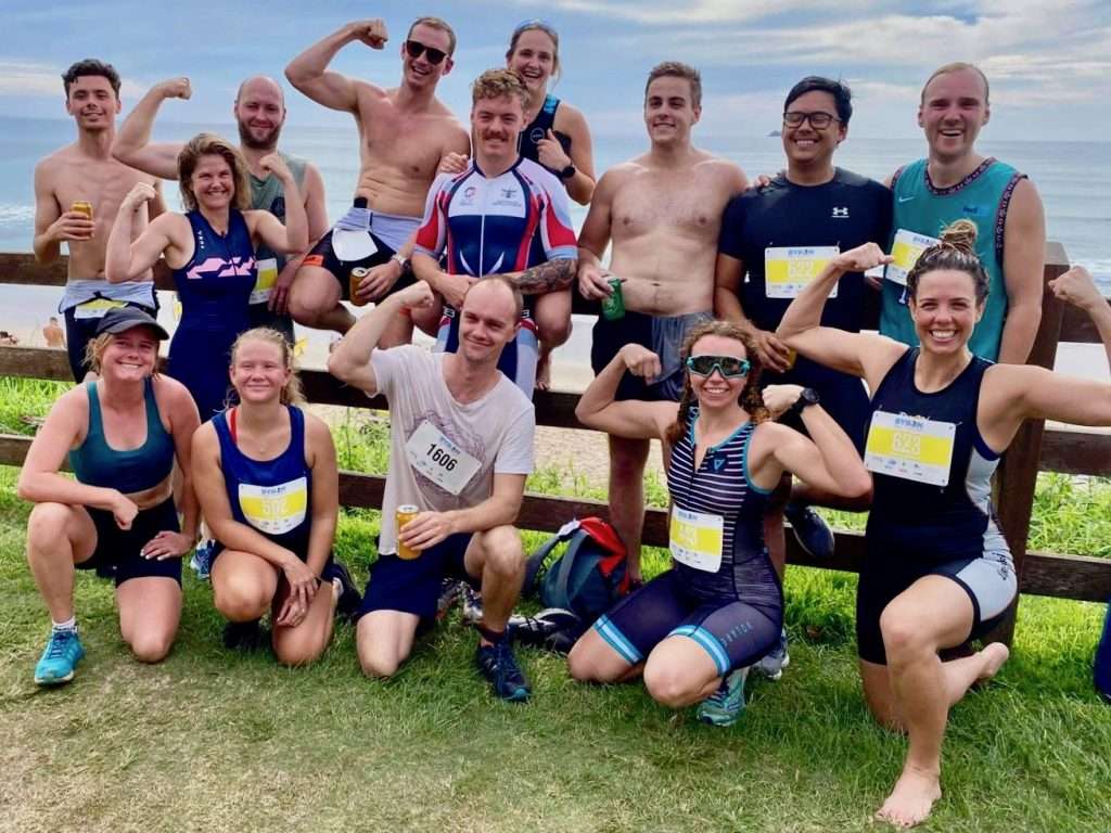
From the home front: Our daughter Michelle had been evacuated from Port Moresby in PNG by the UN two weeks earlier, due to fighting between the mountain tribes and a massive outbreak of Covid. She had been released from 14 days of quarantine in Brisbane – just in time for her 31st birthday on the 8 th May, which she celebrated with friends in Sydney. Karen and her boyfriend Evan, celebrated his masters degree in Occupational Therapy from Sydney Uni a week earlier, by both doing a triathlon in Byron Bay on the 8th.
Michelle in PNG.
Evan’s mum Vicky, Evan and Karen.
The triathlon team.
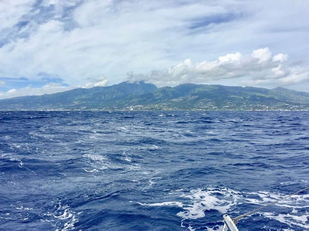
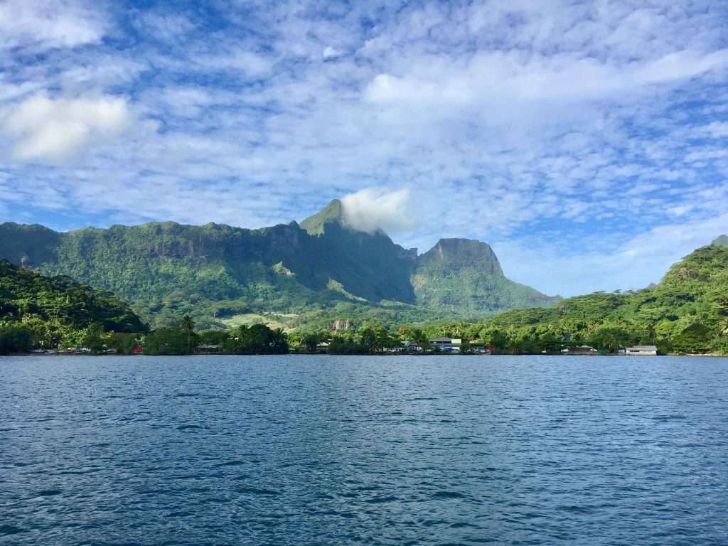
On the 9th May we lifted anchor and crossed the 15 nm to Moorea Island to the west of Tahiti. We enjoyed the 10 days we had in Tahiti, having had all the maintenance items on the boat done, seen all the sights and having met some of the friendly locals. After the hustle and bustle of Tahiti, Moorea is even more relaxed and easy going. Two great bays, Opunohu Bay and Cook’s Bay, cut deep into the North coast and provide secure anchorages.
Leaving Tahiti.
Heading to Moorea.
Our first anchorage was in Cook’s Bay at Pao Pao, at the top of the bay, where there is also a Super U supermarket. We used our bikes to explore the coastal road along the eastern and western sides of the bay. The road took as through lush vegetation and dramatic mountain backdrops, passing the famous Bali Hai hotel featured in old movies and books.
Sailing into Cook’s Bay.
View from our anchorage.
Cycling around Cook’s Bay.
Good stone packing.
Bali Hai resort.
The Maitre’D at the coffee shop.
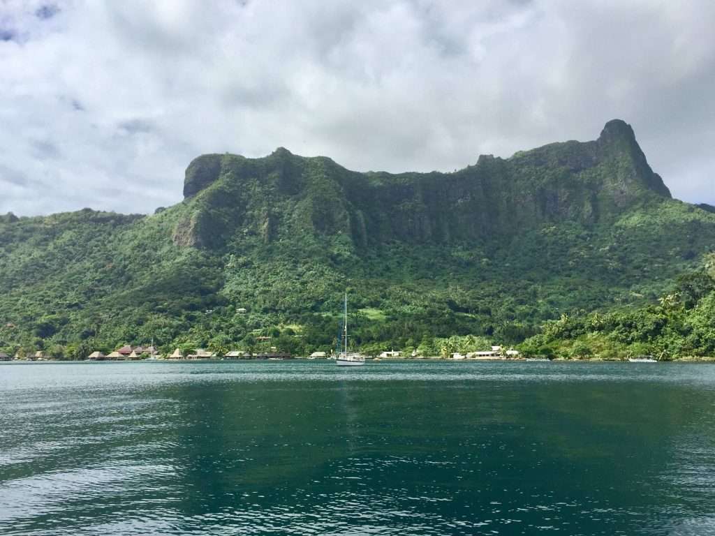
After seven glorious days, we motored the 5 nm to Opunohu Bay where we anchored at the mouth of the bay with 18 other yachts in crystal clear water. An even prettier bay than Cook’s Bay, even though this seemed impossible!
Approaching Opunohu Bay anchorage.
The beach and park next to us.
On Saturday the 15th May 2021 we reached a milestone. It was five years ago, when we set sail from Sydney for the Whitsunday Islands in North Queensland and to ease into retirement – having stopped work two days before! The plan was to cruise the Whitsundays and maybe go north as far as the Louisiades Islands, east of Papua New Guinea.
In the back of our minds was a possible circumnavigation of the world, but we didn’t want to get ahead of ourselves and broadcast goals that we couldn’t achieve. We had to first test ourselves and the new boat in longer distance sailing, to see if this was doable. After three months cruising in the beautiful Louisiades Islands and getting used to not working anymore (honestly!), we headed for Darwin in Northern Australia, sorting out a few teething problems on the way. We also had to add additional equipment to the boat for a safe circumnavigation. Most of this we installed by the time we reached Thailand. Our confidence grew as the miles slipped by under Esprit’s keel and the rest is now history. We have had five years of great experiences and seen interesting places!
Sunset from our anchorage on the 15th May 2021.
In Opunohu Bay we enjoyed beautiful sunsets and drinks on the beach next to our anchorage with other yachties from the UK, Canada, Australia, New Zealand and Germany. We ended up spending two weeks here, as there were so many hikes, cycling, snorkelling and social opportunities for us.
Sundowners with the Canadians.
More sundowners!
The first Protestant church built in Polynesia in 1813, by the London Missionary Society.
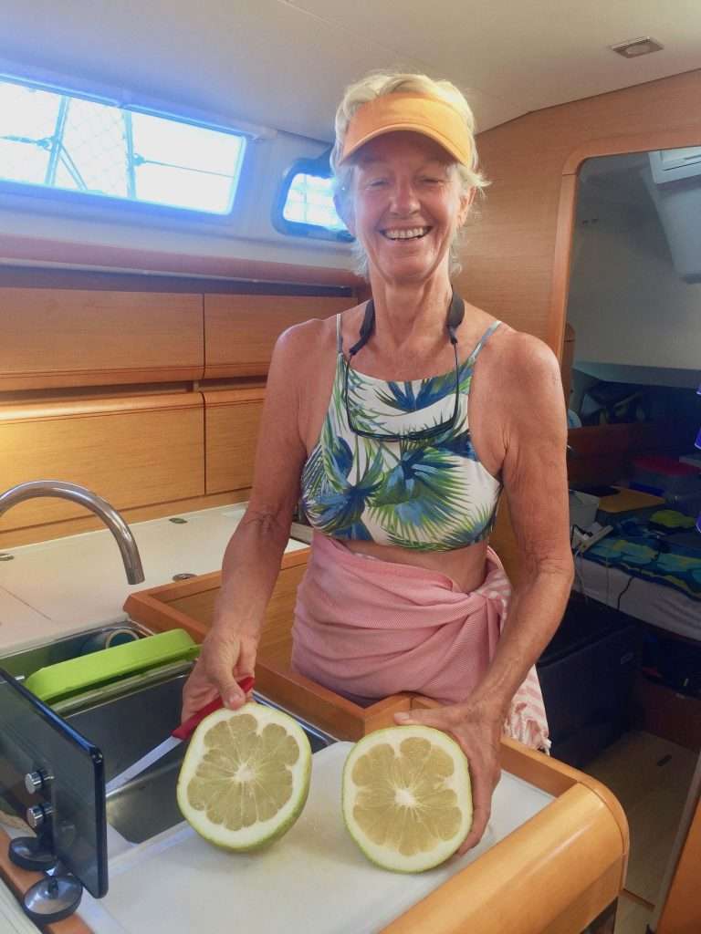
Annie loves the local grapefruit.
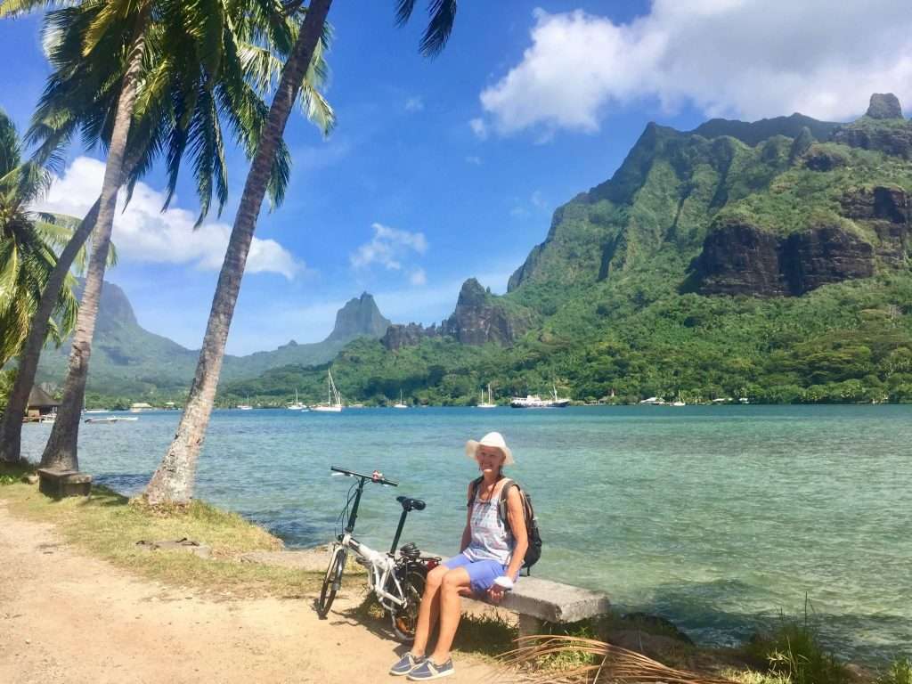
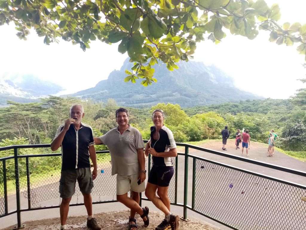
Our first hike was up Magic Mountain across the bay, which afforded a sweeping view of the reefs and surrounding mountains. Arriving breathless at the summit we were surprised to see three young Polynesians running up the mountain for their daily exercise.
Esprit with Magic Mountain in the background.
The start of the Magic Mountain hike.
Halfway up I’m getting a bit sweaty.
View from the top towards the surrounding reef.
View across the bay to our anchorage.
One of the Polynesians who ran up to the top.
The next day we cycled the 15 km around the bay from the Hilton hotel in the East, to the village in the West and back.
Going ashore to go cycling.
The Hilton hotel bungalows.
The roads and sidewalks are well maintained.
Esprit from the shore.
In between the fun things, I managed to service the two halyard winches and the anchor winch, fill the tanks with the water maker, replace the port and starboard navigation lights and after a lot of choice words, replace the engine’s main drive belt (fan belt in the old days, but this one has no fan).
View halfway up Mount Rotui – note the pass through the reef.
After a three hour attempt to climb to the Mount Rotui lookout behind the park, we returned defeated, as the path was very steep and totally overgrown due to a downturn in hikers. On the descent I also managed to slip and fall down a 2m ledge, rolling arse over tit downhill for another 10m before a tree stopped me. Scratched and bloodied, it was only my ego that was injured.
View down to the Hilton bungalows.
Knackered!
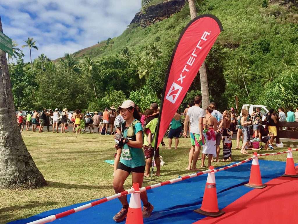
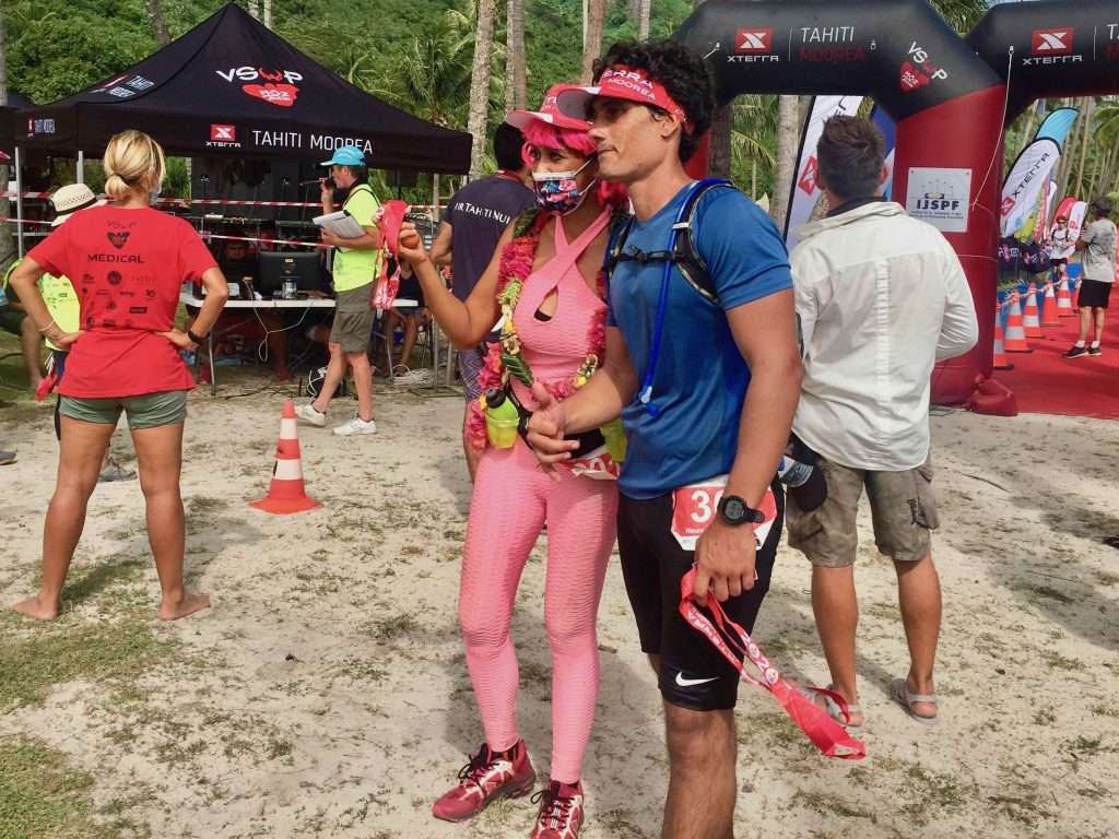
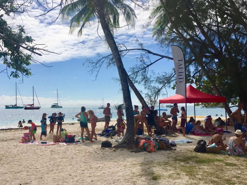
The beach and park next to the anchorage was the venue for the finish of a marathon and triathlon on the 23rd May, creating quite a festive atmosphere with hundreds of competitors and spectators.
Approaching the triathlon finish.
Finish line ahead.
Two Polynesian triathletes.
Cooling off on the beach.
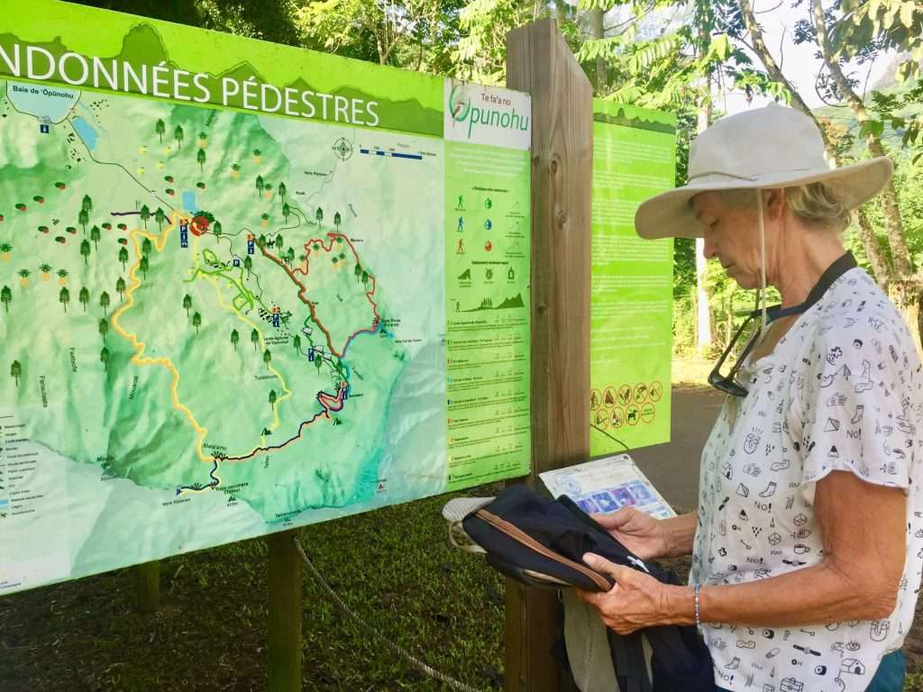
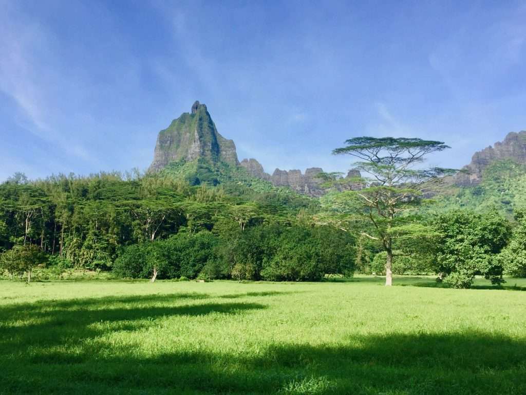
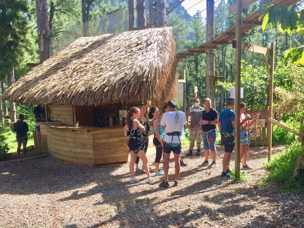
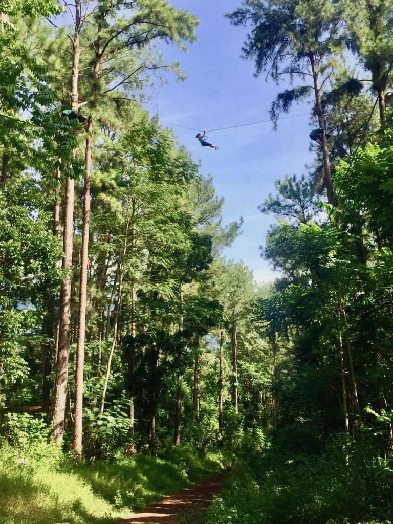
Next, we dinghied to the top of Opunohu Bay to do the Three Pines hike up the Opunohu Valley – a spectacular nature reserve with numerous hikes from 3 km to 20 km in length. There is a veritable Flying Fox (Zip-line) feast for younger folks in the pine forest halfway up the mountain. I counted 23 cable runs with people zipping through the treetops.
Annie with a map of the hiking trails.
Walking up the valley – note the Pierneef trees.
Zipliners being instructed on how to hook up to the cables.
Flying through the treetops.
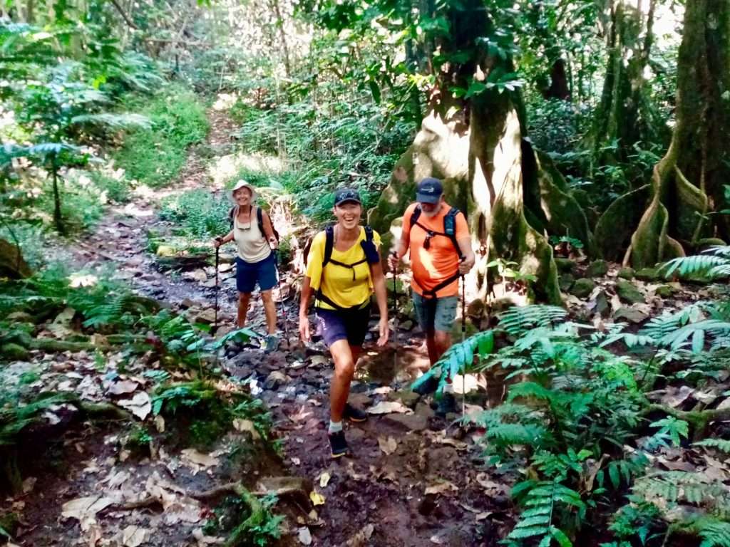
The next day Annie, Neill, Heidi and Jorg tackled a longer hike to the summit of the Belvedere lookout with views over both Cook’s and Opunohu Bays. I sat this one out as my knee was playing up after my fall, but they had a great 5 hour hike up to the Belvedere lookout.
Neill, Annie, Heidi and Jorg on their way to their hike.
The new science centre at the start of the valley.
Hiking up to Belvedere
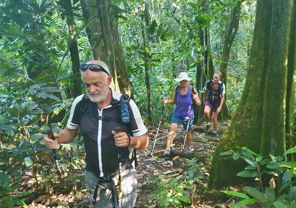
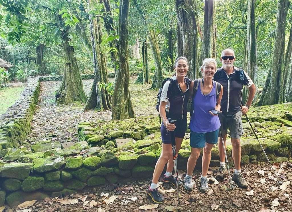
Visiting ancient Polynesian sacred sites (Marae).
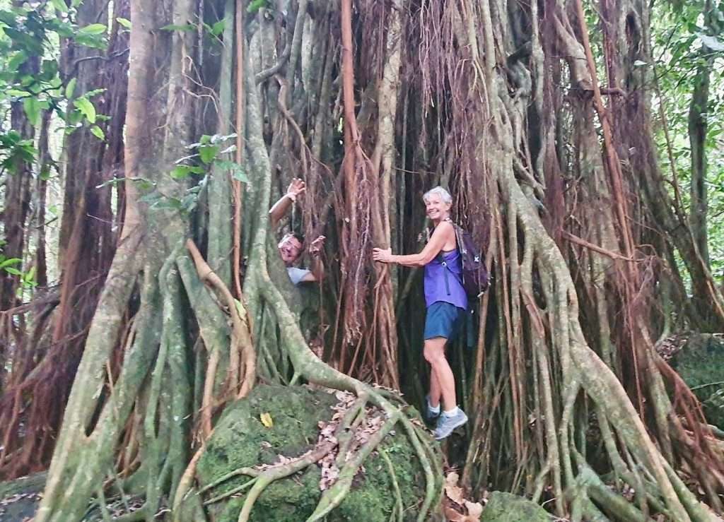
Jorg and Annie at the biggest tree on Moorea.
Neill, Jorg and Heidi on top of the Belvedere lookout.
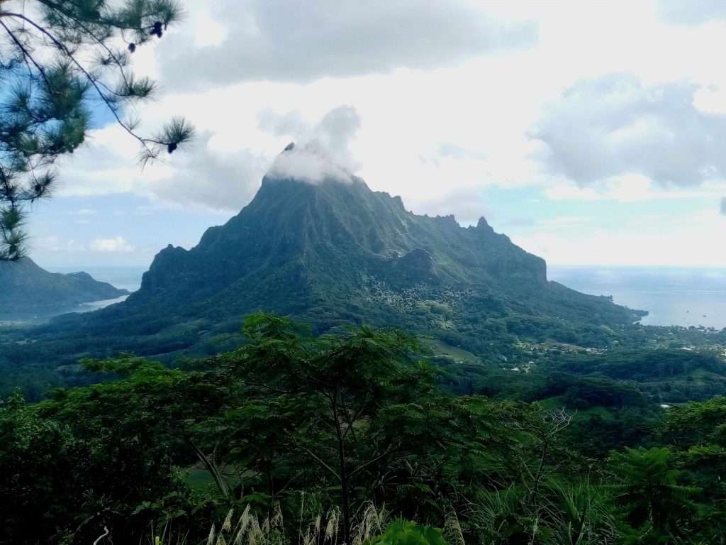
View to Opunohu Bay at left, Rotui Mountain (our Nemesis) and Cook’s Bay on the right.
There were more hikes and dinner parties before we set sail for Fare on Huahine Island on the 30th May, when a favourable wind came through for the 90 nm overnight passage. We plan to visit Raiatea, Bora Bora and Maupiti Islands before we leave French Polynesia.
Another day, another hike – which way now Neill?
Muddy going.
Back in the valley, going home.
After visiting the rest of the Society Islands, we may have to sail back to Australia as Covid-19 is playing havoc with our plans. We have approval to visit Fiji, but an increase in infections had them close their borders this week. None of the other Pacific nations are open at present. At least Australia accepts its citizens, subject to a PCR test and 14 days quarantine in a hotel. We may be back in Oz earlier than expected!